Snow and ice ahead this weekend for Northeast, New England
The heaviest snow is expected from upstate New York into Vermont, New Hampshire and Maine
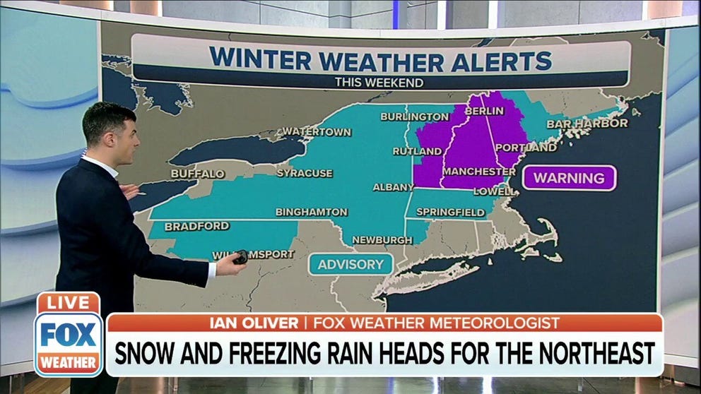
Winter storm warnings for New England, snow this weekend
Vermont, Maine and New Hampshire expecting snow this over weekend.
A strengthening area of low pressure will slide into the Northeast and New England this weekend, spreading snow and ice across the region beginning on Saturday.
The National Weather Service issued a Winter Storm Warning from Vermont into Maine ahead of what could be more than half of foot of snow. A Winter Weather Advisory is also in effect from northern Pennsylvania into Massachusetts.
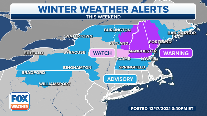
Winter weather alerts were issued ahead of snow and ice in the Northeast.
(FOX Weather)
With cold air in place across the northeastern U.S., an area of snow is forecast to spread from west to east across upstate New York eastward through northern New England Saturday into Saturday night.
Meanwhile, a zone of freezing rain and sleet is expected farther south from near the New York-Pennsylvania border eastward into central New England.
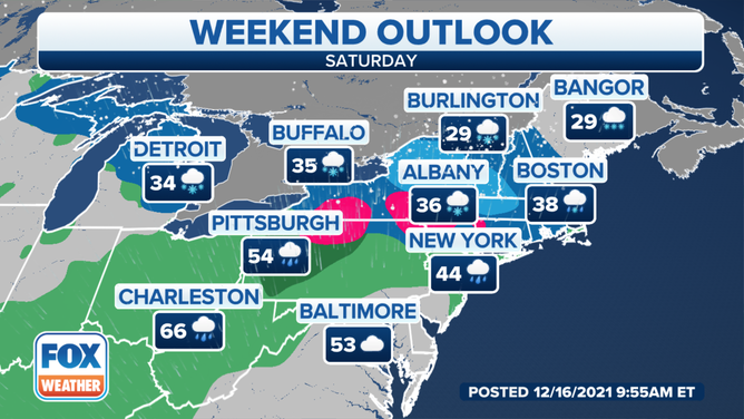
Forecast for Saturday, Dec. 18, 2021.
(FOX Weather)
Snow will linger in parts of Maine on Sunday morning before the low-pressure system slides off the New England coast by the afternoon.
The heaviest snow is expected from the Adirondacks of New York into Vermont, New Hampshire and western Maine, where 5 to 8 inches of snow is predicted. Locally higher amounts of more than 8 inches are not ruled out in the highest elevations of this region.
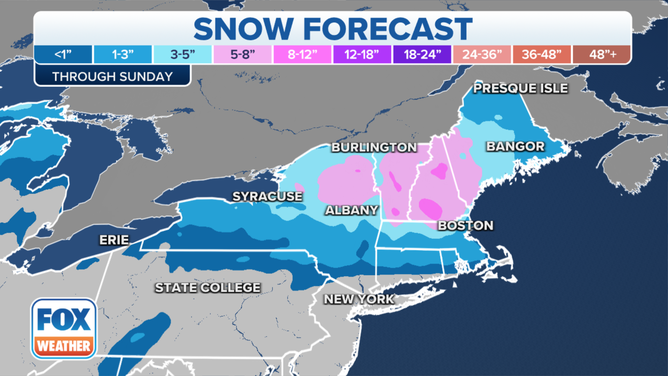
Snow forecast through Sunday, Dec. 19, 2021.
(FOX Weather)
The greatest threat for a glaze of ice from freezing rain will be from parts of northern Pennsylvania and the Poconos into the Catskills of New York and the Berkshires of western Massachusetts. Some patchy ice is also possible in other areas from near the New York-Pennsylvania border eastward into central Massachusetts.
Travel could be very difficult in areas that receive accumulating snow and ice due to slippery roads, especially any secondary roadways that may not be salted or plowed as frequently as the main roads.

Threat for a glaze of ice on Saturday, Dec. 18, 2021.
(FOX Weather)