Severe weather possible in Florida Saturday as nor'easter front brings strong thunderstorms
A trailing cold front from the massive storm will sweep across the Sunshine State Saturday morning, creating a large area of wind shear and triggering a risk of severe weather, especially across the heart of the state.
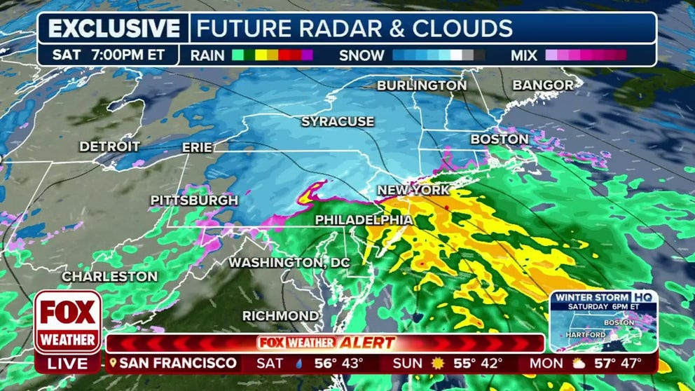
Nor'easter takes aim at at Northeast this weekend as millions sit under winter storm alerts
Several inches of snow are expected in the inland mid-Atlantic and Northeast this weekend as a nor'easter moves up the Eastern Seaboard.
ORLANDO, Fla. — A nor’easter roaring along the Eastern Seaboard may be bringing a threat of wintry weather to much of the Northeast this weekend, but even Florida won’t be able to escape its stormy effects.
A trailing cold front from the massive storm will sweep across the Sunshine State Saturday morning, creating a large area of wind shear and triggering a risk of severe weather, especially across the heart of the state.

(FOX Weather)
NOAA’s Storm Prediction Center has over a million Floridians inside a Level 2 out of 5 risk of severe weather Saturday, including Fort Myers and Naples. Here, a greater risk of a few tornadoes and damaging wind gusts are possible into the early afternoon. Another 9 million are in a level 1 risk, including Orlando and West Palm Beach.

(FOX Weather)
Anywhere inside the severe weather risk zones could see damaging wind gusts over 60 mph in stronger thunderstorms, with an isolated tornado possible. Dangerous and frequent lightning will give Florida a head start on keeping the crown in 2024 for most lightning-prone state in the U.S.
OVER 2.4 MILLION LIGHTNING BOLTS SPOTTED ACROSS THE US IN 2023 WITH WIND FARMS, MIAMI TOP TARGETS
Gusts hit 51 mph in Sarasota Bay and Egmont Channel along Florida's Gulf Coast late Saturday morning, while earlier in the morning several wind gusts topped 40 mph in Florida’s Big Bend area as the front swept through. St. Mark’s Lighthouse recording a gust of 47 mph. Spotters reported a few scattered power outages in the area from toppled trees or branches into power lines.
The peak of the wind shear and stormiest conditions will arrive around midday Saturday, then weather will calm from west to east as the cold front passes through.