Severe thunderstorms bring rare threat of large hail to Central Florida
Most of Florida's notable hail storms occur in late Winter or Spring
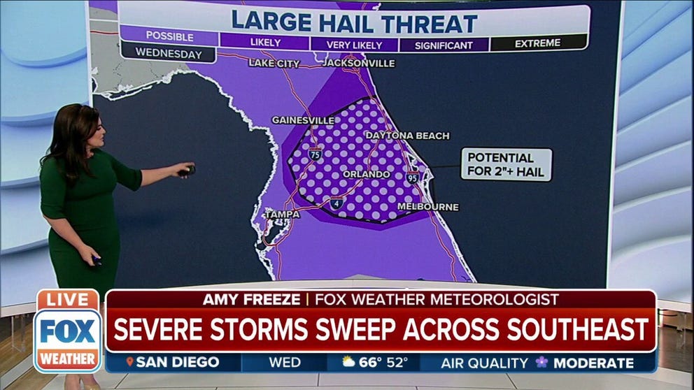
Potential for large hail targets central Florida as severe storms move through
Isolated severe storms will again pop from Central Florida to the eastern Carolinas Wednesday afternoon. Hail and strong wind gusts will be the main hazards.
ORLANDO, Fla. – Severe weather and cooler temperatures created an unusual threat of large hail in Central Florida Wednesday.
Several spotters reported hail of 1-2 inches in diameter – about golf-ball size – around the Lake Mary area of Orlando as a thunderstorm moved through just before 6:30 p.m. EDT. About two hours earlier, a thunderstorm brought hail stones estimated at 1-1.75 inches around the New Smyrna Beach area.
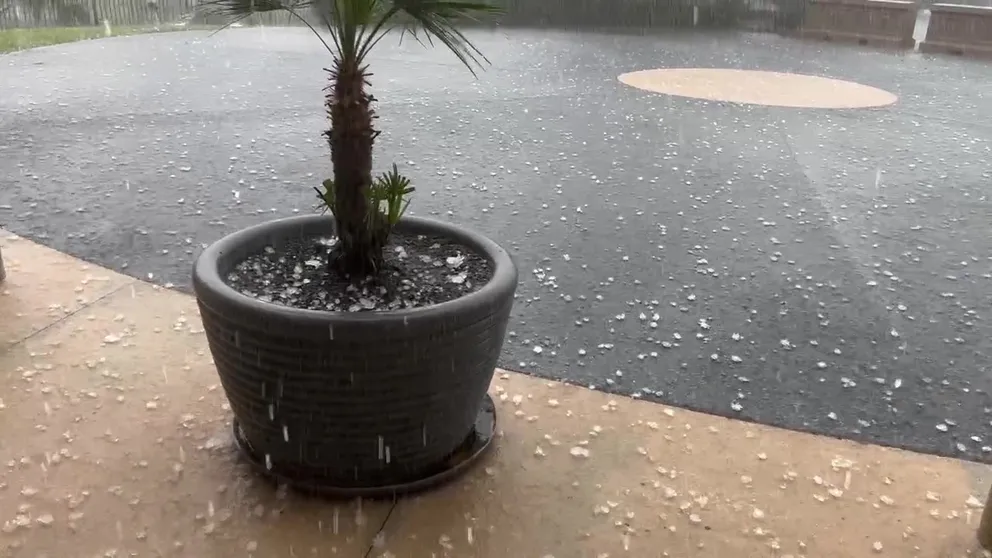
Large Hail falls in Orlando
Hail estimated at about 1-inch in diameter fell at the FOX 35 TV Studios in Orlando Wednesday. (Video: Mike McClain)
Large hail was also reported near Orlando International Airport and along the eastern coast north of Melbourne.
Large hail over 2-inches is rare in Florida because the hail usually melts before it reaches the ground.
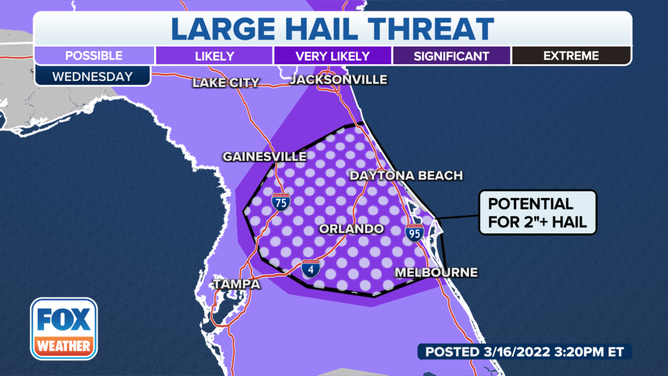
Hail outlook for Central Florida on Wednesday.
(FOX Weather)
Severe weather data by the National Weather Service in Melbourne shows that from 1955-2011 only 3% of hail reports in East Central Florida were 2 inches or greater. Florida storms typically produce hailstones that are under 1 inch, about the size of a peanut or a penny, about 50% of the time, according to the NWS data.
On Wednesday, the NWS in Melbourne said the threat of large, damaging hail is of particular concern with a quarter to golf ball size hail, possibly larger.
The threat of hail greater than 2 inches for Central Florida is unusual primarily because of temperature, explains FOX Weather meteorologist Mike Rawlins.
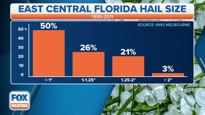
Hail data for 1955-2011 for east Central Florida.
(FOX Weather)
"Florida's warm temperatures typically prevent the state from seeing huge hailstones. With warm air in place from the surface to the upper atmosphere, it's difficult for big hail to form," Rawlins said.
Severe weather data from the NWS Melbourne shows most of Florida's notable hail storms occur in late winter or spring when it's typically cooler in the mid/upper atmosphere.
The last three large hail events in Central Florida happened in March. The most recent recorded hail over 2-inches was in Indialantic in Brevard County on March 27, 2019, followed by March 20, 2018, in Volusia County.
The reason for the large hail threat is that Wednesday's temperature is more supportive for huge hailstones to form because the air is much colder aloft.
FOX Weather Meteorologist Greg Diamond explains that during the summer the freezing level is at 13,000 feet. On Wednesday, it is near 10,000 feet.
"Along with the cold air, strong updraft winds in a storm will allow the hail to remain suspended for a longer period of time and grow before it becomes too heavy and falls to the surface," Diamond said.