Severe storms topple trees, flood interstates during height of Tuesday commute in mid-Atlantic
Temperatures swelling into the 90s mixed with a lingering moisture leftover from Tropical Depression Chantal to bring some soaking thunderstorms.

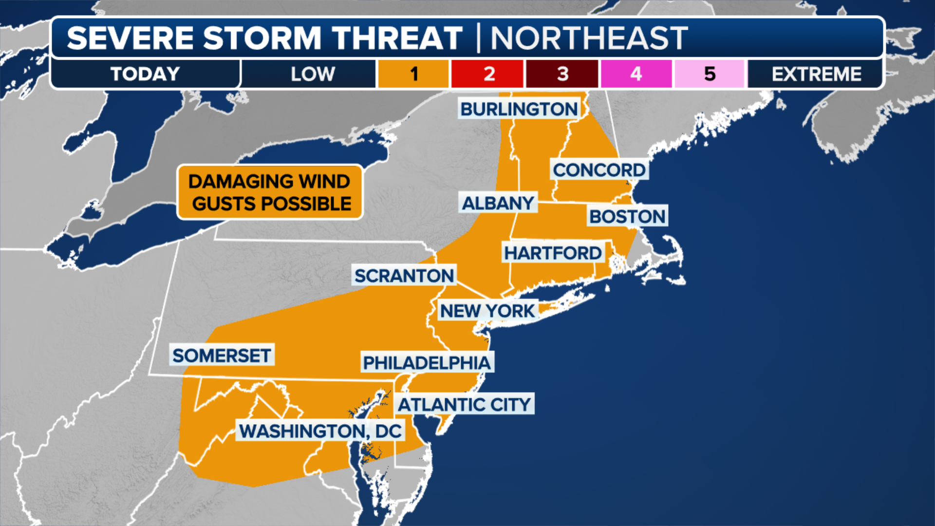
Severe thunderstorms taking aim at I-95 corridor, Northeast
Severe storms capable of producing flash flooding are eyeing the northeast, with thunderstorms taking shape through Tuesday evening. New York, Washington, D.C. and Philadelphia are all in the threat zone.
PHILADELPHIA – A sweltering hot day turned into a stormy evening across much of the Interstate 95 corridor from Washington, Philadelphia and New York City Tuesday evening. And they may be up for round two on Wednesday.
Temperatures swelling into the 90s mixed with a lingering moisture leftover from Tropical Depression Chantal to bring some soaking thunderstorms.
Gusts reached 45-60 mph with a gust of 70 mph clocked in Kingstown, Maryland, according to the National Weather Service.

Warning boxes are color coded as: Severe Thunderstorm Warnings in yellow, Tornado Warnings in red, Tornado Warnings with confirmed tornado in purple, Flash Flood Warnings in green, and Flash Flood Emergencies in pink.
(FOX Weather)
In New Jersey, strong gusts toppled a tree into a home in Long Branch, and other trees down in Lakewood Township and Pemberton.
Heavy rains swamped Philadelphia during the heart of the evening commute as a miserable mix of Heat Advisories, Flash Flood Warnings, Severe Thunderstorms Warnings and the lingering effects of a sanitation strike plagued the city.
The National Weather Service reported flooded lanes along Interstate 76 and near where State Route 611 met I-95 by the sports stadiums.
John F. Kennedy International Airport (JFK) in New York and Ronald Reagan Washington National Airport (DCA) were under Ground Delay programs due to thunderstorms and wind Tuesday afternoon.
About 35,000 people lost power Tuesday, mostly in Pennsylvania and New Jersey, according to FindEnergy.com.
(FOX Weather)
A renewed severe weather threat returns on Wednesday though the focus will shift south a bit. NOAA's Storm Prediction Center has issued a Level 2 out of 5 severe weather threat from Philadelphia south through Washington and into the heart of North Carolina. Again, damaging wind gusts and large hail are the primary threats.