Severe storm threat shifts west as Colorado faces risk of hail and heavy rain
Given the multi-day threat of storms in the region, here's a look at what prediction markets are thinking for Denver's rain total for the month of June. Sponsored by Kalshi.
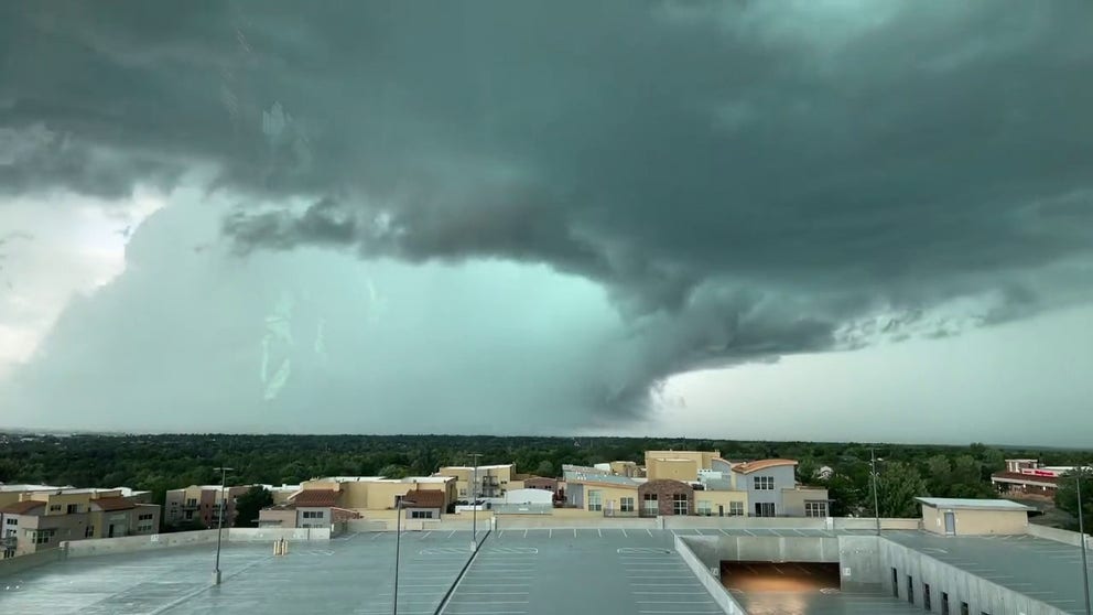
FILE VIDEO: Tornado-warned storm spotted south of Denver
Ominous clouds were seen as a tornado-warned storm moved through Centennial, Colorado, on Thursday.
DENVER, Colorado – An active weather pattern setting up across the Rockies this week, as a collision of atmospheric ingredients provides the recipe for a multi-day severe weather threat.
The nation's severe weather threat is shifting westward Tuesday, with Colorado and parts of the central High Plains facing an increased risk of thunderstorms capable of producing large hail, damaging wind gusts and locally heavy rainfall.
Hot, humid air pushing northward from the Gulf of America is providing plenty of moisture, while fast, energetic winds blowing overhead from west to east across the mountains are creating the spin needed to organize ordinary clouds into intense, rotating storms.
 Severe Storm Threat.
(FOX Weather)
The week kicked off with dangerous severe weather across the High Plains, prompting multiple severe thunderstorm and tornado warnings.
A confirmed tornado was reported in eastern Wyoming, while wind gusts as high as 113 mph were reported near Akron, Colorado.
SAHARAN DUST SETTLES OVER HURRICANE BREEDING GROUNDS. HERE'S WHAT IT MEANS FOR HURRICANE SEASON
Large hail also accompanied the storms, including hail up to 3 inches in diameter near Sterling, Colorado, as a powerful thunderstorm moved through the area.
On Tuesday, eastern Colorado and western Kansas fall under the greatest threat of severe weather. While storms will start as individual, rotating storms in the afternoon, they are expected to merge into a massive, organized cluster as they push eastward into the evening.

A pedestrian crosses Glenarm Place in Denver, Colorado, along the 16th Street Mall in light rain.
(Andy Cross/The Denver Post via Getty Images / Getty Images)
On Wednesday and Thursday, the severe threat settles into a highly localized pattern right along the higher-elevation prairies of eastern Colorado and southeastern Wyoming.
Given the multi-day threat of storms in the region, let's take a look at how trading on prediction markets are thinking for Denver's rain total for the month of June.
The threat of severe weather will become more focused on Wednesday and Thursday, centering on parts of eastern Colorado and southeastern Wyoming near the Rocky Mountains.
A weather pattern developing over the region will continually push moist air toward the mountains, creating favorable conditions for thunderstorms to develop each afternoon and evening.
FLASH LIGHT FAILURE ENDS IN NIGHT TIME HIGH-ELEVATION RESCUE AT COLORADO STATE PARK
As a result, communities along the Front Range and nearby High Plains could see repeated rounds of strong storms capable of producing large hail and damaging wind gusts.
Rather than one long-lasting storm system, this is expected to be a multi-day stretch in which severe thunderstorms may redevelop day after day.
 Denver forecast.
(FOX Weather)
After a winter that produced well-below-average snowfall across much of Colorado, drought concerns continue to mount across the Denver metro area and the Front Range.
According to the U.S. Drought Monitor, Denver County remains in drought, while much of Colorado's Front Range is experiencing conditions ranging from moderate drought (D1) to severe drought (D2).