Rounds of snow stretch from Midwest to Great Lakes, triggering Winter Weather Alerts
Cooler air surged behind the first system, creating favorable chances for snow from the Midwest into the Great Lakes over the weekend.

Swath of snow moving into the Midwest this weekend
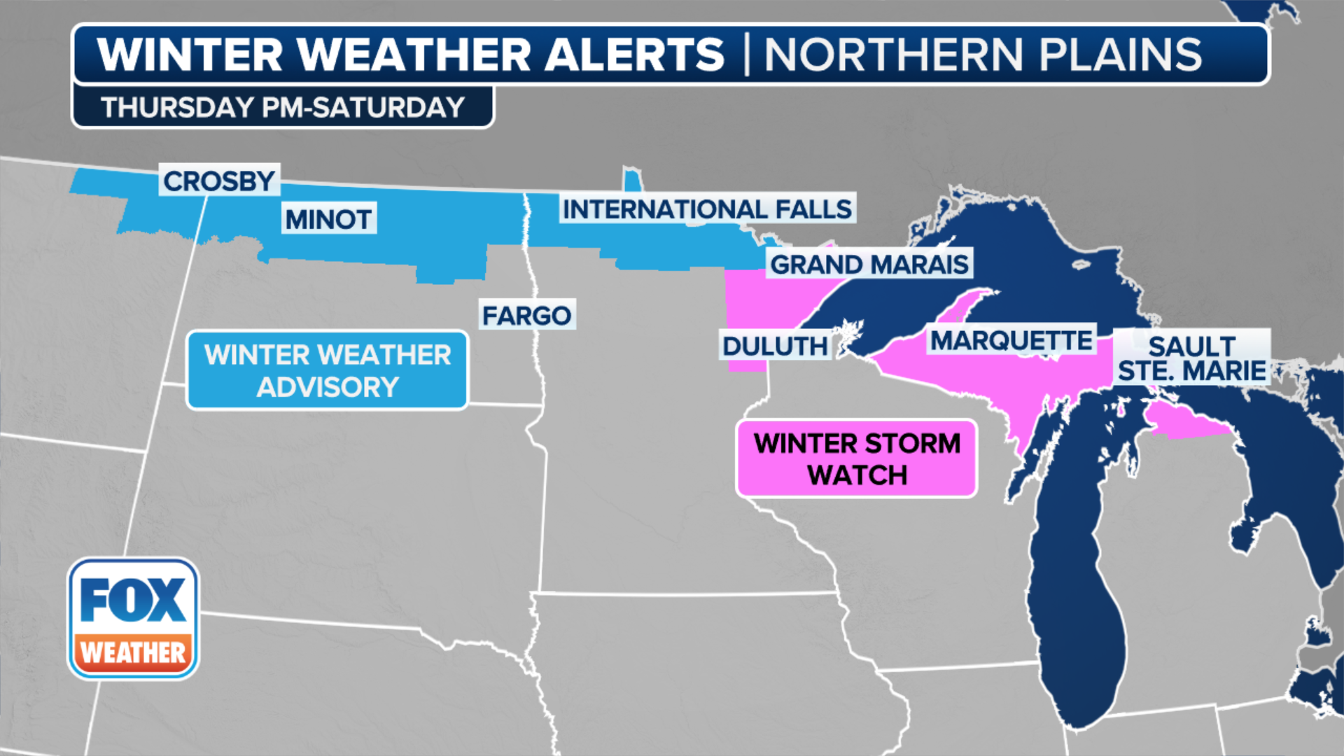
Snow is moving into the Upper Midwest and Great Lakes. Michigan and Wisconsin will see the highest snow totals as the day goes on. Winter weather alerts are in effect from Milwaukee up through northern Michigan until Sunday morning.
Snow is moving out of the Upper Midwest and Great Lakes after the second of a pair of cross-country storms prompted Winter Weather Alerts through Sunday morning.
The first storm brought over a foot of fresh powder to areas of Colorado on Thursday and Friday.
The second system brought snow to the Midwest and the Great Lakes through the weekend. Winter Weather Alerts were in place across northern Wisconsin and Michigan, including Marquette, Michigan.
IMPACTFUL SNOW, RAIN EYEING EAST COAST AS LA NIÑA WINTER MAKES ITS RETURN
(FOX Weather)
Cooler air surged behind the first system, creating favorable chances for snow from the Midwest into the Great Lakes over the weekend.
Snow totals are on the lighter side across the Midwest, with 1 to 3 inches. The majority of the snow in the Upper Midwest fell through Saturday, with light snow expected on Sunday.
WINTER STORM WARNING EXPLAINED: WHAT DOES IT MEAN AND WHEN IS IT ISSUED?

ROYAL OAK, MICHIGAN, USA - JANUARY 25, 2023: A contract worker clears snow for a local apartment complex as forecasts project the winter storm dropping up to 8 inches in Metro Detroit, in Royal Oak, Michigan, United States on January 25, 2023.
(Adam J. Dewey/Anadolu Agency / Getty Images)
The arrival of more cold air will cause snow totals to increase closer to the Great Lakes as the weekend progresses.
3 to 5 inches of snow is likely across the Upper Peninsula of Michigan, with a strip of 5 to 8 inches of snow expected to fall between Green Bay, Wisconsin and Alpena, Michigan through Sunday.
Gusty winds in Michigan's Upper Peninsula caused blowing snow and localized whiteout conditions Saturday night.

(FOX Weather)
Now, the snow is shifting further into the Great Lakes and into the Northeast.
Lake-effect snow will likely continue into Monday morning around Lakes Erie and Ontario, according to the FOX Forecast Center.
Snow totals remain unclear for the Northeast at this stage, but stay tuned to FOX Weather as the forecast improves.