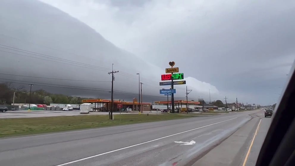
Surreal roll cloud spotted in Oklahoma in wake of thunderstorms
The rolling motion in teh cloud is the result of winds changing speed and direction at an inversion.
Surreal roll cloud looms over Oklahoma town
A horizontal roll cloud put on a show in Atoka, Oklahoma in the wake of thunderstorms that rolled through the area Tuesday night.
ATOKA, Okla. -- Clouds put on a show in Oklahoma in the wake of thunderstorms that rolled through the area Tuesday night.
Those driving in Atoka Wednesday morning found this surreal tubular cloud formation -- known as a horizontal roll cloud.
"They're relatively rare in that this is not associated with the surging winds ahead of a thunderstorm (called a shelf cloud)," says FOX Weather meteorologist Greg Diamond. "But instead was behind the main line of storms."
Diamond says the rolling motion results from winds changing speed and direction at an inversion -- when the air temperature reverses from its usual state, resulting in warm air on top of cool air.
"The shear across the inversion sets up a rolling motion much like that of a rolling pin used in a bakery," he said.
