

Rare severe weather targets New England, with tornadoes, hurricane-force winds triggering Level 3/5 threat
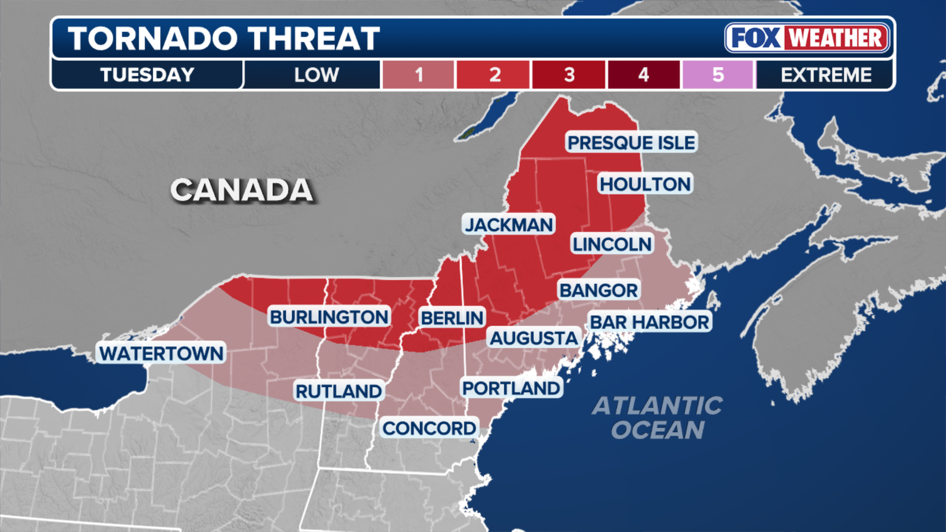
The greatest risk of the strongest storms will be across parts of northern Maine, northern New Hampshire, northern Vermont and New York's North Country.
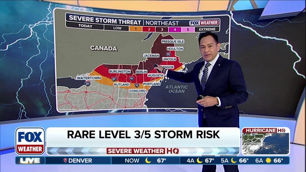
Rare severe weather targets New England with tornado risk, hurricane-force winds
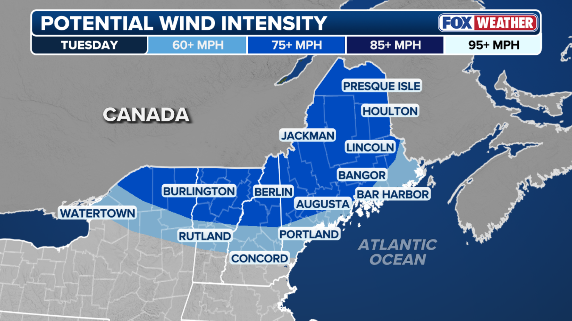
A rare severe weather threat is targeting nearly 2 million people across northern New England and New York's North Country beginning Tuesday afternoon, with thunderstorms capable of producing hurricane-force wind gusts and even tornadoes in a region that rarely experiences intense severe weather.
BURLINGTON, Vt. — A rare severe weather threat is targeting nearly 2 million people across northern New England and New York's North Country beginning Tuesday afternoon, with thunderstorms capable of producing hurricane-force wind gusts and even tornadoes in a region that rarely experiences intense severe weather.
WHAT IS THE SEVERE THUNDERSTORM RISK SCALE?
![Rome NY Storm Damage]() Image 1 of 3
Image 1 of 3FILE - Apparent tornado damage in Rome, NY on July 16, 2024. (Joel Hart via Facebook)
![Rome NY Storm Damage]() Image 2 of 3
Image 2 of 3FILE - Apparent tornado damage in Rome, NY on July 16, 2024. (Joel Hart via Facebook)
![Rome NY Storm Damage]() Image 3 of 3
Image 3 of 3FILE - Apparent tornado damage in Rome, NY on July 16, 2024. (Joel Hart via Facebook)
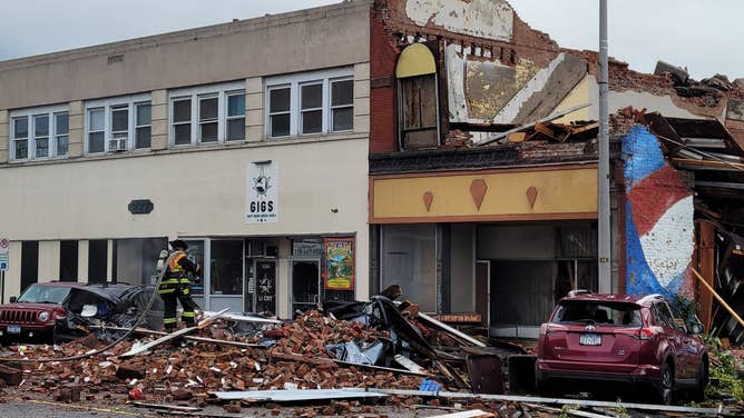

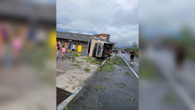
Storms will be fueled by a heat dome baking much of the Northeast, with temperatures in the upper 90s and places like Plattsburgh and Syracuse, New York, expected to approach near-record highs.
WHAT IS A HEAT DOME AND HOW CAN IT AFFECT YOU DURING THE SUMMER MONTHS?
A powerful storm system moving out of Canada will collide with this hot, humid air, triggering thunderstorms beginning Tuesday afternoon. The greatest risk of the strongest storms will be across parts of northern Maine, northern New Hampshire, northern Vermont and New York's North Country.
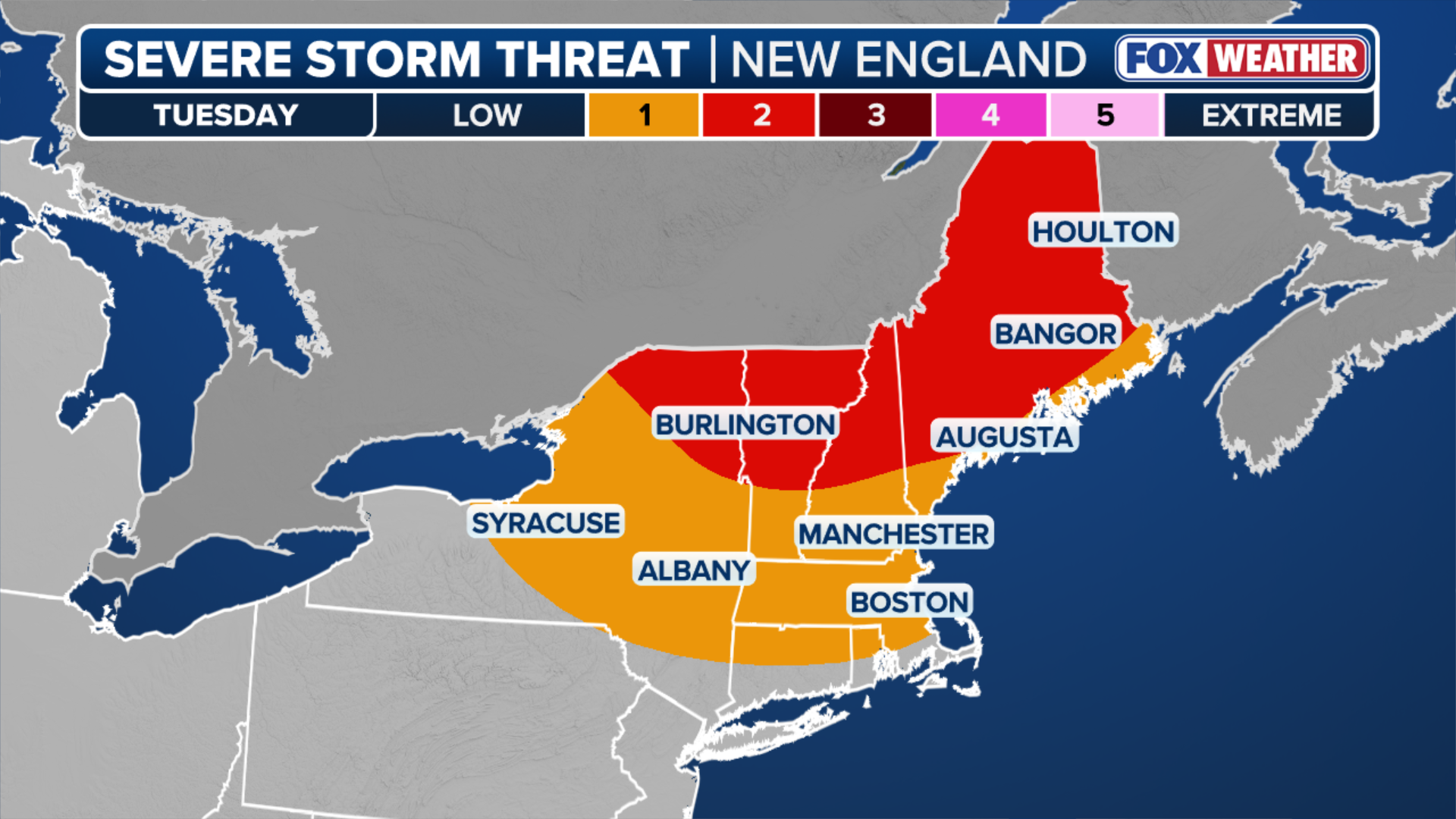
(FOX Weather)
NOAA's Storm Prediction Center (SPC) has issued a Level 3 out of 5 risk of severe thunderstorms that includes Presque Isle and Jackman, Maine, Berlin, New Hampshire, Burlington, Vermont and Plattsburgh.
TORNADO SAFETY: EVERYTHING YOU NEED TO KNOW ABOUT TAKING SHELTER DURING SEVERE WEATHER
These areas could see EF-2 tornadoes, damaging wind gusts up to 75 mph and egg-sized hail within the most intense storms.
A Level 2 severe storm threat covers areas just south, including Bangor and Augusta, Maine.
(FOX Weather)
People traveling on Interstates 95, 93,91 and 87 should stay aware of the forecast.
The forecast currently has the worst of the storms developing in the late afternoon, which could limit some of the severe weather impacts due to a loss of the peak of the daytime heat.
SEE IT: YELLOWSTONE BISON RAMPAGES THROUGH CAMPGROUND, TOSSING GRANDFATHER 8 FEET IN THE AIR
"However, if the system speeds up and rolls in earlier than expected during the peak of afternoon heating, the coverage and overall danger of these severe storms will likely spike," the FOX Forecast Center said.
(FOX Weather)
Thunderstorms are expected to continue across the region well into the night and overnight hours.
The heavily forested landscape and widespread overhead power lines could make parts of the region especially vulnerable to tree damage and power outages if the strongest storms produce hurricane-force wind gusts.
Check back for updates on this developing story.