Atmospheric river forecast to bring deluge of rain, snow and potential flooding to Pacific Northwest
By the end of the week, some parts of Washington could see between 5 and 8 inches of rain, with more widespread areas across the Pacific Northwest picking up between 1 and 3 inches.
Atmospheric river to drench Pacific Northwest this weekend
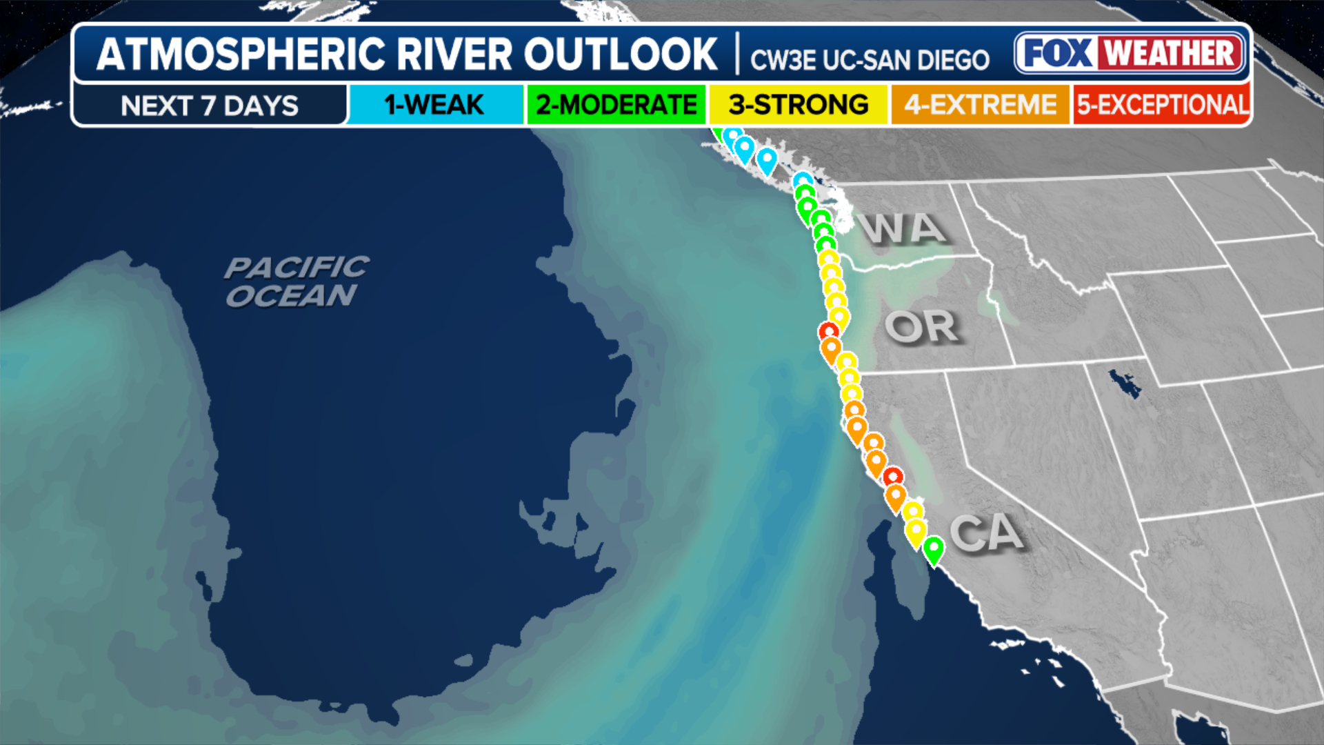
The Pacific Northwest will face an even more powerful atmospheric river that is set to slam into the region beginning Friday. Rain totals of 3-5 inches are forecasted up down the coast from Northern California to the Washington-Canada border.
PORTLAND, Ore. – The Pacific Northwest will face an even more powerful atmospheric river that is set to slam into the region beginning Friday. After an initial round of stormy weather that began last weekend, this upcoming atmospheric river could drop several inches of rain in coastal areas and several feet of snow at higher elevations when all is said and done.

(FOX Weather)
According to the FOX Forecast Center, new forecasts suggest that the more intense portion of the storm may have shifted farther south, with the strongest impacts targeting southern Oregon and Northern California. Cities including San Francisco and Eureka in California and Medford, Oregon, will see the most intense part of the storm on Saturday and Sunday.
(FOX Weather)
Atmospheric rivers are rainstorms along the West Coast fueled by moisture, typically with tropical origins, carried by the jet stream. These storms are sometimes compared to a river of water vapor in the sky. When an atmospheric river comes ashore, it brings moderate to heavy rainfall for two days or more.
By the end of the week, some parts of Washington could see between 5 and 8 inches of rain, with more widespread areas across the Pacific Northwest picking up between 1 and 3 inches.

(FOX Weather)
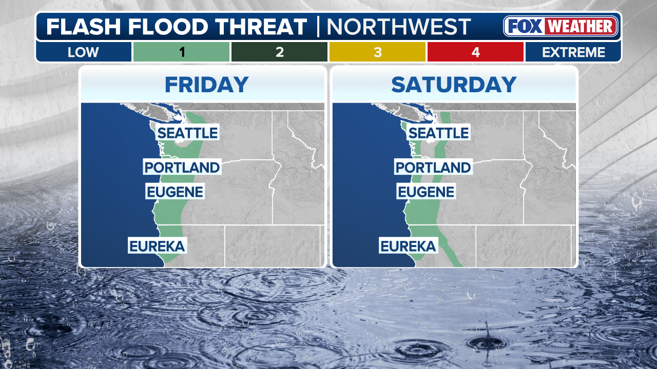
The heaviest rainfall is forecast between Friday and Saturday.
With so much rain comes the threat of flooding. A Level 1 out of 4 flash flood threat has been issued by NOAA's Weather Prediction Center for the Northern California coast, coastal Oregon and parts of western Washington for Friday and Saturday.
(FOX Weather)
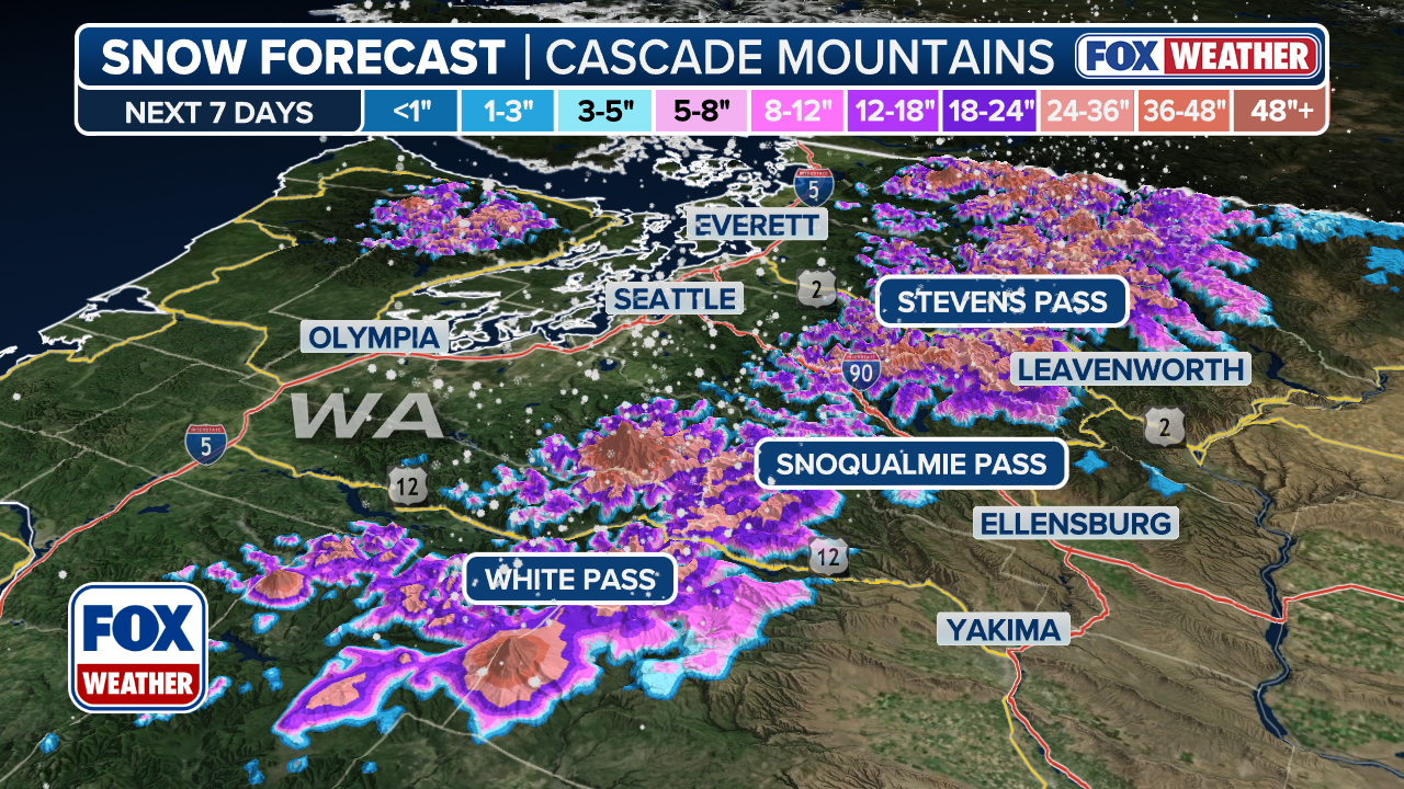
For elevations above 5,000 feet in the Cascade Mountains, the storms will mean snow for the mountain passes. Snow accumulations could reach 2 feet or more in some areas, but it's still early to tell how much snow will pile up.
(FOX Weather)
According to the FOX Forecast Center, the rain and snow will be beneficial for the drought across the Northwest region. Portions of the Cascades are in severe to extreme drought, and portions of eastern Washington, northern Idaho and western Montana are under extreme and exceptional drought conditions.
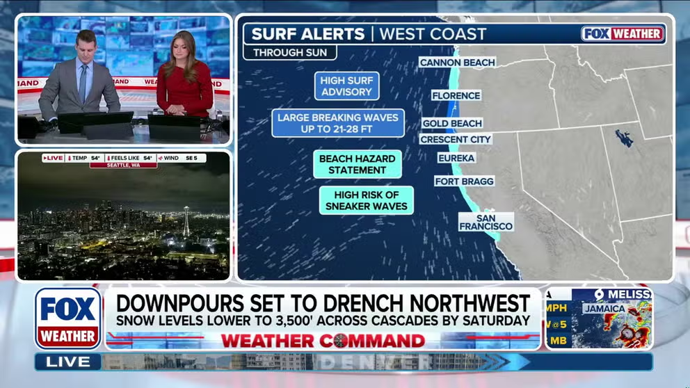
Meanwhile, the storm is also expected to bring 20-foot waves to parts of the coast. The National Weather Service offices in Portland, Oregon, and Eureka, California, have issued a few High Surf Advisories calling for large breaking waves of 21-28 feet in the surf zone that are capable of pulling swimmers quickly out to sea.
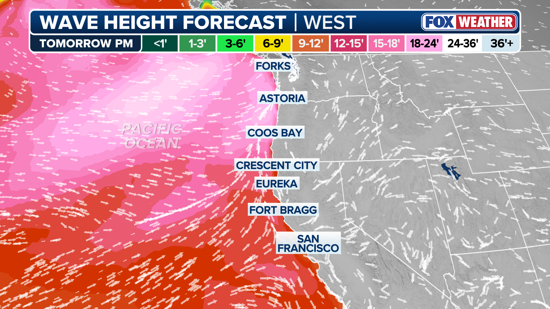
(FOX Weather)
The FOX Forecast Center is tracking a busy head start to the rainy season as a wet pattern looks to take hold of the region for several weeks. NOAA's Climate Prediction Center has forecast above-average precipitation for the Pacific Northwest over the next month.