Northeast faces severe weather, flooding threat as front moves through
Unsettled weather continues through Saturday
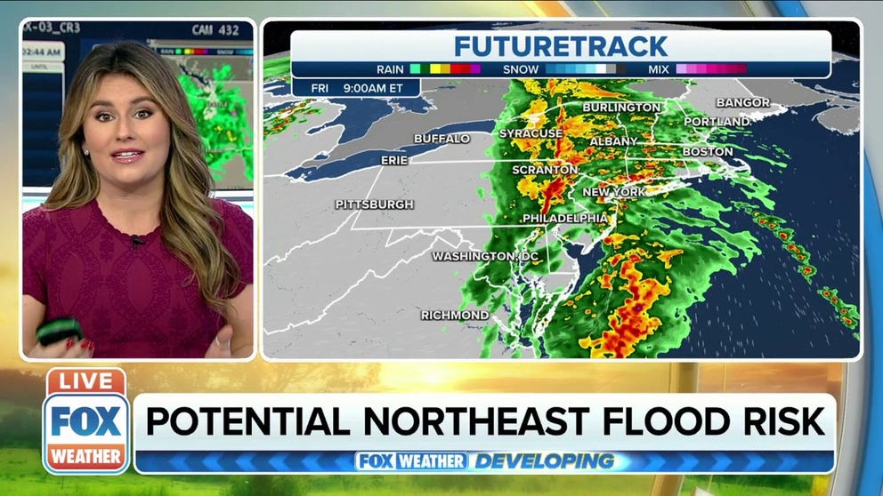
Severe storms, heavy rain hitting the Northeast
Severe storms and heavy rain is hitting the Northeast causing some potential flooding on Friday.
A Tornado Warning was issued for parts of New York on Friday morning as the Northeast could see both severe weather and some flooding with a cold front marching through the region.
The unsettled weather will likely continue through much of Saturday as a secondary system moves quickly east.
Here’s a closer look at the forecast.
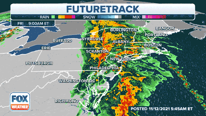
A line of storms will move across the Northeast U.S. on Nov. 12, 2021.
(FOX Weather)
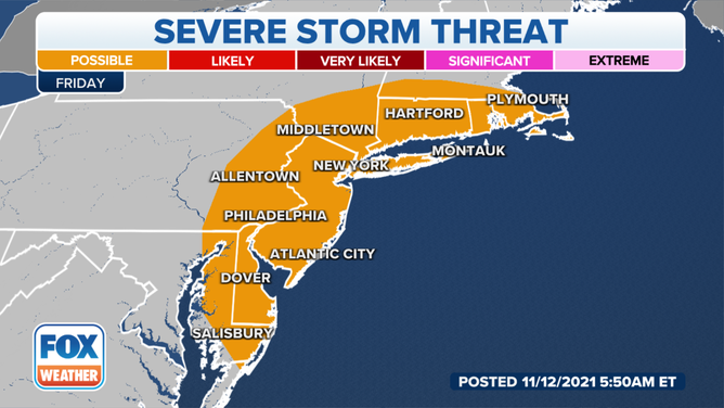
Severe weather threat
A Tornado Warning was issued near Binghamton, New York, on Friday morning, but there were no immediate reports of damage. Watch the FOX Weather livestream for the latest information. Download the FOX Weather app to get the latest weather alerts sent to your phone.
The Storm Prediction Center has placed coastal sections of the Northeast in a marginal risk of severe weather for Friday. That’s the lowest rating on the five-level scale.
The severe weather outlook for Nov. 12, 2021, from the Storm Prediction Center.
(FOX Weather)
The primary threat with any severe thunderstorms that do develop will be gusty winds, but there is also a chance of isolated tornadoes as the front moves into moisture-rich air along the coast.
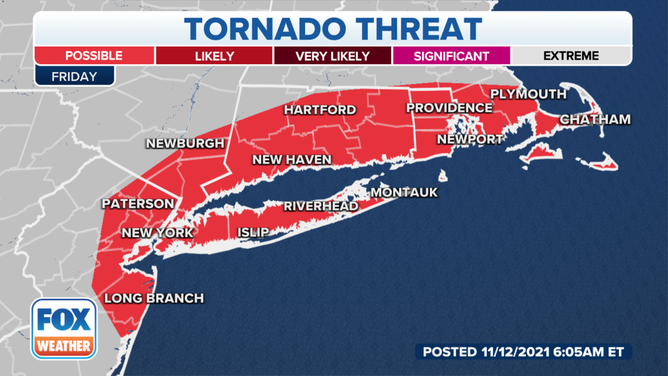
The tornado outlook from the Storm Predicton Center on Nov. 12, 2021.
(FOX Weather)
On Saturday, the severe weather threat diminishes. However, some thunder and lightning are possible as a second frontal system swings through.
Flooding threat
The Weather Prediction Center has issued a marginal risk of excessive rainfall Friday from northern New Jersey to coastal Maine. That is the lowest rating on the four-level scale.
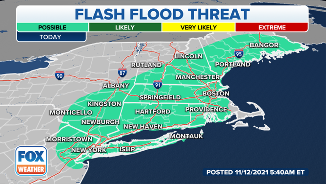
The flash flood threat from the Weather Prediction Center on Nov. 12, 2021.
(FOX Weather)
Rainfall amounts of 1 to 2 inches are likely as the line moves through. However, some isolated pockets of 3-inch rainfall are possible.
The flooding risk also diminishes on Saturday.
Improvement by Sunday before next system
Rain should end by Saturday evening, with skies clearing through Sunday morning. Expect abundant sunshine and cool temperatures in the low 50s during the day Sunday before clouds move back in ahead of the next weather-maker on Monday.