

Atlantic heating up with 3 areas to watch as El Niño continues to strengthen to its strongest ever
One system is expected to bring heavy rain to Bermuda, while another could bring several inches of rain and gusty winds to Portugal and Spain.
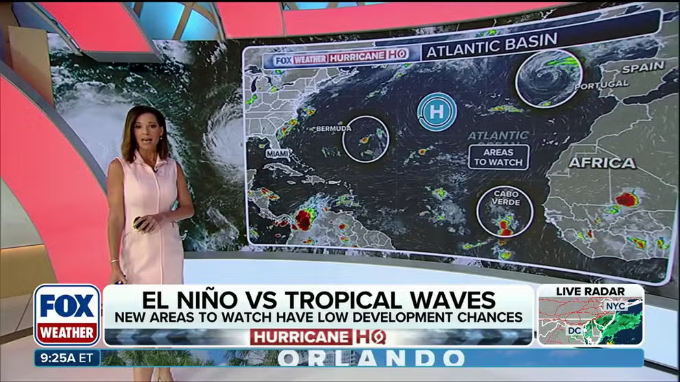
Atlantic hurricane season heats up with three areas to watch
Three areas are being monitored across the Atlantic for possible tropical development next week. While most impacts are expected to remain limited to heavy rain and gusty winds, forecasters are keeping a close eye on the systems as they evolve.
THE TAKEAWAY
- Three new areas to watch were declared in the Atlantic.
- The first area could cause heavy rain in Bermuda
- The second area will bring inches of rain and gusty winds to Portugal and Spain
The National Hurricane Center has designated new areas to watch in the Atlantic that could begin to develop sometime next week.
The first area to watch is located in the central Atlantic.
This area is a small, non-tropical low-pressure system located approximately 620 miles southeast of Bermuda.
 Areas to watch in the Atlantic.
(FOX Weather)
The system could develop into a tropical depression in the next few days.
It is forecast to bring heavy rain to Bermuda around Monday and Newfoundland on Wednesday before curving into the far northern Atlantic.
WHY IS IT SO RARE FOR HURRICANES TO MAKE LANDFALL ON HAWAII?
The second area is a non-tropical system near Portugal that is producing winds near hurricane force.
According to the FOX Forecast Center, a pool of unusually warm water in the area could allow the system to develop tropical characteristics before it dies out early next week.
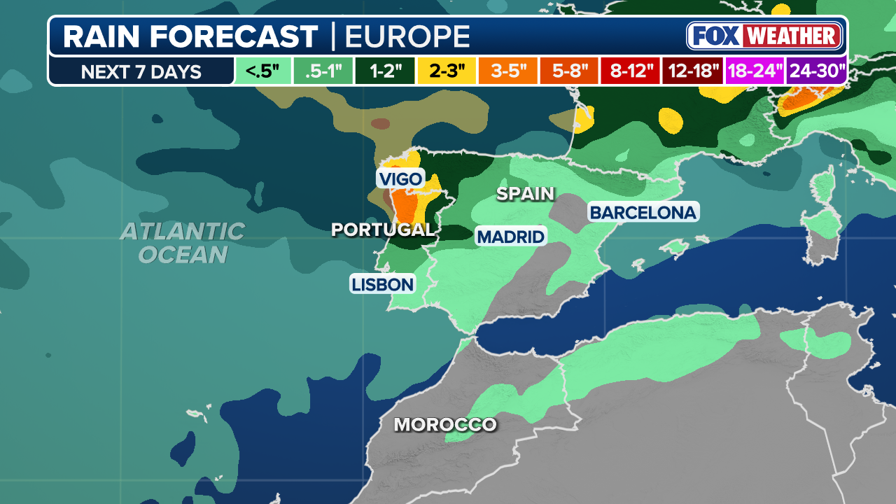 The amount of rain expected in Portugal and Spain.
(FOX Weather)
The system is expected to bring several inches of rain and gusty winds to Portugal and western Spain. Rainfall totals of 1 to 3 inches are forecast, along with wind gusts of up to 50 mph.
The third area to keep an eye on is a strong tropical wave rolling off Africa into the eastern Atlantic.
Although the development signal for late next week has persisted, it is less pronounced than in model runs earlier this week.
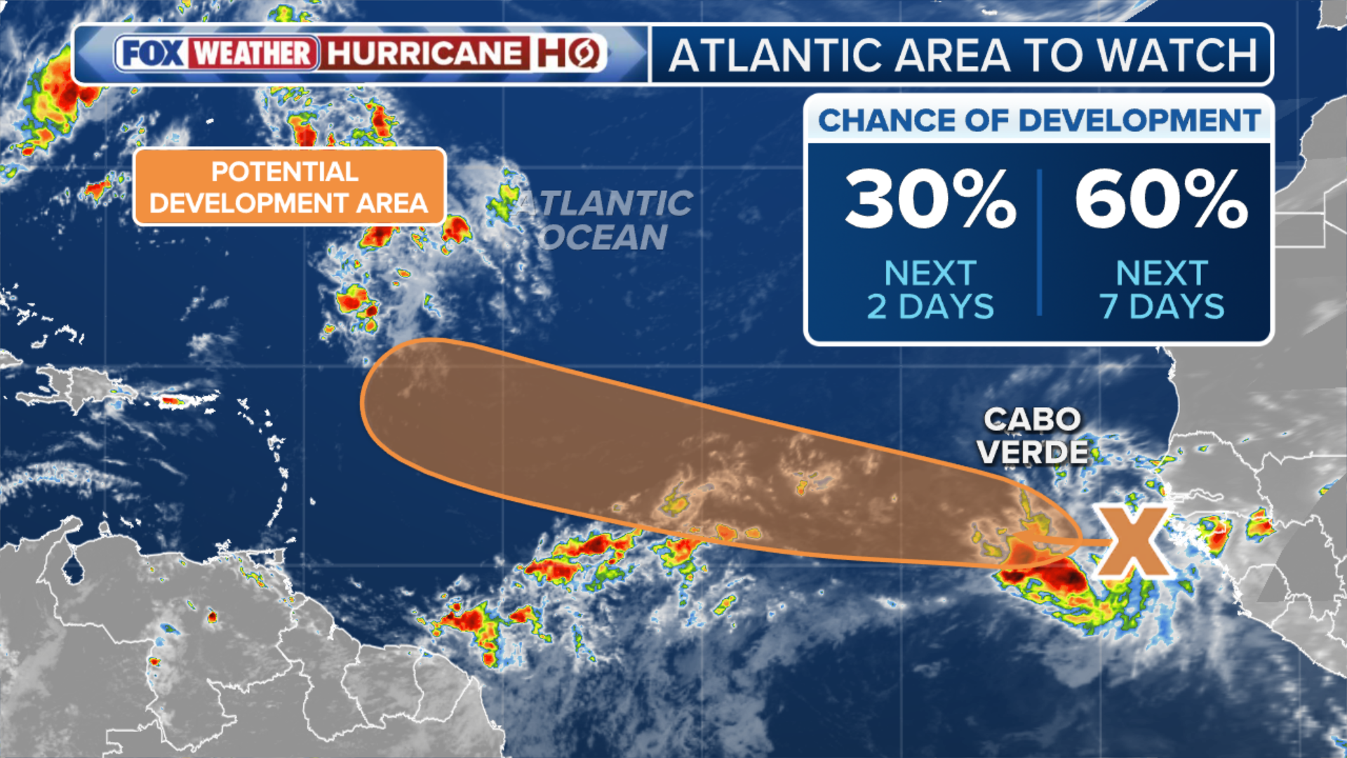 The overview of the third area to watch in the Atlantic
(FOX Weather)
Still, some forecast models suggest it could quickly develop into a tropical depression or storm early next week.
RAIN, WIND AND… SNOW? TROPICAL STORM LALA BRINGS A WINTRY SURPRISE TO HAWAII
The National Hurricane Center has placed low odds on development next week.
Once in the Atlantic, the wave will face its share of atmospheric hostility.
This will likely be a system for the northeastern Caribbean islands to monitor toward the end of next week.
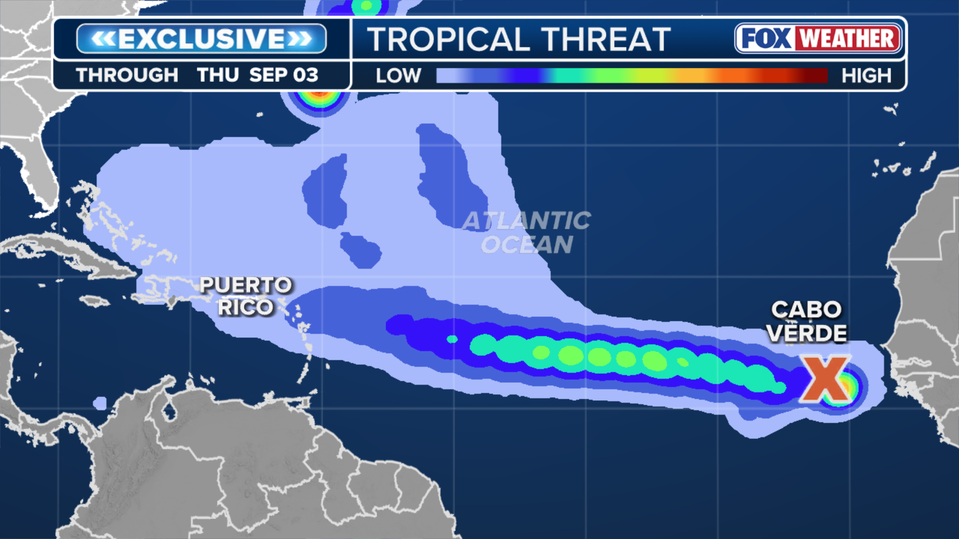 Overview Atlantic tropical threat.
(FOX Weather)
The FOX Forecast Center said impacts beyond rain are unlikely with the system.
There is no threat to the U.S.
Aug. 20 marks the unofficial start of the most active part of the Atlantic hurricane season.
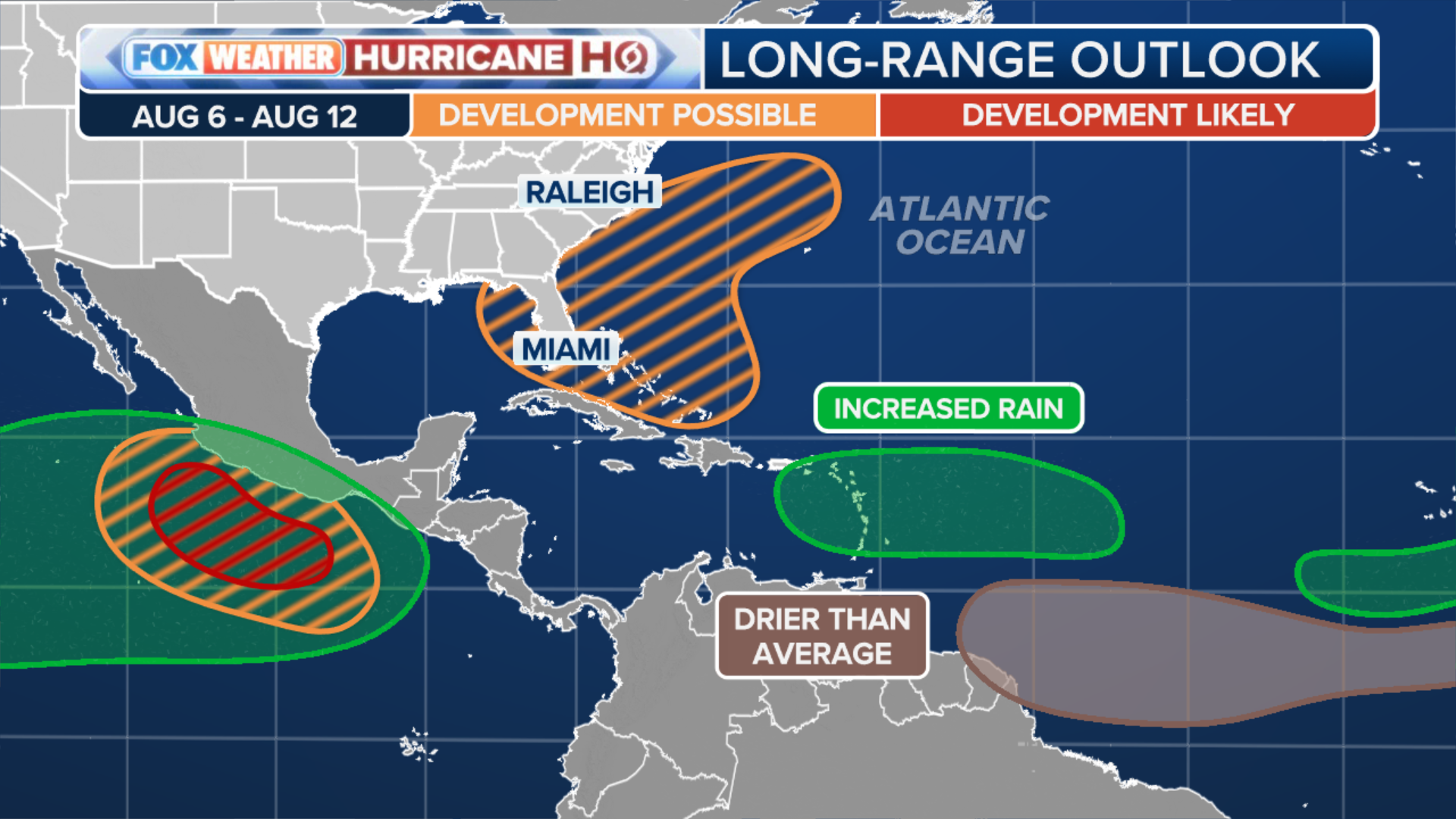 Long-range outlook.
(FOX Weather)
Nearly two-thirds of all activity happens between now and October.
The Atlantic hurricane season runs from June 1 to Nov. 30.
Stay with FOX Weather as we continue to update this story with the latest information.