National Hurricane Center monitoring two areas for possible development
Hurricane season will end November 30
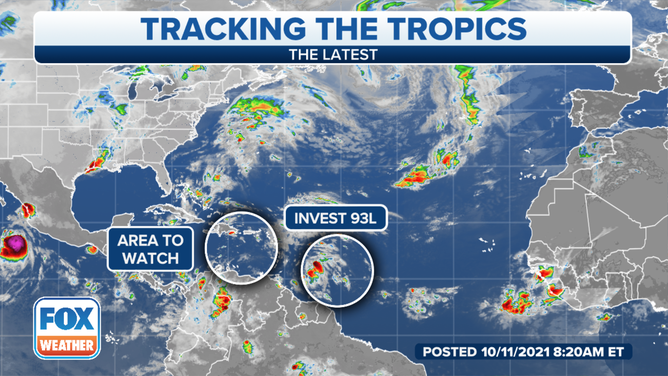
Two areas are being monitored for possible development into tropical systems.
(FOX Weather / FOX Weather)
The National Hurricane Center is monitoring two areas in the Atlantic Ocean for possible development into a tropical system over the next several days.
Invest 93L is located about 400 miles east-southeast of the Winward Islands and continues to produce clouds and storms to the area.
An invest is a naming convention used by the NHC to identify areas it is investigating for possible development into a tropical depression or tropical storm within the next five days.
Forecasters said some slow development is possible over the next few days while the system moves west-northwest at about 15 mph toward the Lesser Antilles. After that, the NHC said strong upper-level winds could limit future development.
Regardless of development, heavy rain and gusty winds could occur across portions of the central and northern Lesser Antilles Tuesday and across the Virgin Islands and the Leeward Islands on Wednesday.
A second area is also being monitored.
That system is located over the Caribbean Sea is producing a large area of disorganized showers and storms. While conditions are unfavorable for development over the next day or two, there could be some gradual development when it’s located near the Bahamas midweek.
Heavy rain will be possible over parts of the Lesser Antilles, Puerto Rico and Hispaniola over the next few days.