

Rounds of thunderstorms, dangerous flash flooding slam Southeast as multiday event lingers into next week
By the end of the week, at least 1 to 3 inches of rain will likely have fallen for most of the Southeast.
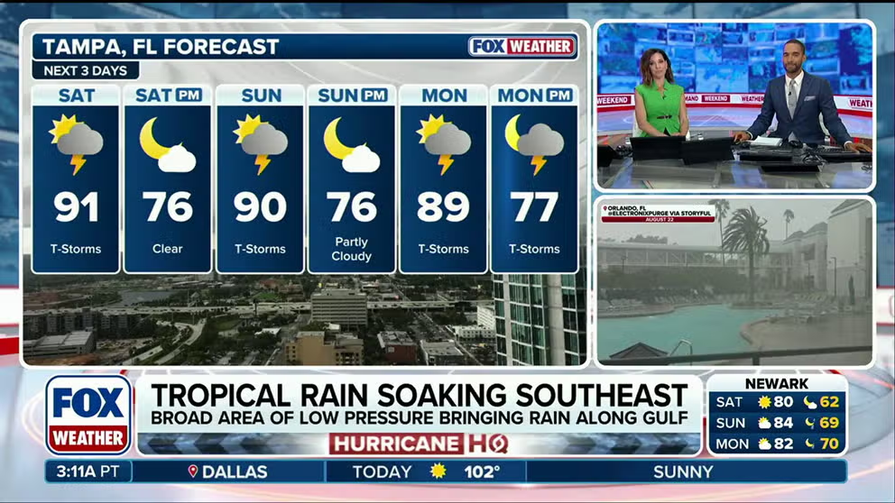
Heavy rain soaks the Southeast, triggers flash flood threats
Rounds of rain and thunderstorms will batter the Southeast through the weekend, triggering a Level 1 out of 4 flash flood threat across several states, from Louisiana through parts of Virginia. Stick with FOX Weather for the latest:
THE TAKEAWAY
- The cold front that created severe storms in the Northeast is pushing into the South.
- Sunday storms will pose a damaging wind threat.
- By Monday, at least 1 to 3 inches of rain will likely have fallen for most of the Southeast.
The South has seen little relief as a flash flood threat continues its grasp on the region until this weekend.
The active weather pattern began early this week with thunderstorms, with the severe weather threat ramping up on Wednesday and then shifting to a flood threat on Thursday. Now, that threat will remain through the weekend.
Daily rounds of showers and storms will increase throughout the weekend, keeping things unsettled.
KNOW YOUR FLOOD TERMINOLOGY: WHAT FLOOD WATCHES, WARNINGS AND EMERGENCIES REALLY MEAN
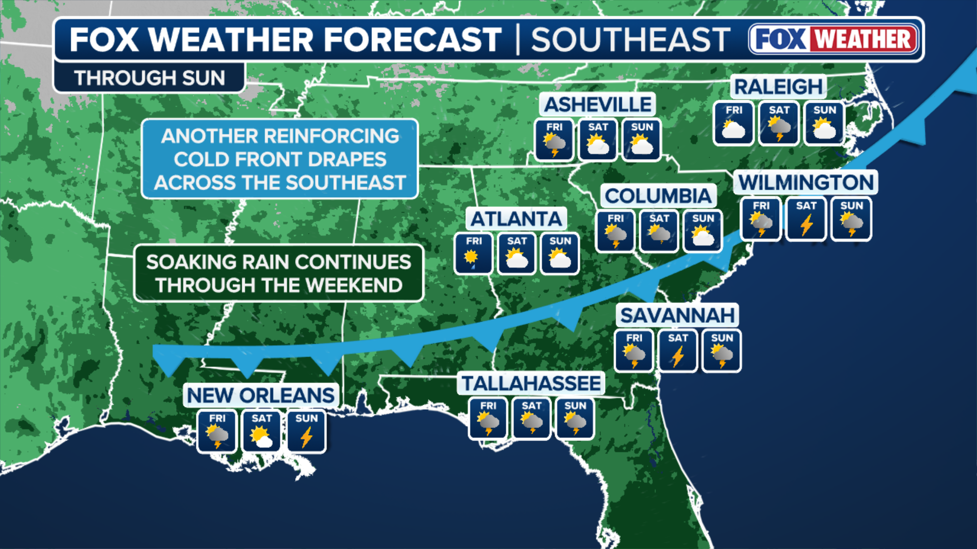
(FOX Weather)
A front lingering over the region has slowed down, keeping the same areas under a threat for flash flooding all the way through Monday.
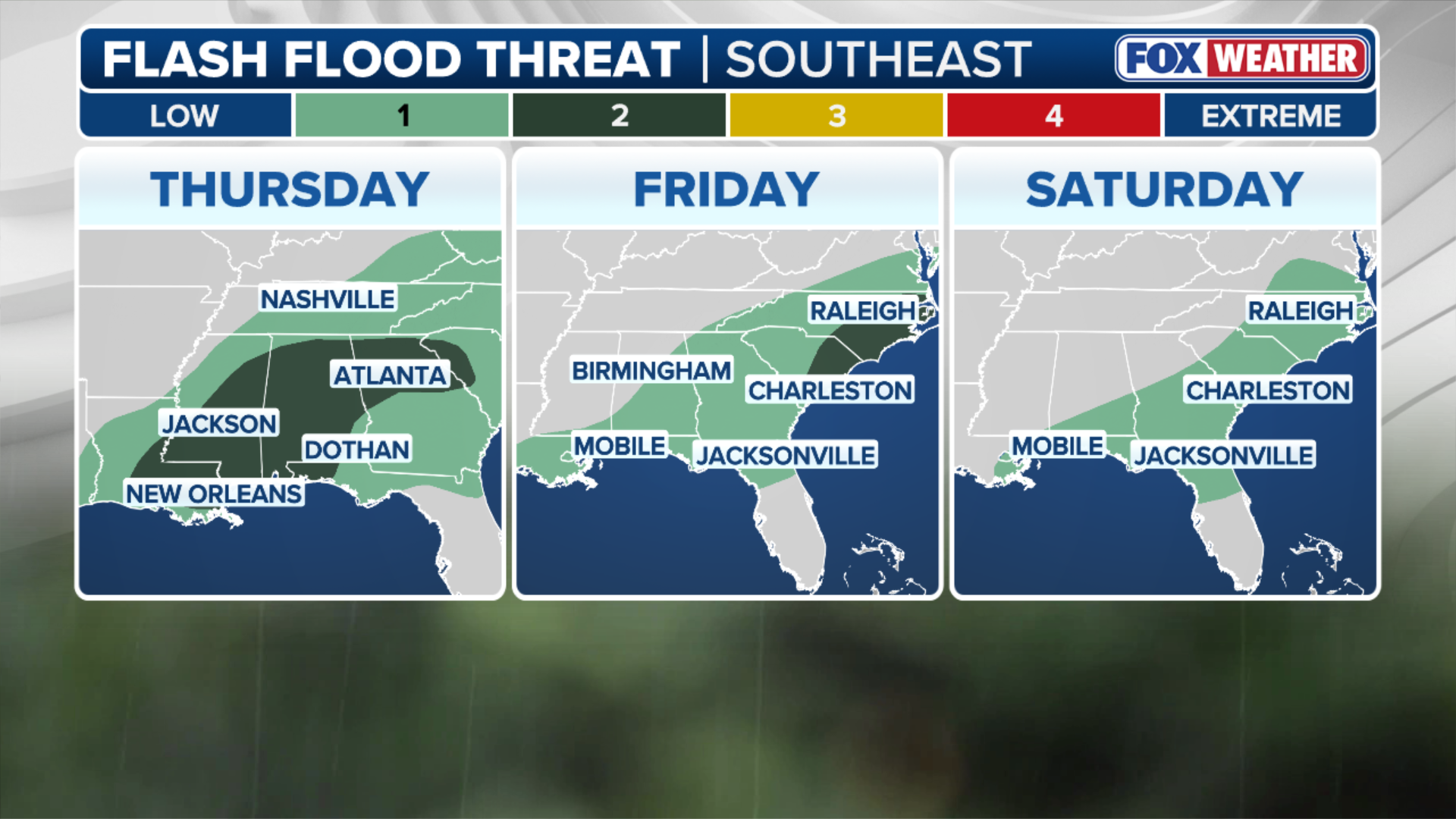
(FOX Weather)

TOPSHOT - Rain from the remnants of Hurricane Harvey falls in New Orleans, Louisiana on August 29, 2017.
( SHAWN FINK/AFP / Getty Images)
Sunday's flash flood threat covers parts of Louisiana, Alabama, Mississippi, Florida and the very southwestern tip of Georgia.

(FOX Weather)
By Monday, at least 1 to 3 inches of rain will likely have fallen for most of the Southeast.
The FOX Forecast Center said no one day will be wetter than the other, but it could spoil outdoor weekend plans for millions.