Saltwater creeping up Mississippi River amid lowest levels in a decade
Water from 41% of the U.S. drains into the mighty Mississippi which carries it to the Gulf of Mexico. It serves as not only a water source for the millions who live along it but also an important transportation route.
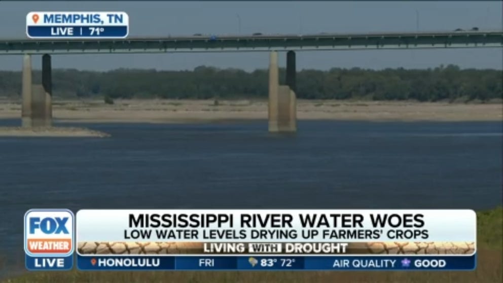
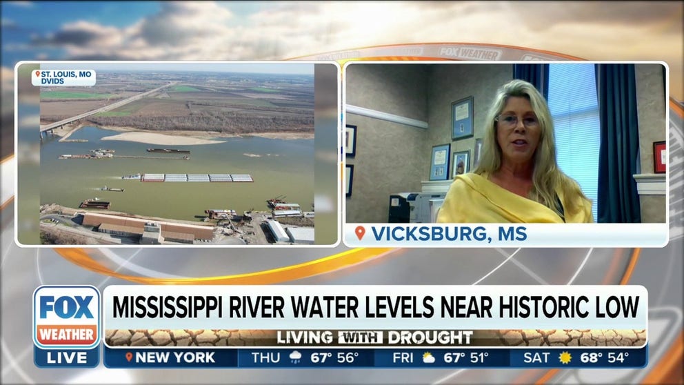
Mississippi River water woes: Low water levels impacting millions of Americans
Slow shipping along the Mississippi River in impacting farmers' profits. FOX Weather's Nicole Valdes reports.
It has been a decade since water levels in the Mississippi River have reached levels as low as they are now. In fact, they’re so low that saltwater from the Gulf of Mexico is rushing upstream to fill the gap.
According to the Lower Mississippi River Forecast Center, water levels are at or below the low-water threshold along a nearly 400-mile stretch of the river from near where the Ohio River meets the Mississippi River south to near Vicksburg, Mississippi.
Between Osceola and Helena in Arkansas, water levels are actually below the gauges. Memphis, Tennessee, is among the places experiencing the lowest levels – minus 8.3 feet as of Wednesday afternoon.
WATCH: TORNADO PASSES SHIPS ON MISSISSIPPI RIVER IN NEW ORLEANS
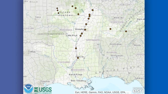
Brown dots mark locations where water levels in the Mississippi River are at or below the low-water threshold as of Oct. 12, 2022.
(NOAA/USGS/LMRFC)
What’s causing it?
According to Jeff Graschel, service coordination hydrologist at LMRFC, the last time water levels in the Mississippi River were this low was in 2012.
Graschel said the phenomenon happens about once a decade when a lack of rainfall and drought conditions combine to create a parched landscape across the 41% of the U.S. that drains into the river.
Even after rain falls in areas that feed the river, it takes a while for that water to reach the most impacted parts of the Mississippi, according to Graschel. He said rain in northern stretches of the basin, such as western Pennsylvania and Minnesota, can take nearly a month to reach New Orleans on the southern end of the river.
DROUGHT-PARCHED WEST LOOKS TO MIGHTY MISSISSIPPI FOR SOLUTIONS TO WATER CRISIS
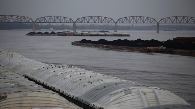
![Barge on the Mississippi River in Memphis]() Image 1 of 2
Image 1 of 2A river barge pushes its cargo up the Mississippi River as the sun sets in Memphis, Tennessee, United States on January 06, 2018. (Samuel Corum/Anadolu Agency)
![Barge traffic piles up as water levels fall on Mississippi]() Image 2 of 2
Image 2 of 2Barge traffic is seen on the Ohio River near the confluence with the Mississippi River at Cairo, Illinois, Wednesday, December 19, 2012. (E. Jason Wambsgans/Chicago Tribune/Tribune News Service)

Saltwater moving upstream
In addition to being the main drainage path for water across a large part of the country, the Mississippi River is also the primary water source for towns and cities along it.
According to the Army Corps of Engineers, the bottom of the river is deeper than the surface water of the Gulf of Mexico into which it feeds. This means that when the river’s flow is reduced, saltwater from the gulf can flow up the river.
"If you get too much salt in the water, then that doesn’t allow you to be able to use it for consumption," Graschel said.
Graschel said this happened in 2012 and is happening again this time around.
Matt Roe, spokesman for the Army Corps of Engineers’ New Orleans office, said this year’s so-called saltwater wedge had made it about 57 miles upstream as of Wednesday afternoon.
NEBRASKA MAN BREAKS WORLD RECORD BY FLOATING 38 MILES DOWN MISSOURI RIVER IN 800-POUND PUMPKIN
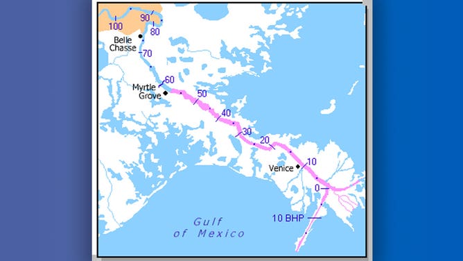
Map showing the position of the saltwater wedge (pink) in the Mississippi River as of Oct. 12, 2022.
(Army Corps of Engineers)
"Currently, the greatest risk associated with the saltwater intrusion is the appearance of unsafe salinity levels at the intakes of municipal drinking water and industrial intakes along the river in Plaquemines Parish," Roe said in a written statement to FOX Weather.
According to Roe, the Corps started construction Tuesday on an underwater mound, or sill, near Myrtle Grove, Louisiana. The goal is to stop the progression of the denser saltwater, which hugs the bottom of the river.
"In about two weeks, construction of the underwater sill will begin to have impacts on the wedge," Roe said.
Saltwater intrusion jeopardizes Mississippi River's safe drinking water supply
The US Army Corps of Engineers is dredging and constructing an underwater sill in the Mississippi River to maintain navigation channel due to low water levels.
Traffic jam
The Mississippi River is also a major trade route to the heartland of America, and low water levels can make navigating the river difficult or even impossible.
"You have less depth in the river system and stuff, because the channel is not as deep, and then you also have less width of the channel, too, because there’s not much water," Graschel said.
Last week, the U.S. Coast Guard closed parts of the river to traffic near Memphis and Stack Island. Those areas have since reopened to some traffic after dredging allowed for safe travel.
Viking Cruises said last week that it had to call off its planned cruise to St. Paul, Minnesota, which was scheduled to depart Oct. 15.
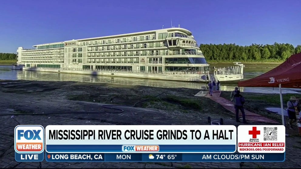
Mississippi River cruise ship grinds to a halt due to low water levels
Water levels on parts of the Mississippi River are so low that traffic on the heavily traveled waterway is being impeded, including one company’s river cruise.
"This is also the time of year they are moving a lot of grain from the Midwest area, moving southward, but then, conversely, there’s a lot of fertilizers and stuff that are being moved northward up into the Midwest," Graschel said.
The Army Corps of Engineers told FOX Weather on Wednesday that more dredging of the river is underway south of Memphis and near Cairo, Illinois, where the Ohio and Mississippi rivers meet.
Is relief in sight?
Graschel said a cold front traversing the country this week is producing rain across parts of the basin, but it’s just a drop in the bucket.
"Right now, we’re not seeing indications that would actually alleviate the low-water conditions we have at this time," Graschel said.