Midweek storm could bring first snow of season to parts of Northeast
There has not yet been an official measurable snowfall to whiten the ground in Boston, New York City, Philadelphia or Washington
Midweek storm could bring first snow of season to parts of Northeast
A midweek storm could bring the first snow of season to parts of the Northeast.
A midweek storm could bring the first snow of the season for many in the Northeast and mid-Atlantic.
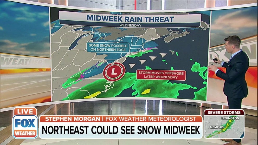
While snowflakes might have already fallen from the sky in some areas, there has not yet been an official measurable snowfall (at least 0.1 inches) to whiten the ground in Boston, New York City, Philadelphia or Washington. There's a chance of that changing by Wednesday, but the uncertainty in the storm's track is high, and that will be the key in determining who gets snow and who just sees rain.
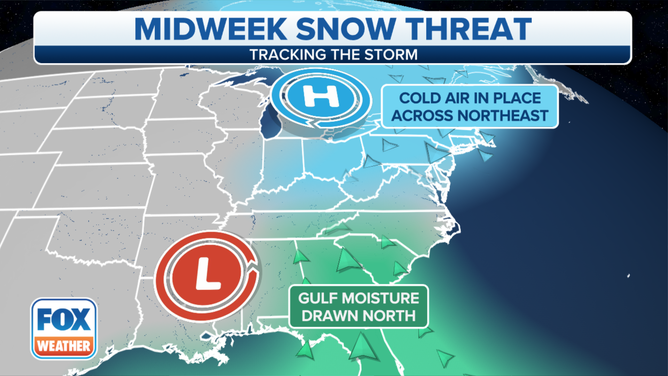
The setup for this potential storm involves an area of high pressure to the north that will be funneling down cold air from Canada.
Meanwhile, a developing low-pressure system in the South will tap into moisture from both the Gulf of Mexico and the Atlantic Ocean as it slides up the Eastern Seaboard on Wednesday.
(FOX Weather)
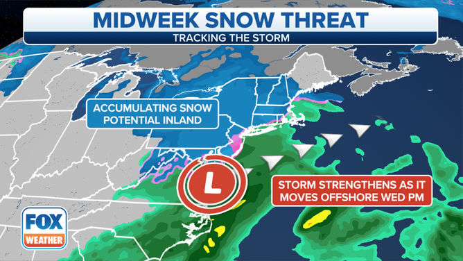
There are two scenarios for this midweek storm, but either way, we don't expect it to become any sort of blockbuster storm for the Northeast.
However, we will note that accumulating snowfall is not out of the question for some areas of the Northeast and mid-Atlantic that haven't yet seen their first snow of the season.
WHEN CAN YOU EXPECT THE FIRST SNOW OF THE SEASON?
(FOX Weather)
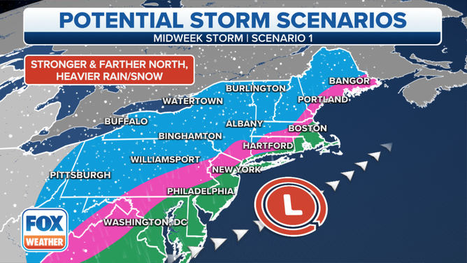
In the first scenario, the low-pressure system would track closer to the East Coast, which would cause much of the Interstate 95 corridor from Boston to Washington to be on the warm side of the storm.
That means any snow would be confined to interior portions of the Northeast, as the highly populated Northeast Megalopolis only sees a cold, soaking rain on Wednesday.
(FOX Weather)
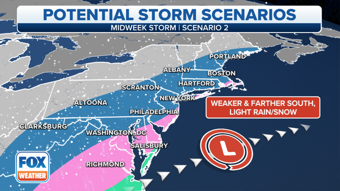
Scenario two would be the colder, snowier outcome for the Boston-to-Washington corridor along Interstate 95. In this case, the area of low pressure would track farther south, allowing the Northeast to tap into some of that cold air from Canada.
WHICH IS THE SNOWIEST MONTH OF THE YEAR?
Even in this scenario, however, any snow would be light and may not add up to much, but it would be the first snow of the season for the major Northeast cities. It will likely still struggle to snow along the coast due to the influence from the relatively warmer Atlantic Ocean, but Interstate 95 might be just far enough inland for snow if this second scenario comes to fruition.
(FOX Weather)
We'll be fine-tuning this forecast over the next day or so, so check back with FOX Weather for updates.
For now, the key takeaway is that this will likely just be a nuisance-type event on Wednesday. The exact track of the low-pressure system up the Eastern Seaboard will be the key to determining who sees snow and who just gets rain.