

Saharan dust plume intensifies, blankets heat dome gripping Florida, Gulf Coast allowing temperatures to soar
The blanket of African dust, working together with a heat dome in the Southeast, will combine to bring feels-like temperatures approaching 110 degrees.
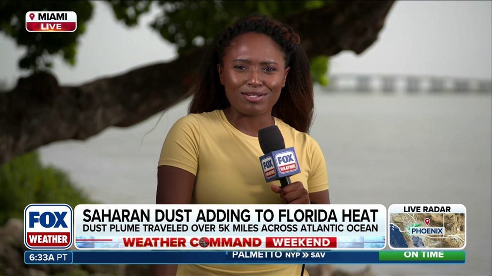
5,000-mile Saharan dust plume intensifies Florida heat
FOX Weather Correspondent Brandy Campbell reports live from Miami, where the heaviest concentrations of Saharan dust are blanketing Florida and the Gulf Coast this weekend. The plume has traveled over 5,000 miles across the Atlantic Ocean, acting as a thermal blanket that intensifies the extreme heat locked across the region
MIAMI — Saharan dust has once again traveled over 5,000 miles across the Atlantic Ocean, bringing hazy skies to parts of Florida and the Gulf Coast this weekend.
The blanket of African dust, working together with a heat dome in the Southeast, will combine to bring feels-like temperatures approaching 110 degrees.
The dust is also part of a massive plume stretching across parts of the Atlantic Ocean that's contributing to the ongoing pause in the Atlantic hurricane season.
5 THINGS TO KNOW ABOUT THE SAHARAN DUST PLUME
(FOX Weather)
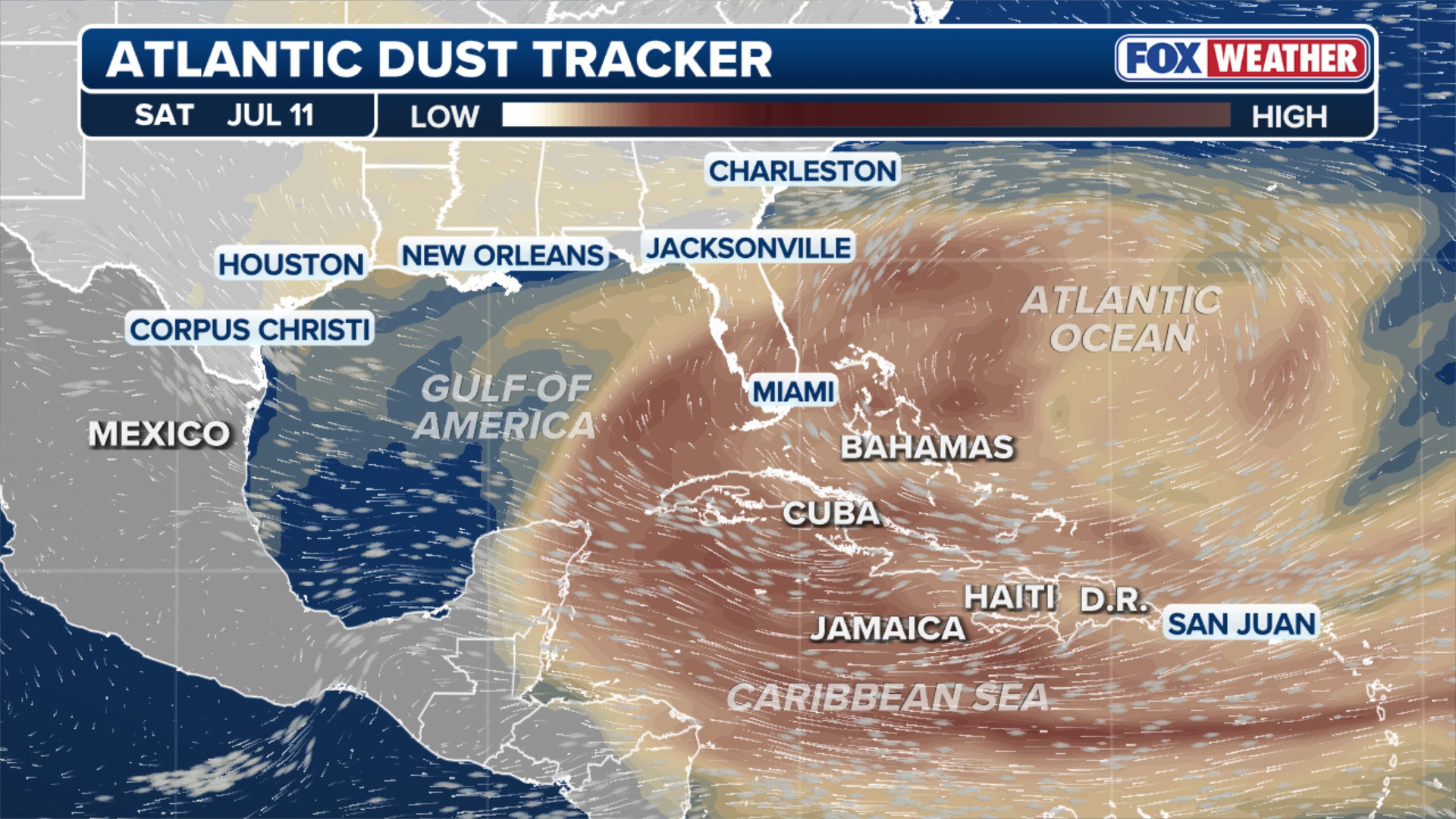
On Sunday, the highest dust concentration will expand across the entire Gulf of America, bringing dust to portions of coastal Texas and Louisiana to begin the workweek.
The dust is forecast to remain around the Gulf Coast and Florida through most of next week, the FOX Forecast Center said.
SAHARAN DUST SETTLES OVER HURRICANE BREEDING GROUNDS. HERE'S WHAT IT MEANS FOR HURRICANE SEASON
The Saharan Air Layer is a mass of very dry, dusty air that forms over the African desert and is lofted high into the atmosphere by strong winds. While its dry air typically suppresses tropical storm development, it also heavily impacts Florida and portions of the Gulf Coast, the FOX Forecast Center said.

Watch: Florida skies turn hazy as Saharan dust settles over Miami
Florida DOT cameras capture Saharan dust bringing hazy skies over Miami on Wednesday, July 8, 2026.
The dust began impacting the Sunshine State last week, with Florida Department of Transportation cameras in Miami capturing the thick haze on Wednesday afternoon.
Additionally, FOX Weather Correspondent Brandy Campbell shared video from her airplane seat as Saharan dust blanketed the Florida Everglades on Thursday.
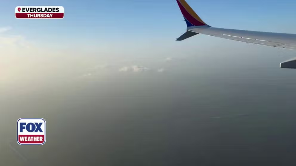
View from above: Layer of Saharan dust blankets the Florida Everglades
A layer of Saharan dust blanketed the Florida Everglades on Thursday, July 9, 2026. The dust acts as a thermal blanket, trapping heat and will help keep temperatures elevated through the weekend. The dust is also part of a massive plume stretching across parts of the Atlantic Ocean that's contributing to the ongoing pause in the Atlantic hurricane season.
The dust is forecast to remain around the Gulf Coast and Florida through most of this week.
Beyond the vibrant sunsets and milky skies, the heat dome over the region will combine with the dust—which acts as a thermal blanket—allowing temperatures to soar.
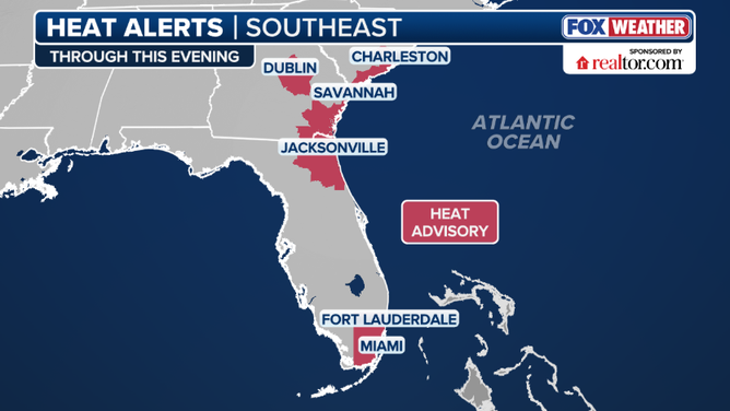
Heat Alerts
(FOX Weather)
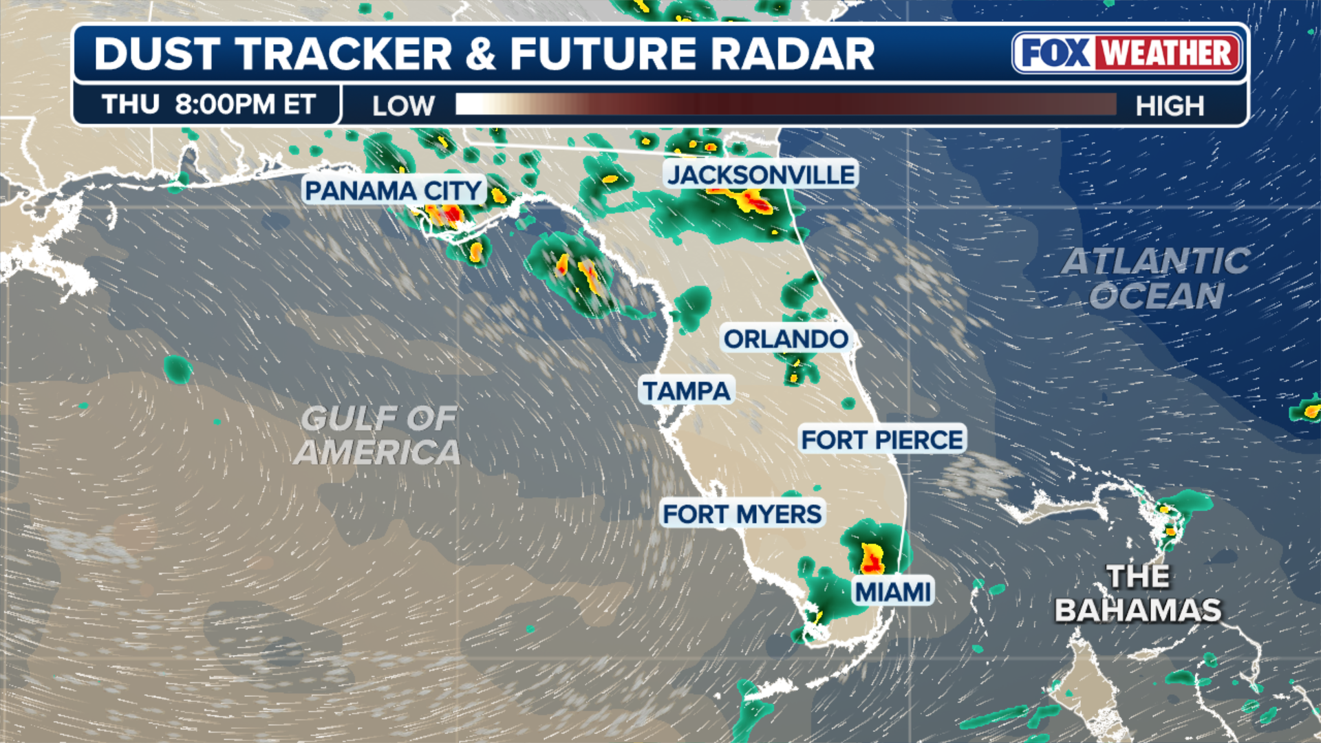
Along with the extreme heat and Saharan dust, severe storms are creating a triple threat across Florida.
Strong to severe storms have been scattered around the Sunshine State so far this weekend.
On Friday, a couple of tornadoes were reported in the Fort Myers area, while Gainesville recorded a thunderstorm wind gust of 65 mph, a notable blow that ranks as the third-strongest wind gust on record in the North-Central Florida college city.
(FOX Weather)
While Saharan dust would usually act to keep storms at bay, high amounts of atmospheric moisture will allow these storms to overcome the dry air.
Storms are expected to develop late in the day, producing strong wind gusts before weakening as quickly as they form.
THE AIR QUALITY INDEX EXPLAINED: WHAT AIR QUALITY IS BAD?
The dust is also reducing air quality across the state and could become an issue for groups with respiratory conditions — especially as air quality levels are expected to plummet with more concentrated plumes moving in.
The U.S. Virgin Islands in the Caribbean will also be affected by the dust, with the Department of Health warning residents of the extreme temperatures and the dust.
FOX Weather will continue to bring you the latest forecasts and information as the dust gets closer.