

More heavy rain, severe storms target waterlogged Midwest as flash flood threat grows
According to the FOX Forecast Center, damaging winds and flash flooding will pose the biggest threats.
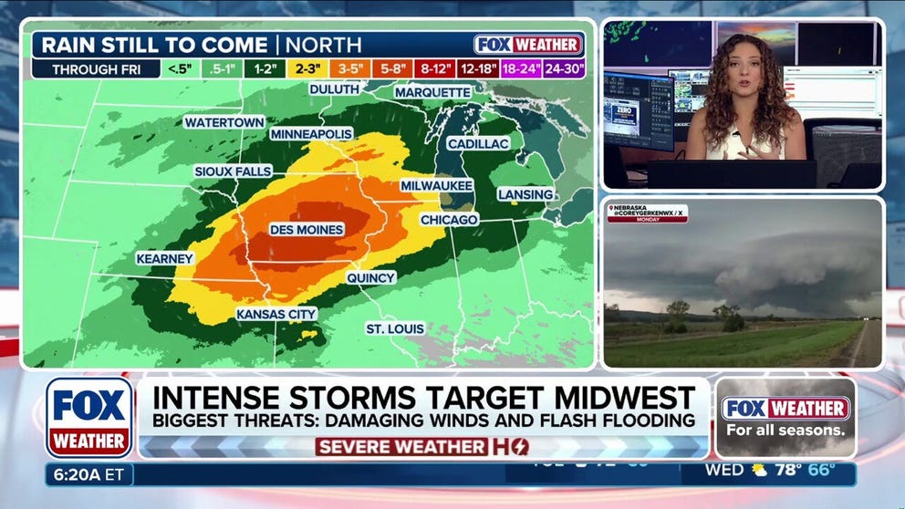
More rounds of severe storms, increased flood threats target Midwest this week
The soggy September saga continues across parts of the Midwest on Sunday, with ongoing downpours and severe weather. Flash flooding will become increasingly likely and severe storms are expected to fire off later this afternoon. Full forecast:
THE TAKEAWAY
- More rounds of severe storms and flash flood threats will impact the Midwest through Friday.
- Damaging winds and heavy rain are the primary concerns of these storms.
- A Level 2 out of 4 flash flood risk has been issued through Wednesday.
The soggy start to September continues across the Midwest this week, with periods of rain and strong to severe storms expected through Friday.
The storms will bring the risk of flash flooding, with that threat increasing through midweek as additional rounds of heavy rain move across an already waterlogged region. Damaging wind gusts will also be possible.
FLOODING RAIN, THUNDERSTORMS THREATEN MAJOR EAST COAST CITIES AS ONGOING DOWNPOURS DRENCH NORTHEAST
A Level 2 out of 4 flash flood risk is in place through Wednesday.
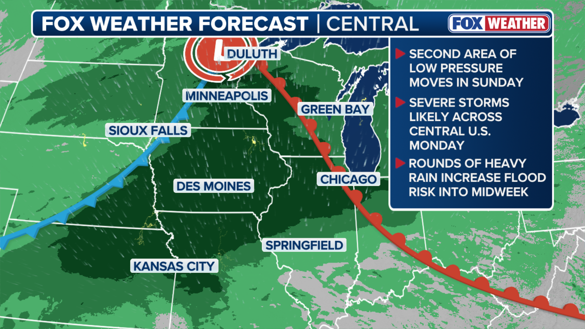
(FOX Weather)
September has already been a remarkably wet month across parts of the Midwest. In fact, some locations are reporting their wettest start to September on record.
More rain this week could add inches to already-soaked areas, keeping flooding concerns elevated through the week.
KNOW YOUR FLOOD TERMINOLOGY: WHAT FLOOD WATCHES, WARNINGS AND EMERGENCIES REALLY MEAN
A storm system moving in from the Pacific Northwest will swing into the Midwest from Sunday into Monday, drawing up moisture ahead of it.
PERSISTENT DOWNPOURS TRIGGER FLOOD THREAT FOR DROUGHT-RIDDEN SOUTHEAST THROUGH THE WEEKEND
While the low-pressure system will intensify farther north in Canada, its trailing cold front will spark the chance for a few severe storms on Monday.
This has prompted a Level 1 out of 5 severe storm threat stretching from Wisconsin to Nebraska, with damaging wind gusts being the main concern.

(FOX Weather)
Additionally, a smaller pocket of severe storms is increasingly likely around Omaha, where a Level 2 out of 5 severe storm threat has been issued.
"Right now, if morning storms move out, the chance for severe hazards will exist," the FOX Forecast Center said.
As the cold front moves through on Monday, the weather pattern will shift to a more active one as the system will become stationary over the region, increasing the chance of rain.
REMAINS BELIEVED TO BE LINKED TO HURRICANE HELENE VICTIM DISCOVERED YEARS AFTER DEADLY STORM
This brings an elevated risk of flash flooding starting Sunday and continuing through at least Thursday morning.
Moisture from the Gulf of Mexico will fuel thunderstorms across the region, bringing heavy rain that could fall at rates of 1 to 2 inches per hour.

(FOX Weather)
Rainfall totals of 3 to 5 inches are becoming likely across most of Iowa and southern Minnesota, with a broader 2 to 3 inches possible from Chicago to Omaha.
Because soils across Iowa, Minnesota and the wider Midwest are already saturated from previous rainfall, it will take less additional rain to trigger flash flooding.
Repeated rounds of storms over the same corridors will lead to rapid runoff, increasing the risk for urban street flooding, small stream overflows and sudden water rises in low-lying areas.
A Level 2 out of 4 flash flood threat exists every day through Wednesday across the region, including major metropolitan areas such as Chicago, Milwaukee, Des Moines and Omaha.
Stay with FOX Weather for the latest on the developing storm threat.