Relentless rain raises flood risk for much of Oklahoma, Missouri Ozarks
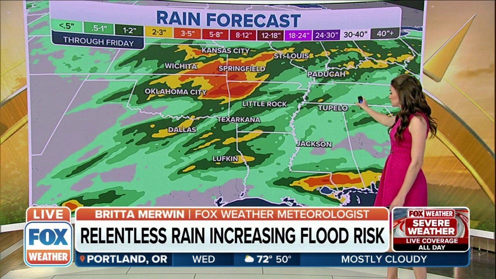
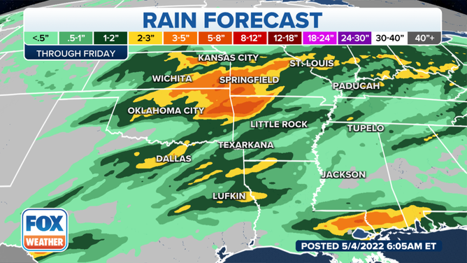
Widespread rainfall amounts of 1 to 3 inches are likely from Nebraska to North Texas. Localized amounts could be as high as 5 to 7 inches.
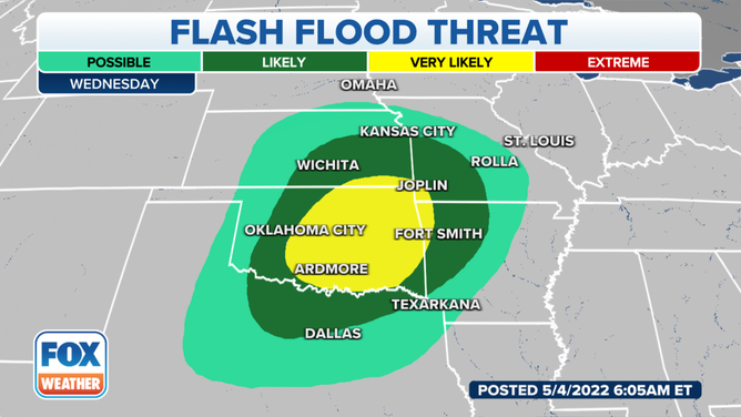
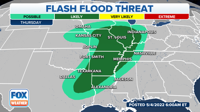
Rounds of heavy rain across Plains, Midwest and South could trigger flash flooding
Widespread amounts of 1-3" are likely from Nebraska/Iowa to North Texas. Localized amounts could be as high as 5-7".
As several rounds of rain soak the Plains, Midwest and South this week, the risk of flash flooding is increasing across the central U.S. on Wednesday.
(FOX Weather)
Widespread rainfall amounts of 1 to 3 inches are likely from Nebraska to North Texas. Localized amounts could be as high as 5 to 7 inches. This could result in flash flooding and mainstem river flooding, especially in rivers that have seen rises from recent rainfall.
(FOX Weather)
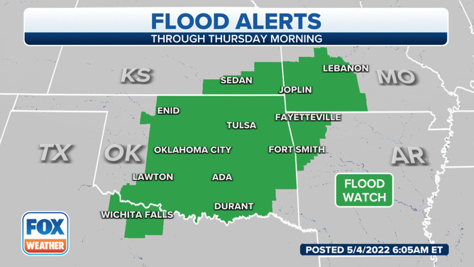
A Flood Watch has been posted through Thursday morning for much of Oklahoma, southeastern Kansas, the Missouri Ozarks, northwestern Arkansas and northwestern Texas. Some locations could experience significant and impactful flooding from the slow-moving storm system, the National Weather Service said.
HOW TO WATCH FOX WEATHER ON TV
(FOX Weather)
The NWS in Springfield, Missouri, said showers and thunderstorms will continue to expand into the region on Wednesday. Cloud-to-ground lightning and brief periods of heavy rain are possible. A couple of storms could become marginally severe, with hail up to the size of quarters.
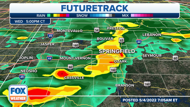
The flash flooding threat will largely hold off until the evening and peak overnight into Thursday morning.
(FOX Weather)
Robust thunderstorms are possible, again, on Thursday afternoon and evening. The primary hazards will be damaging wind gusts and excessive rainfall, though isolated tornadoes and large hail cannot be ruled out.
CLICK HERE TO GET THE FOX WEATHER UPDATE PODCAST
Check back with FOX Weather for frequent updates as we progress through this active week with daily heavy rain threats. And be sure to download the FOX Weather app for the latest forecast and weather alerts for your exact location, plus the 24/7 livestream of America's Weather Team.