Heavy rain moving into South Florida later this week
1-2 inches of rain is expected across much of South Florida, but some locally higher amounts are possible
Downpours could lead to flooding in South Florida late in the week
Heavy rain could lead to flooding in South Florida.
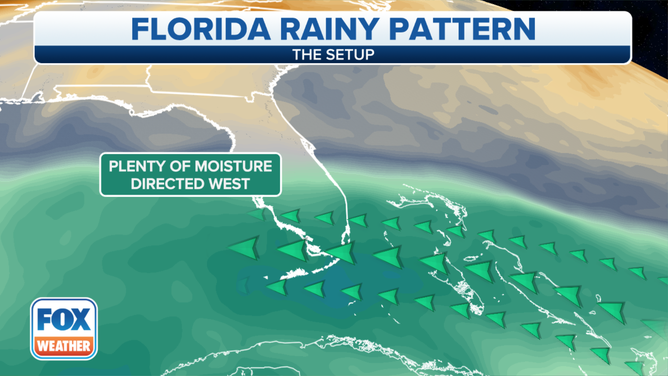
Increasing moisture over South Florida will create opportunities for heavy rain and possible flooding by the end of the week.
(FOX Weather)
Wednesday is expected to be mild, with temperatures in the 80s across much of central and southern Florida. But as the day continues, clouds are expected to move into the region as tropical moisture over the southeastern Gulf of Mexico moves north.
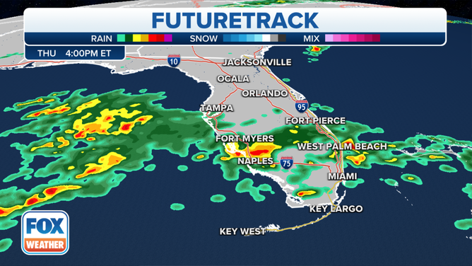
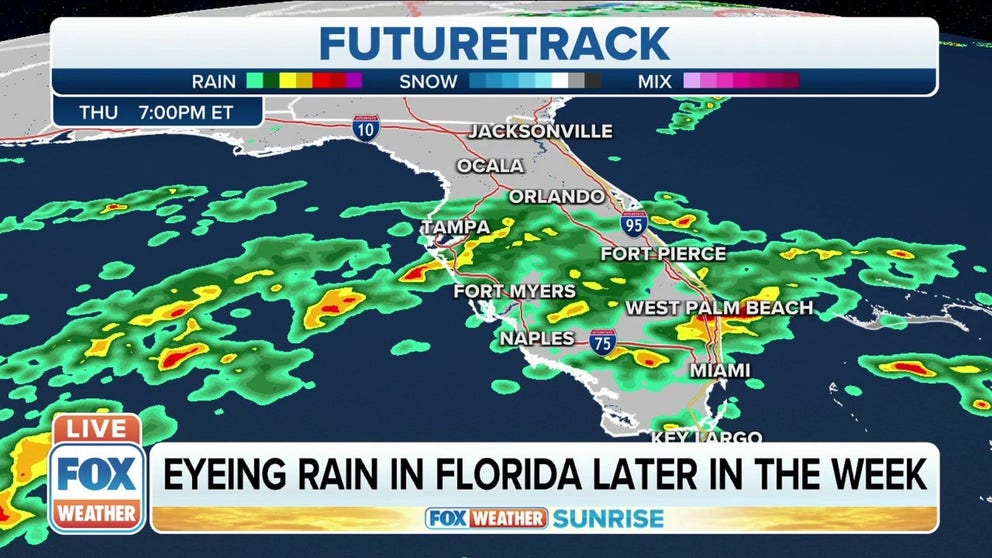
By Thursday afternoon, heavy rain is expected to move into the region.
(FOX Weather)
By Thursday morning, showers and possible thunderstorms will move into the area, and some rain could be heavy.
Because of that, there is the possibility of some localized flooding in any areas where showers and storms set up.
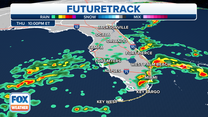
By Thursday evening, heavy rain could move into places like Miami, West Palm Beach and Fort Pierce.
(FOX Weather)
The threat for showers and storms will continue into Thursday evening, where places like Miami, West Palm Beach and Fort Pierce could see heavier downpours. That could make the evening commute a bit slower, so anyone heading out onto the roads should allow for some extra time.
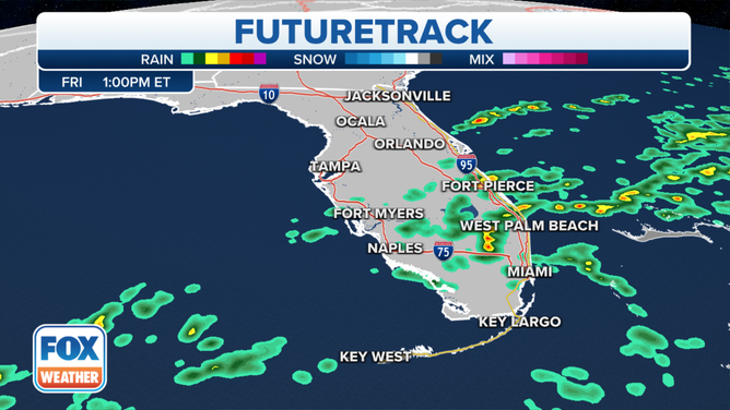
The threat for some rain and possible thunderstorms remains on Friday.
(FOX Weather)
Heavy rain and storms are still possible across South Florida on Friday, but not nearly as widespread as the rain is expected on Thursday.
(FOX Weather)
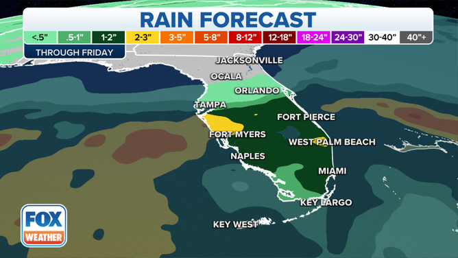
As far as rain totals go, a general 1-2 inches of rain can be expected across much of South Florida, but some heavier amounts are possible where the heavier rain sets up. Areas between Tampa and Fort Myers could see 2-3 inches of rain. Areas surrounding West Palm Beach could also see some higher rain totals before the system moves through the region.