

Multiday threat targets millions across the Midwest, Great Lakes with destructive storms and flash flooding
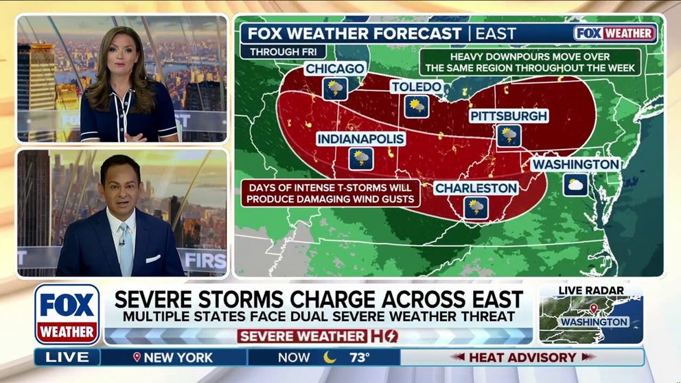
This stormy pattern will remain over the region for much of the week, with thunderstorms tapping into high humidity to produce heavy rain and a flash flood threat as storms repeatedly track over the same areas from Chicago through the Ohio Valley into Pittsburgh and the central Appalachians, including Charleston, West Virginia.
Midwest, Ohio Valley to be slammed by more days of severe storms and potential flooding
Another round of severe weather is targeting parts of the Midwest and the Ohio Valley beginning Monday afternoon, after Sunday's storms spawned at least one tornado in northwestern Illinois. This stormy pattern will remain over the region for much of the week, with thunderstorms tapping into high humidity to produce heavy rain and a flash flood threat as storms repeatedly track over the same areas.
Another round of severe weather is targeting parts of the Midwest, Great Lakes and the Ohio Valley after Sunday's storms spawned at least one tornado in northwestern Illinois.
This stormy pattern will remain over the region for much of the week, with thunderstorms tapping into high humidity to produce heavy rain and a flash flood threat as storms repeatedly track over the same areas from Chicago through the Ohio Valley into Pittsburgh and the central Appalachians, including Charleston, West Virginia.
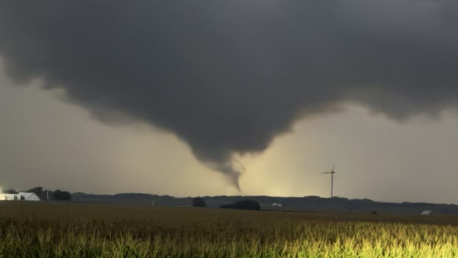
Tornado spotted by FOX Weather Exclusive Storm Tracker Brandon Copic near Annawan, Illinois, on Aug. 9, 2026.
(FOX Weather Exclusive Storm Tracker Brandon Copic / FOX Weather)
A Tornado Warning was issued for the Baltimore area Monday night, but was quickly revoked. Regardless, millions in the area are seeing destructive wind gusts of up to 80 mph, according to the FOX Forecast Center.
Ground stops were in effect at nearly every major Northeast airport on Monday evening.
A tornado was spotted by FOX Weather Exclusive Storm Tracker Brandon Copic Sunday evening near Annawan, Illinois, as severe storms rumbled across the state. Storms produced strong wind gusts across Illinois, Indiana, Michigan and Wisconsin.
The National Weather Service (NWS) recorded a 73 mph wind gust just west of Fort Wayne, Indiana.
(FOX Weather)
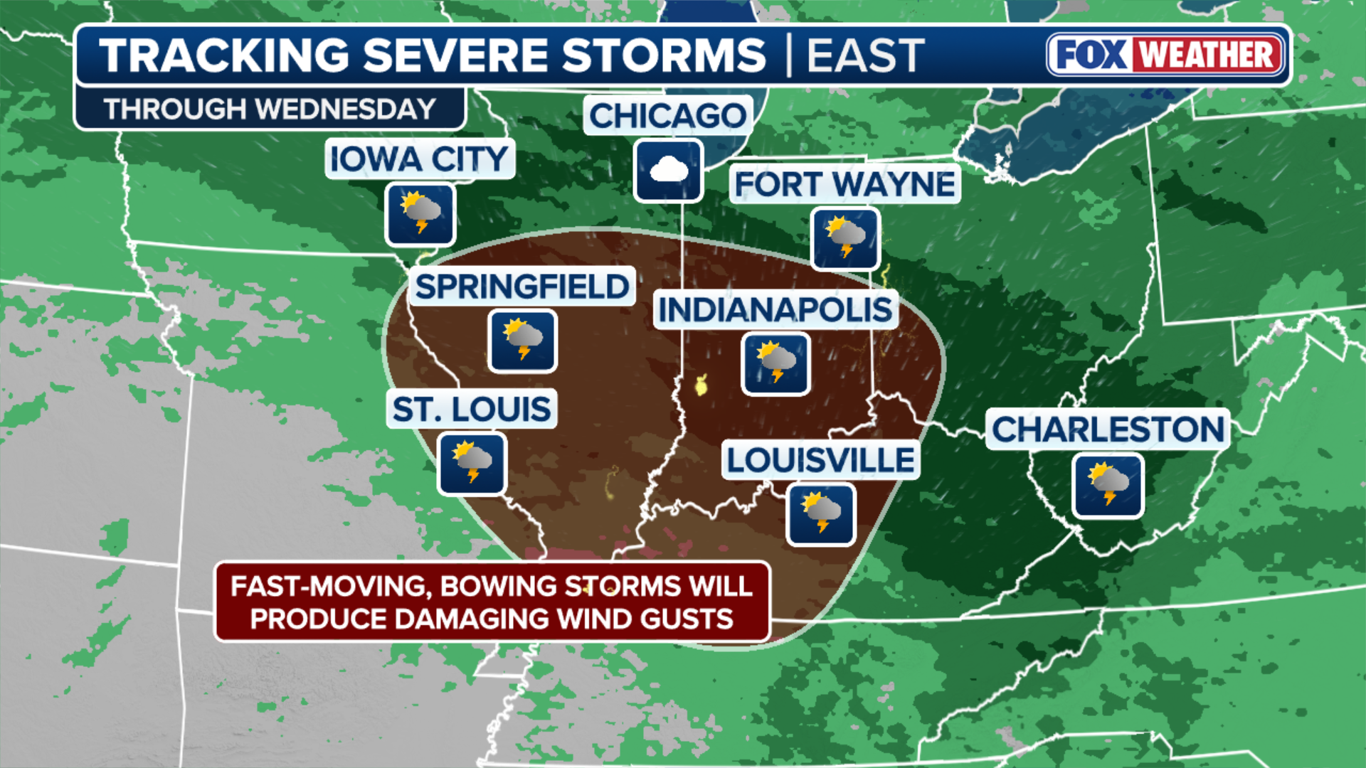
Severe storms are forecast to redevelop beginning Monday afternoon. NOAA's Storm Prediction Center (SPC) has issued a Level 2 out of 5 risk of severe thunderstorms across a corridor from northern and central Illinois to eastern Pennsylvania, as well as parts of northern West Virginia and western Maryland.
This includes the Chicago, Indianapolis, Cleveland, Pittsburgh, Baltimore and Scranton, Pennsylvania, metro areas. Large hail, damaging wind gusts and an isolated tornado are all possible.
4 MAJOR CELESTIAL EVENTS TO DOMINATE THE NIGHT SKY NEXT WEEK
This corridor is also under a Level 2 out of 4 risk of flash flooding, beginning Monday evening after the initial round of storms.

(FOX Weather)
Tuesday's severe weather threat will shift slightly south, farther into the central Appalachians and into Virginia.
Areas in and around Charleston, West Virginia, including parts of southwestern Ohio are under a Level 3 out of 4 flash flood risk through Tuesday.
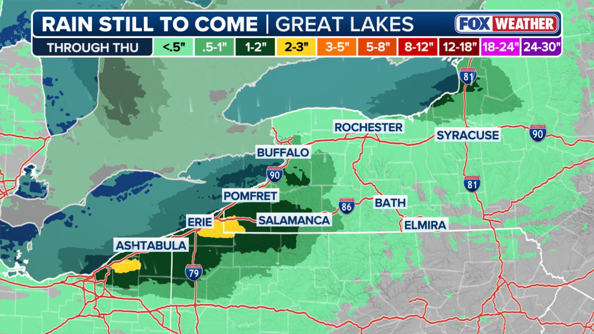
Widespread rain totals of 2 to 3 inches are expected from Chicago to Cleveland, with localized pockets of 3 to 5 inches of rain possible in northern Indiana and Ohio where those repeat showers occur.
(FOX Weather)
Additionally, rain will likely continue into Thursday, with localized rainfall totals across West Virginia potentially exceeding half a foot by the end of the week.
Stick with FOX Weather as we continue to track the storms and give you the latest forecast and information.