Florida's days of flash flood threats eases as stalled front begins to budge
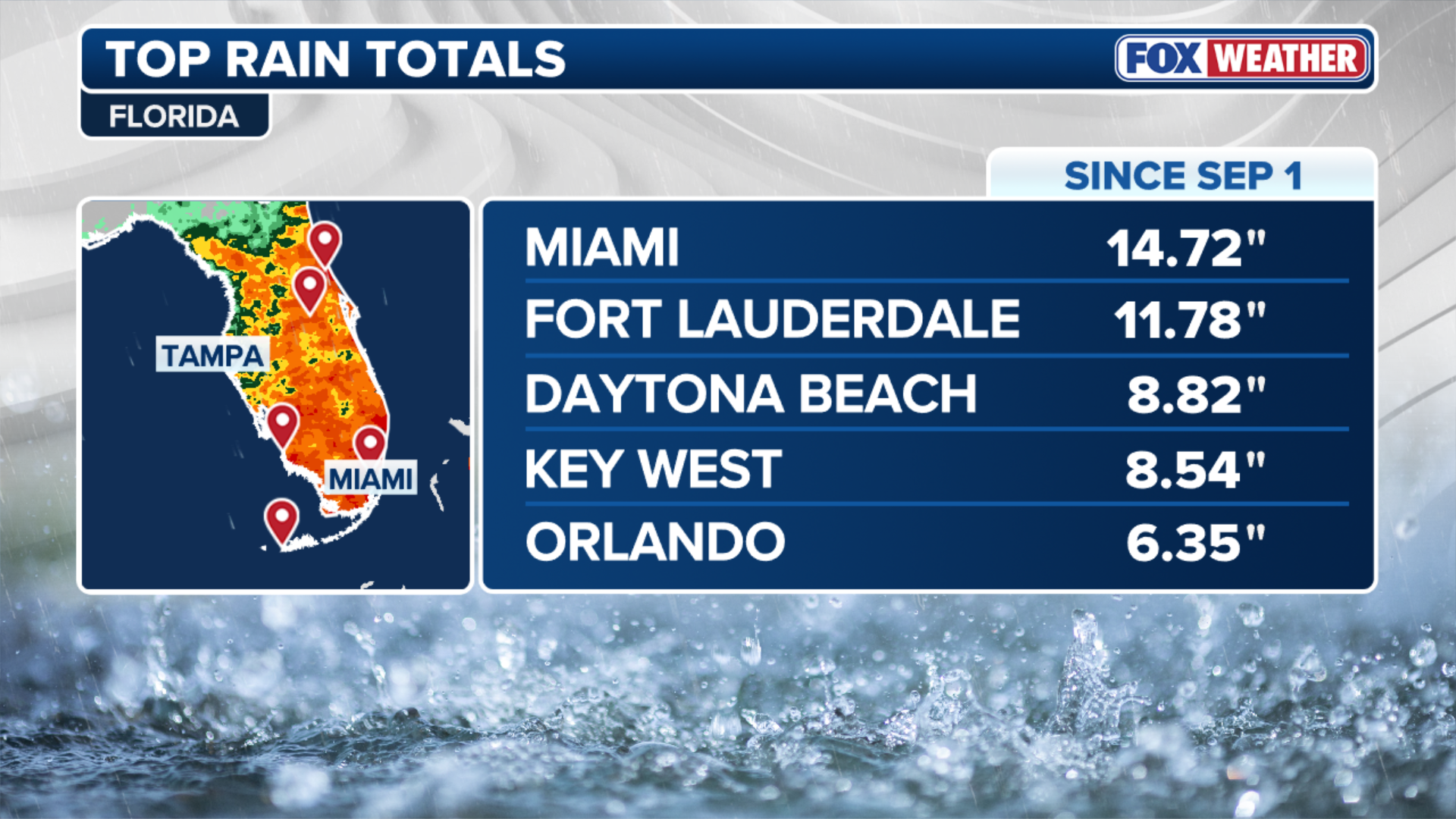
Miami has seen more than 10 inches of rain since the beginning of September, while Fort Lauderdale and Orlando have picked up nearly 7 inches.
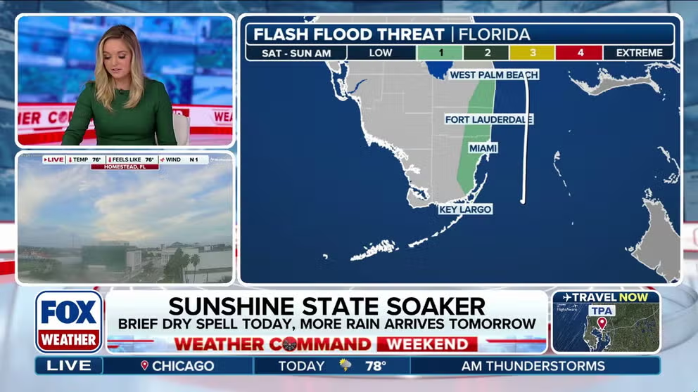
More rain arrives for Florida this weekend
While under a brief dry spell Saturday, more rain is headed Florida's way for Sunday. Miami has seen more than a foot of rain since Sept. 1.
MIAMI – After several weeks of almost daily rain for Florida, a stalled frontal boundary will finally begin to move south into the weekend, allowing the Florida Panhandle and northern part of the state to begin to see some relief from the precipitation.
However, a Level 2 out of 4 Flash Flood Threat remains in place for South Florida through Sunday morning, where Miami and other urban areas re at increased risk of brief floods.
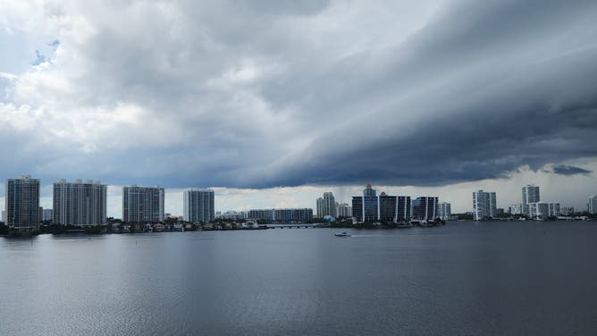
Miami shelf cloud on Sept. 12, 2025.
(David Vergel via Storyful)
During this weeks-long weather pattern, rounds of heavy rain and thunderstorms have been popping up during the afternoon and evening hours, giving residents and travelers the opportunity to get some time outdoors in the morning before the extreme weather moves in.
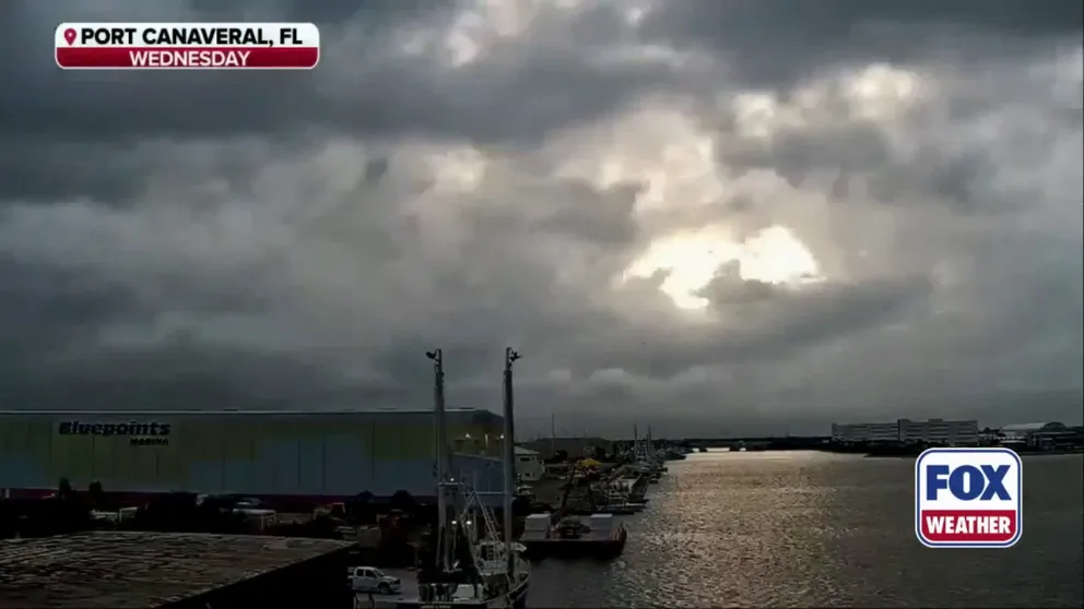
Watch: Time lapse video shows rain moving over Port Canaveral, Florida
A time lapse video shows rain moving over Port Canaveral in Florida on Wednesday, Sept. 10. Florida has seen days of rain leading to a flood threat this week.
The FOX Forecast Center said the extended washout is due to a lingering frontal boundary in combination with tropical moisture.
DOWNLOAD THE FREE FOX WEATHER APP

(FOX Weather)
In fact, several cities in Florida have picked up well over 5 inches of rain.
Miami has seen more than 8 inches of rain since the end of last weekend and more than a foot of rain since the beginning of September. Over 2 inches of that rain fell in two hours Wednesday afternoon, with about 0.61 inches of rain in nine minutes that was followed an hour later by another burst of rain that brought 0.67 inches in another nine minutes.
(FOX Weather)
Meanwhile, cities like Orlando, St. Augustine, Daytona Beach and Naples have all picked up more than 6 inches of rain since the beginning of the month.
All that water will maintain an underlying flood threat through Sunday morning, with parts of the Gold Coast in a Level 1 out of 4 flood threat.

(FOX Weather)
This includes cities like West Palm Beach, Fort Lauderdale and Miami.
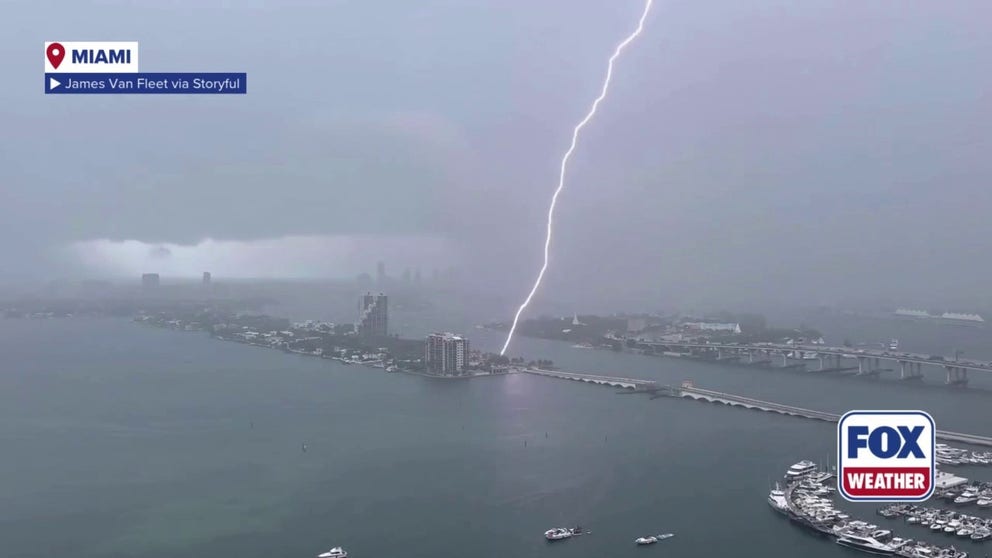
A large lightning strike was observed in Miami on Wednesday
Parts of South Florida were hit by rain and thunderstorms on Wednesday, as locals observed a large lightning strike.
"Obviously, if you get the heavy rain and repeated rounds of it in an urban area where you have cement and blacktop, it's going to flood," FOX Weather Meteorologist Marissa Torres said. "But the hope is also that areas that you get more into Alligator Alley, into some of the areas where the ground is a little bit sandier, it can absorb it a little better."
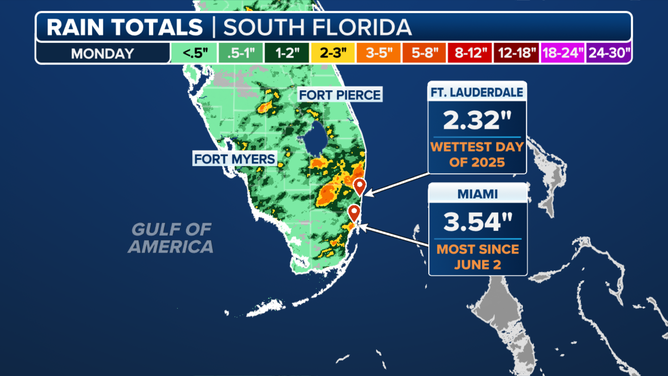
Florida rain totals on Monday, Sept. 8, 2025.
(FOX Weather)
While the flood threat is unwanted, this week’s rainfall has been a crucial step toward easing drought impacts. Parts of South Florida are actually seeing a rain deficit this year. The state's southeastern coast is under severe drought, according to the U.S. Drought Monitor. Miami was about 8 inches below its average rainfall for this time of year, and Fort Lauderdale was 14 inches below average.
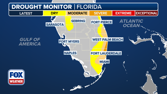
This graphic shows the Florida drought monitor.
(FOX Weather)