

Prolonged rain, flash flood threats target areas of Florida with a month's-worth of rain in just a week
Some parts of Florida could see upwards of 8 inches of rain by next Thursday when this rain event concludes, the FOX Forecast Center said.
Sunshine State bracing for soaking week ahead
Parts of North Florida will be wet for the weekend, but the storms really ramp up into early next week, when the Sunshine State is really the only place in the country seeing wet weather.
THE TAKEAWAY
- A slow-moving cold front taps into tropical moisture to trigger a Florida flood threat into next week.
- Parts of North to Central Florida could see 5 to 8 inches of rain.
- A level 1 out of 4 flash flood threat is already in place for Monday and Tuesday.
Unfortunately for Floridians, the stretch of wet weather isn't letting up for the next several days, bringing necessary rain to drought-stricken parts of the state.
Some parts of Florida could see upwards of 8 inches of rain by next Thursday when this rain event concludes, the FOX Forecast Center said.
🌧️KEY WEST WATERWORKS: Duval Street in Key West turned into a river Thursday as torrential downpours soaked South Florida. Key West broke a daily rain record that had stood since 1943. Watch FOX Weather for details about an upcoming week of rain on tap for the Sunshine State: pic.twitter.com/SLjl6HFv7C
— FOX Weather (@foxweather) October 2, 2026
MILLIONS ACROSS SOUTHEAST FACE DAYS OF HEAVY RAIN, INCREASED FLOOD THREAT IN WET START TO OCTOBER
The slow-moving cold front that is triggering flooding in parts of the Southwest and Southern Plains into this weekend will arrive in Florida early next week.
![A look at how Florida rain takes shape next week.]() Image 1 of 3
Image 1 of 3A look at how Florida rain takes shape next week. ( )
![A look at how Florida rain takes shape next week.]() Image 2 of 3
Image 2 of 3A look at how Florida rain takes shape next week. ( )
![A look at how Florida rain takes shape next week.]() Image 3 of 3
Image 3 of 3A look at how Florida rain takes shape next week. ( )
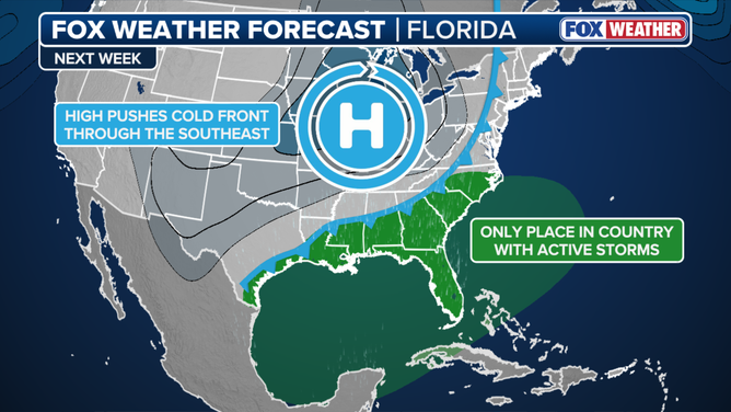
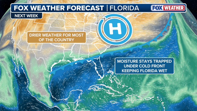
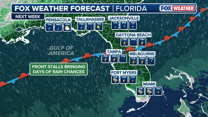
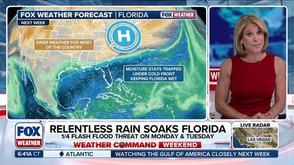
The cold front will stall as it taps into tropical moisture originating from Central America, getting trapped between the boundary and strong high pressure to the north. This setup will lock in a prolonged period of continuous rainfall over the state.
Rain will start to fall on Monday, and is expected to persist through late next week. The highest rainfall totals will concentrate near the stationary front in the Panhandle and North Florida.
OCTOBER OUTLOOK: SUMMER TRIES TO HOLD ON WITH EL NIÑO IMPACTS EXPECTED TO MAKE A SPOOKY APPEARANCE

(FOX Weather)
This is where those 5 to 8 inch rain totals could happen, particularly from Jacksonville to Tampa.
"In fact, some locations could easily eclipse their monthly October averages in just a single week—Jacksonville, for example, typically averages only 4.03 inches for the entire month," the FOX Forecast Center said.
Because of this, a level 1 out of 4 flash flood threat is already in place for Monday and Tuesday across parts of the Florida Panhandle and North Florida.
(FOX Weather)
While official flood threats have not yet been extended beyond Tuesday, additional advisories and risk upgrades are likely as confidence increases in the forecast model guidance, according to the FOX Forecast Center.
All of this moisture will further help ease Florida's drought, of which more than half of the state is in a stage of moderate drought or higher, according to the latest data from the U.S. Drought Monitor.
Stick with FOX Weather as we continue to bring you the latest forecasts on this system heading into next week.