Severe storms, flash flooding possible for Southern Plains, mid-South on Saturday
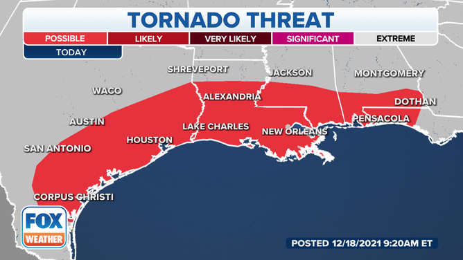
Severe weather will be regionalized along the Gulf States from Corpus Christi, Texas, to Destin, Florida
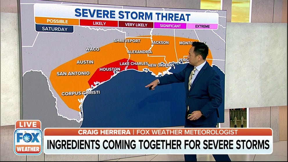
Ingredients come together for severe storms Saturday near Houston
There is a slight risk of strong to severe storms across parts of southeast Texas and a marginal risk of excessive rainfall for much of the area. The primary threat will be large hail, damaging winds and isolated tornadoes along with locally heavy rain.
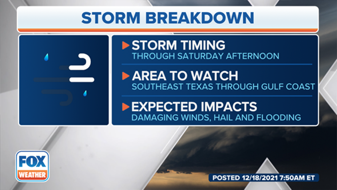
HOUSTON – A stalled-out cold front will bring flooding rain and a threat for severe weather for Southern Plains and Mid-South on Saturday afternoon.
Severe weather will be possible for the Gulf States from Corpus Christi, Texas, to Destin, Florida. The best chance will exist from Houston, Texas, to Lake Charles, Louisiana. Damaging winds, large hail, and tornadoes are all possible.
(FOX Weather)
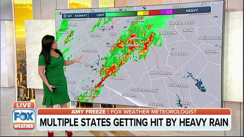
The National Weather Service in Houston said showers and thunderstorms have begun to develop to the west Saturday morning, and they expect activity to increase and spread into Southeast Texas through Saturday afternoon along and ahead of the front.
Flooding and flash flooding are concerns from the Southern Plains through the mid-South, and Ohio Valley as moisture from the Gulf of Mexico spreads north.
(FOX Weather)
Houston is expecting 1-2 inches of rain with isolated higher amounts. Most of the rain will occur around and south of Interstate 10. Minor street flooding is possible, especially for urban areas, the NWS said. The rain and storms could also hamper tornado recovery efforts in the nation’s heartland.
Unsettled weather, heavy rain for the mid-South on Saturday
Flooding and flash flooding will be a concern from the Southern Plains through the mid-South and Ohio Valley on Saturday as moisture from the Gulf of Mexico spreads north.
These storms and the cold front will bring an end to the area's recent record-breaking warmth as temperatures fall.
With breezy north winds behind the front, the NWS said temperatures will continue to fall with Sunday and Monday morning lows expected to bottom out in the upper 30s in north Texas, 40s in the central part of the state and around 50 at the coast. Clouds will linger into Sunday for much of the area resulting in highs mainly in the 50s.
The NWS said a disturbance will move east across Texas on Sunday night and bring another shot of rain to the area.