Flash Flood Emergency declared in Mississippi as torrential rains trigger water rescues
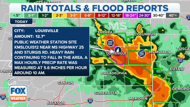
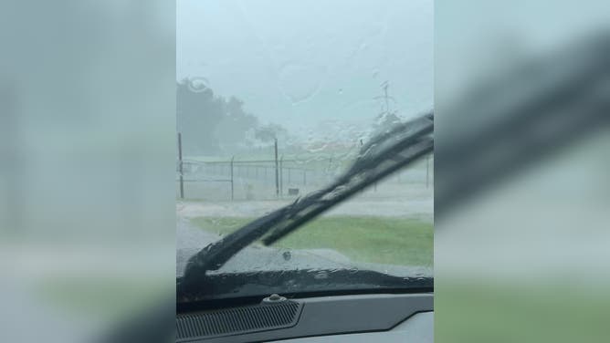
The worst rain Thursday morning was reported in Louisville, where 6-10 inches had already fallen with 3-5 more inches of rain still on the way, falling at rates of 2-3 inches per hour, according to the National Weather Service.
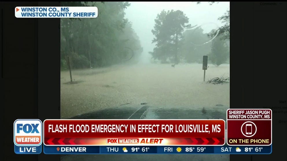
Winston County sheriff describes Flash Flood Emergency in Mississippi
There is an increasing threat for flooding across parts of the Lower Mississippi Valley through Friday morning. Multiple rounds of rain could send totals well above 6 inches, which falling over a short period of time could lead to the potential for significant flooding.
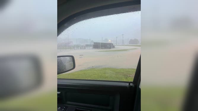
LOUISVILLE, Miss. – Torrential rains reaching over a foot in accumulation from slow-moving thunderstorms have triggered Flash Flood Emergencies in parts of Mississippi as rising waters prompt urgent rescues.
The worst rain Thursday morning was reported in Louisville and Ackerman, where more than 6-12 inches had already fallen with 3-5 more inches of rain still on the way, falling at rates of 2-3 inches per hour, according to the National Weather Service.
Louisville Police have reported multiple flooded structures and vehicles, with water rescues ongoing, according to the NWS.
"We’ve had several vehicles go head first into deep water," Winston County Sheriff Jason Pugh told FOX Weather. "In two locations, we have two vehicles that are under water completely."
Luckily there have been no reports of anyone injured.
More than a foot of rain has fallen in Mississippi Thursday.
(FOX Weather)
Meanwhile, floodwaters have washed out multiple roads in the Louisville area as a spotter reports 12.91 inches of rain so far in the storm just Thursday.
"Many of the surface streets in Louisville are under water; the highways are under water," Pugh said. "Several road and highways are closed."
![Flooding in Louisville, Mississippi]() Image 1 of 5
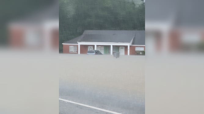
Image 1 of 5Flash flooding inundates a home in Louisville, Mississippi on July 13, 2022. (@JohnJohnReb / Twitter)
![Flooding in Starksville, Mississippi]() Image 2 of 5
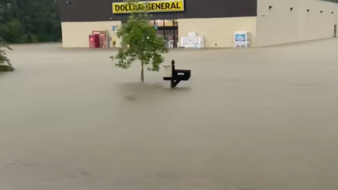
Image 2 of 5A Dollar Store is flooded after heavy rains hit Starksville, Mississippi on July 13, 2023. (Carrie Carter/Facebook)
![Flooding in Ackerman, Mississippi]() Image 3 of 5
Image 3 of 5Flash flooding inundates Ackerman, Mississippi on July 13, 2022. (Ackerman Police Department)
![Flooding in Ackerman, Mississippi]() Image 4 of 5
Image 4 of 5Flash flooding inundates Ackerman, Mississippi on July 13, 2022. (Ackerman Police Department)
![Flooding in Ackerman, Mississippi]() Image 5 of 5
Image 5 of 5Flash flooding inundates Ackerman, Mississippi on July 13, 2022. (Ackerman Police Department)
7 FACTS YOU SHOULD KNOW ABOUT FLASH FLOODS
Unfortunately, the rain was still falling as the midday hours approached, and floodwaters have reached levels higher than officials had seen in quite some time, Pugh said.
"The water is getting steadily deeper at this point, and it is making it hard to respond to people in homes and residences," Pugh said, adding water has gone into several homes. "We’re urging people that if they need us, we will get to them, and for them to try to stay safe until we can get there and get them saved."
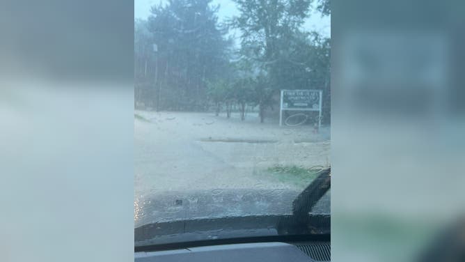
In nearby Ackerman, the story is similar with multiple roads flooded and closed. The NWS reports a roof collapsed at a building in town due to the weight of the heavy rains and a church was flooded. Another spotter reported floodwaters surrounded businesses on Main Street and was starting to push inside.
Drivers underestimating the dangers
An emergency shelter has opened in Louisville to provide shelter to flood victims.
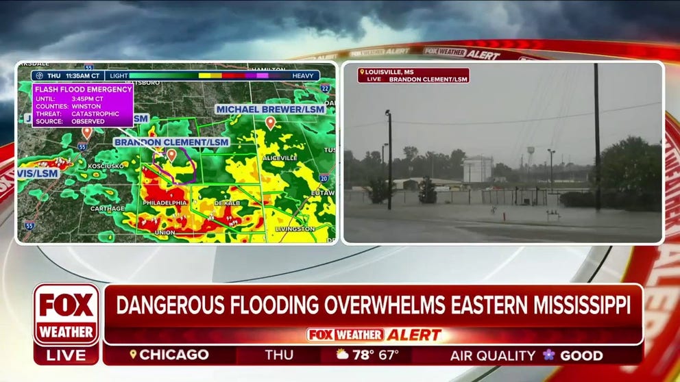
Dangerous flooding overwhelms eastern Mississippi
There is an increasing threat for flooding across parts of the Lower Mississippi Valley through Friday morning. Multiple rounds of rain could send totals well above 6 inches, which falling over a short period of time could lead to the potential for significant flooding.
"We’ve got everybody in the field that we can get into the field at this point," Pugh said.
The Flash Flood Emergency for Louisville, which also covers the town of McMillan, remains in effect until 3:45 p.m. CDT, while a second Flash Flood Emergency alert covers Ackerman until 5:45 p.m. CDT.
Pugh is urging everyone who can to stay at home and stay off the roads. If urgent travel is needed, beware of flooded roads where water may be higher than it seems, or roads may be washed out below. Pugh said many of those needing rescue underestimated the dangers.
"Drivers didn't realize how deep the water was," Pugh said. "Then the vehicles flooded out… and the waters continued to rise."
The relentless rain has also triggered Flash Flood Warnings in counties surrounding Louisville. Those alerts stretch into western Alabama, where a portion of Interstate 20/59 has been closed in Sumter County in both directions because of rushing water over the highway.
Second day with Flash Flood Emergencies in the South
It’s the second day with heavy rains triggering Flash Flood Emergencies in the South. On Wednesday, severe weather swept across the Mississippi Valley, dumping 8-10 inches of rain in just a few hours for parts of southwestern Arkansas, including the city of Stamps.
The National Weather Service said multiple roads in the area were reported as impassible, and flooding was occurring inside buildings in Stamps.
Another Flash Flood Emergency was later issued for portions of northwestern Louisiana, including the town of Haynesville. The NWS noted flash flooding was occurring after a quick 4 to 6 inches of rain fell over the area.