Double-Dip: La Nina conditions expected for second winter in a row
Of the past 12 La Nina winters, eight of them have been "double-dip."
La Nina conditions have emerged and will extend through winter for the second year in a row, according to the National Oceanic and Atmospheric Administration's Climate Prediction Center.
((NOAA Climate.gov) / FOX Weather)
La Nina conditions have emerged and will extend through winter for the second year in a row, according to the National Oceanic and Atmospheric Administration's Climate Prediction Center.
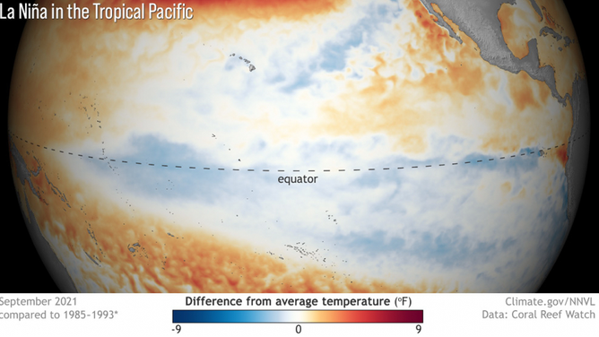
In an announcement Thursday, the CPC said below-average sea surface temperatures were indicated over the past month, showing that La Nina conditions have emerged.
"Our scientists have been tracking the potential development of a La Nina since this summer, and it was a factor in the above-normal hurricane season forecast, which we have seen unfold," said Mike Halpert, deputy director of NOAA’s Climate Prediction Center. "La Nina also influences weather across the country during the winter, and it will influence our upcoming temperature and precipitation outlooks."
La Nina is one part of the El Nino Southern Oscillation (ENSO) cycle, which has three phases:
- El Nino: A warming of the ocean or above-average sea surface temperatures in the central and eastern tropical Pacific Ocean
- La Nina: A cooling of the ocean or below-average sea surface temperatures in the central and eastern tropical Pacific Ocean
- Neutral: Neither El Nino or La Nina and generally close to average.
There's currently an 87 percent chance of La Nina for the upcoming winter season between December and February 2022 and is expected to last through spring 2022.
Consecutive La Ninas are not uncommon and are often referred to as a "double-dip." A La Nina developed in August 2020 and dissipated in April as neutral condition returned.
Of the past 12 La Nina winters, eight of them have been "double-dip."