Dangerous fire weather conditions exist in Plains
Conditions are perfect for large fires to start, so officials are urging people to use extra caution and avoid activity that could spark a fire
Dangerous fire weather conditions in Plains
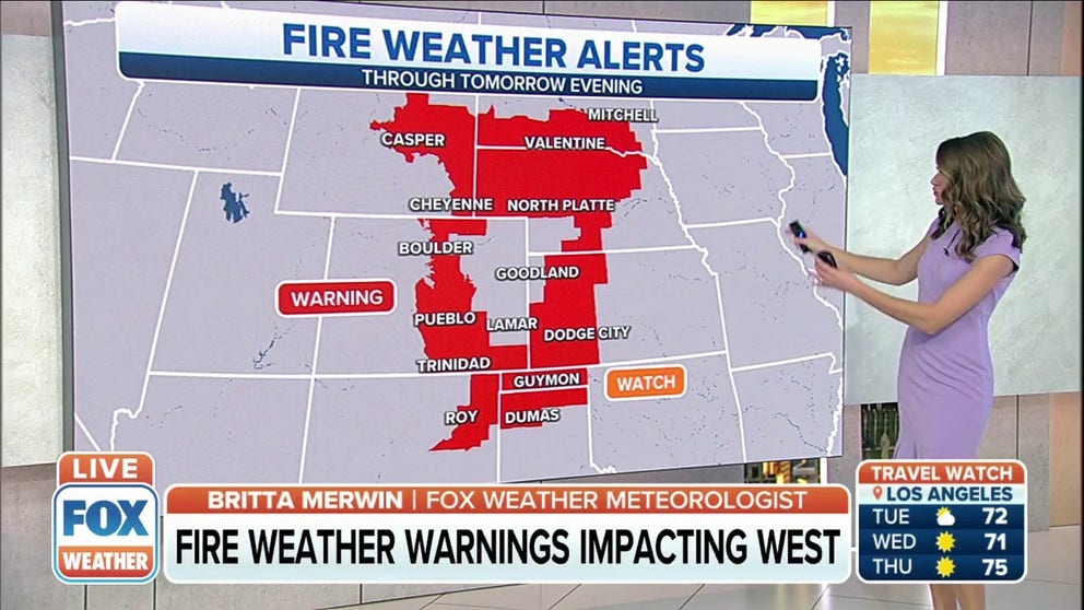
Fire Weather Warnings are up for parts of Nebraska, Wyoming, Colorado, and Kansas for Tuesday. Gusty winds and very dry air will create critical fire weather conditions during the afternoon.
Fire weather warnings have been issued across the Plains as dry air and gusty winds will create dangerous fire weather conditions starting Tuesday afternoon.
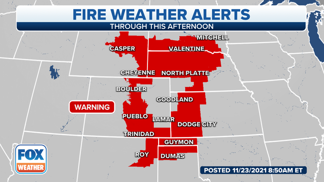
Gusty winds and very dry air will create critical fire weather conditions in the Plains Tuesday afternoon.
An upper-level trough will start to move west Tuesday and that will bring a southwesterly to westerly flow to much of the Plains.
The National Weather Service says low pressure is expected to deepen over eastern South Dakota by late Tuesday afternoon, with the trough extending south back to the southern Colorado-Kansas border.
Strong, gusty winds will develop across eastern Wyoming, southern South Dakota and northern Nebraska. Given the dry air in place, humidity levels will drop into the single digits over most of the region.
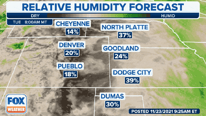
Low humidity will help create dangerous fire weather conditions in the Plains.
Critical fire weather conditions will exist over portions of southeastern Wyoming into western Nebraska, where the strongest winds and lowest humidity are likely to occur later Tuesday afternoon.
Critical fire conditions may also head farther south in parts of southeastern Colorado and northeastern New Mexico, where dry air and strong winds develop.
Dangerous fire conditions are also expected farther east into the Texas and Oklahoma panhandles and western Kansas and Oklahoma, although they won’t be as critical.
Humidity levels in those areas are likely to stay above critical. Still, according to the National Weather Service, given the dry conditions, stronger winds and lack of rain, elevated fire conditions are likely.