Great Lakes see feet of snow as lake-effect machine winds down
Snow showers re-developed Saturday morning downwind of Lake Michigan. The bands were not as intense as on Friday, but still caused travel issues.
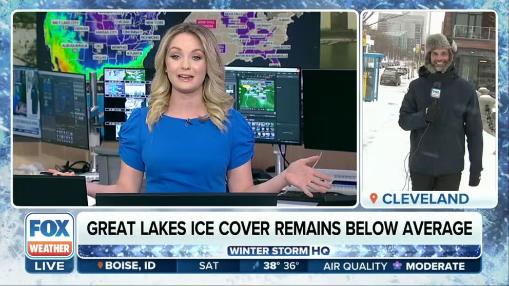
Cleveland blanketed under several inches of lake-effect snow
A surge of air over the still-warm Great Lakes fired up a widespread lake-effect snow event Friday and into the early weekend that brought inches to feet of new powder to downwind communities.
CLEVELAND – A surge of air over the still-warm Great Lakes fired up a widespread lake-effect snow event Friday and into the early weekend that brought inches to feet of new powder to downwind communities.
Snow showers re-developed Saturday morning downwind of Lake Michigan. The bands were not as intense as on Friday, but still caused travel issues.
Winter weather warnings and advisories were extended through most of the day Saturday as estimated snowfall rates were around 1 to 2 inches per hour.
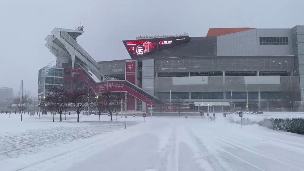
Watch: Cleveland, Ohio covered in layer of snow
A Winter Weather Advisory was issued for Ohio on Friday due to snowfall, causing slick roads. The advisory will be in place until Saturday.
Friday, locally heavy snow occurred across portions of the Upper Peninsula of Michigan, the western portions of the Lower Peninsula of Michigan, across northwest Indiana, and from northeast Ohio and Cleveland across far northwest Pennsylvania into portions of western New York State.
![Snow flies in Cleveland, Ohio, on Jan. 19, 2024.]() Image 1 of 4
Image 1 of 4Snow flies in Cleveland, Ohio, on Jan. 19, 2024. (Jarrod Maloney)
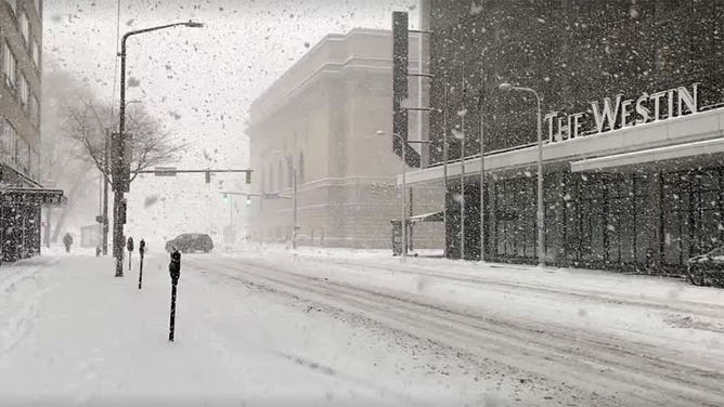
![Snow falls in Cleveland, Ohio on Jan. 19, 2024.]() Image 2 of 4
Image 2 of 4Snow falls in Cleveland, Ohio on Jan. 19, 2024. ( )
![Snow falls in Cleveland, Ohio on Jan. 19, 2024.]() Image 3 of 4
Image 3 of 4Snow falls in Cleveland, Ohio on Jan. 19, 2024. ( )
![Snow falls in Cleveland, Ohio on Jan. 19, 2024.]() Image 4 of 4
Image 4 of 4Snow falls in Cleveland, Ohio on Jan. 19, 2024. ( )


One major difference from the lake-effect snow earlier in the week that pummeled Buffalo and western New York is the direction of the winds. A direction out of the north to northwest caused communities west of South Bend, Indiana, and around northern Ohio to see the heaviest snowfall.
The wind shift created an intense lake-effect band of snow that stretched 200 miles from north to south, spanning the entire length of Lake Michigan.
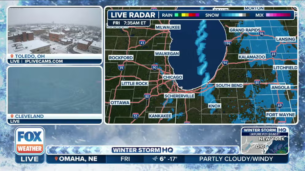
Intense lake-effect snow band stretches 200 miles across Lake Michigan
Converging winds created a 200-mile long band of heavy snow over Lake Michigan Friday, focusing heavy snow bands into northwestern Indiana.
"This is like taking a fire hydrant of snow and pointing it all at one spot," said FOX Weather Meteorologist Britta Merwin. "We have converging winds, so the winds are coming together, forcing up into the atmosphere, creating a convective band of heavy snow that is piling right into northern Indiana."
The National Weather Service in northern Indiana said Friday's highest snow totals were 32 inches on the north side of La Porte near the Crestview Estates neighborhood and 27 inches near Michigan City. Emergency officials declared a travel warning in La Porte County, restricting travel to emergency personnel only.
"Michigan City, you’re right into the thick of it," Merwin said. "It’s an isolated spot, but they’re getting hammered with heavy snow. It’s just a really gnarly and interesting phenomenon we’re monitoring on Lake Michigan."
Lake effect snow also poured in off Lake Erie across the northern shores of Ohio.
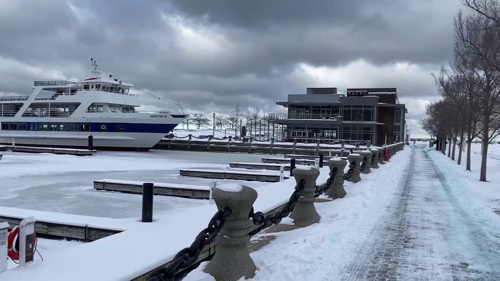
Snow covers ground near frozen-over Lake Erie in Cleveland
Lake-effect snow will persist in the area Saturday, and the heaviest amounts will be located in northwest Pennsylvania. Cold temperatures will return, though not as frigid as earlier in the week.
Some suburbs of Cleveland reported around a foot of snow, while officially in Cleveland, just under 7 inches of snow fell Friday. More snow was falling there on Saturday morning as temperatures dropped into the mid-teens.
The Ohio Department of Transportation said more than 1,100 employees worked statewide to clear snow-covered highways and interstates.
Sheriff Dallas Baldwin declared a Level 1 Snow Emergency in Franklin County, which includes Columbus, Ohio. Multiple surrounding counties also issued snow emergencies.
The lake-effect snow will end by early Sunday for the foreseeable future as warmer air floods across much of the country.