Bryan Norcross: Tropical Storm Philippe is weakening while Rina should come together soon
Puerto Rico and the surrounding region will likely feel the effects from what’s left of Phillipe over the weekend and early next week as the system drifts across the northeastern Caribbean islands.

FOX Weather is your Hurricane HQ, streaming free 24/7.
(FOX Weather)
Updated at 8:45 a.m. EDT on Tuesday
A band of strong upper-level winds is pulling Tropical Storm Philippe apart. As the storm plods to the west, a combination of hostile upper winds and increasingly dry air is forecast to eventually weaken the storm into a remnant low-pressure system in a few days.
Puerto Rico and the surrounding region will likely feel the effects from what’s left of Phillipe over the weekend and early next week as the system drifts across the northeastern Caribbean islands.
Everybody in the islands should keep an eye on Philippe to be sure it dies out on schedule. In any case, some gusty tropical downpours are in the forecast.
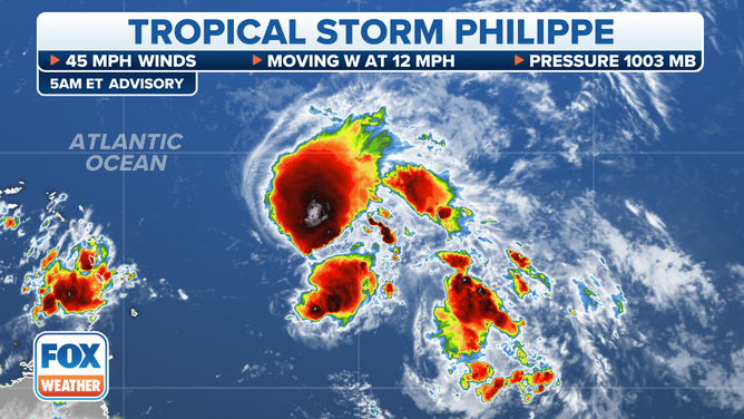
Tropical Storm Philippe's stats.
(FOX Weather)
Tropical Storm Rina appears likely to form out of the tropical disturbance trailing Philippe. This system is south of the band of hostile upper winds, so for now it should have clear sailing to organize and strengthen. In addition, Philippe has moistened likely-Rina’s path ahead.
The future track of likely-Rina is somewhat dependent on how strong it gets. Like Philippe, if it develops into a strong tropical storm or a hurricane, it will likely get scooped to the north by a robust dip in the jet stream. But if it can’t strengthen in the next few days, a weaker version of likely-Rina is more likely to track closer to the islands. There is no indication now that Rina is a threat to land, but Philippe was forecast to turn north as well, so we’ll watch it through the weekend.
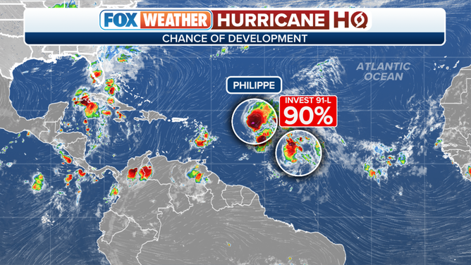
The tropical weather outlook for the Atlantic Ocean.
(FOX Weather)
Overall, the long-range computer forecasts predict generally hostile atmospheric conditions across the tropics for the next couple of weeks. It would only take a small patch of conducive atmosphere for a storm to quickly spin up over the record-warm waters of the western Caribbean, however. So we’ll watch that region closely going forward.