Tropical disturbance approaching Caribbean will have to be watched later this week
This disturbance, like the one that evolved into Hurricane Ian, is coming from a low latitude. According to the long-range computer forecast models, however, the steering pattern ahead of this system is very different than the one that turned Ian to the north into Cuba and Florida.
The podcast Tracking the Tropics with Bryan Norcross is now available to stream.
(FOX Weather)
Updated at 8:45 a.m. EDT
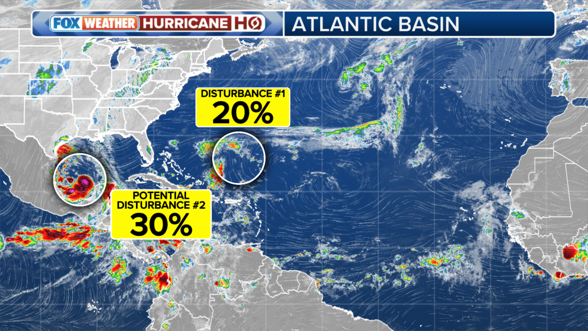
Tropical Disturbance #1 is a disorganized cluster of tropical moisture with the beginnings of a circulation. The upper winds are a bit hostile at the moment, and dry air has occasionally infiltrated the system. So development is expected to be slow.
This disturbance, like the one that evolved into Hurricane Ian, is coming from a low latitude. According to the long-range computer forecast models, however, the steering pattern ahead of this system is very different than the one that turned Ian to the north into Cuba and Florida. But, of course, it will bear watching.
Like Ian, the disturbance will pass through the southern Caribbean islands as a moisture surge tomorrow. Some gusty tropical downpours are likely. The system is forecast to continue into the Caribbean Sea on an unusual track that might bring tropical squalls to the ABC Islands – Aruba, Bonaire, and Curaçao – and the northern coast of Venezuela. If the system survives into late week, we will have to watch it.
(FOX Weather)
In a repeat of the Ian scenario, long-range projections indicate that the atmospheric environment over the western Caribbean will be conducive for the disturbance to organize and strengthen.
HOW TO WATCH FOX WEATHER ON TV
Throughout this week and into next, a blocking high-pressure system across Florida, the Bahamas, and the northern Caribbean islands should keep the disturbance tracking west, bottled up in the Caribbean. People in the Yucatán Peninsula of Mexico and Belize are going to have to keep an eye on how the system develops late week.
The disturbance has hurdles to jump before it reaches the western Caribbean and a more conducive environment for development. We’ll see how it deals with the nearby dry air and its upcoming brush with the Venezuelan coast.
The National Hurricane Center is giving the system a medium chance of organizing into at least a tropical depression in the next five days. The most likely time for development appears to come late in that period or early next week.
Hurricane Hunters are going to investigate the disturbance to be sure we have the best possible data on its structure.
Tropical Disturbance #2 appears to be on its way to becoming the next tropical depression or tropical storm. Fortunately, it’s in the far eastern Atlantic and is forecast to move north into the open ocean. If it gets a name soon, it would be Tropical Storm Julia. If the Caribbean system unexpectedly beats it, the following name on the list is Karl.
Nothing else appears to be in the offing.
FOX Weather Hurricane Specialist Bryan Norcross has a podcast, Tracking the Tropics with Bryan Norcross, available now on FOX News Audio. You can get it on your device by clicking here.