Bryan Norcross: Keeping an eye on the Caribbean as Tammy moves out to sea
A robust cold front pushing off the U.S. Southeast coast this week will keep any tropical systems away.

FOX Weather is your Hurricane HQ, streaming free 24/7.
(FOX Weather)
Updated Saturday at 9 a.m. ET
The consensus of the various computer forecasts is that a broad area of low pressure will slowly develop in the southern Caribbean Sea over the next few days. There are signs of a broad circulation trying to form already under somewhat hostile upper winds. The arcing coastline from Nicaragua around to Colombia can help get rotation started in that area.
There are no signs at the current time of it turning into anything significant. The National Hurricane Center is giving the potential system a low chance of developing into even a tropical depression in the next several days.
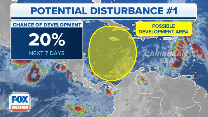
A broad area of low pressure will slowly develop in the southern Caribbean Sea over the next few days.
(FOX Weather)
Some computer forecasts pull the system north in the direction of Jamaica, eastern Cuba, Haiti, and the southeastern Bahamas. Residents in those areas should keep an eye on things. The effects might just be a gusty moisture surge, though there's a slight chance for more development.
A robust cold front pushing off the U.S. Southeast coast this week will keep any tropical systems away.
In the central Atlantic, Tropical Storm Tammy is weakening and pulling away from Bermuda. Winds have already diminished on the island. Tammy is forecast to continue into the open ocean and die out in a few days.
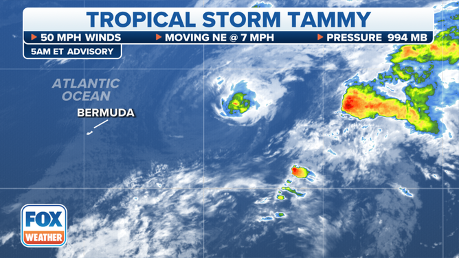
Tropical Storm Tammy is weakening and pulling away from Bermuda.
(FOX Weather)
Otherwise, nothing seems likely to develop in the next week or more as a winter-like weather pattern slowly settles in. The waters are still quite warm, however, so there's no guarantee that something couldn't still spin up.