Bryan Norcross: Hurricane Idalia's impacts begin in Florida today
ll indications are that it will become a powerful storm before making landfall on the west coast of Florida north of Tampa Bay or in the Big Bend south of Tallahassee. Squally weather will spread from south to north up the western part of the Florida peninsula today.
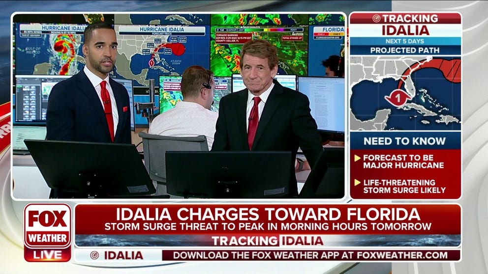
Storm surge threat from Hurricane Idalia to peak Wednesday morning
Idalia is beginning to rapidly intensify in the Gulf of Mexico and is on a collision course with Florida. It is forecast to become a Category 3 hurricane, making landfall on Wednesday in the Big Bend area of Florida.
Updated on Tuesday at 7:40 a.m. ET
Idalia became a hurricane overnight and is now heading north in the southern Gulf of Mexico. All indications are that it will become a powerful storm before making landfall on the west coast of Florida north of Tampa Bay or in the Big Bend south of Tallahassee. Squally weather will spread from south to north up the western part of the Florida peninsula today.
Winds will become increasingly gusty in the rain squalls this afternoon as Hurricane Idalia strengthens and tracks offshore of Southwest Florida. Through the day, the center of the intensifying hurricane will edge closer and closer to the peninsula as Idalia begins to slowly arc to the east. Weather conditions along the west coast of Florida will deteriorate by late this afternoon or this evening, when it will become dangerous to drive.
The storm-surge threat will increase through the evening in most areas and peak in the morning hours tomorrow when the winds shift so they are blowing the water into the bays, inlets, and rivers, including Tampa Bay.
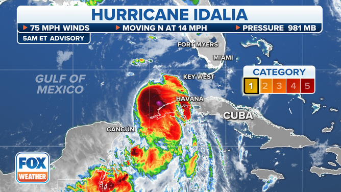
Position of Hurricane Idalia on the morning of Aug. 29, 2023.
(FOX Weather)
If the current National Hurricane Center forecast track ends up being Idalia's path into Florida, the devastating inundation from storm surge up to 12 feet above normal high tide will hit the Nature Coast and the Big Bend – the area north of the Tampa metro area. No matter what, the Gulf will rise along most of the west coast of Florida and in Tampa Bay. The only question is how much.
We all remember Hurricane Ian from last year, Hurricane Charley, and other storms that tracked down the right side of the cone. A similar track in this case would be a near worst-case scenario for the Tampa Bay area.
The calculation is that Gulf water and water inside Tampa Bay would rise up to 7 feet above normal high tide if the set of worst-case conditions come together, including the storm hitting at high tide – much like what happened in Ian. Anybody not evacuating from low-lying areas is betting that Idalia is not going to duplicate what Hurricane Ian did last year.
This situation calls for everyone's full attention to local officials. The National Hurricane Center is in close touch with every Florida county to help them make decisions to keep their residents safe.
The first part of today is your last chance to take action to make your situation better after the storm has passed. Look around. Pick up things that can blow in the wind. Park your car on high ground, away from trees, or in a protected place. Have a way to charge your cellphone from your car.
In the Tampa Bay area, the odds are that the strongest winds will come from a general westerly direction. Park your car on the east side of a building if possible.
Even though there has been a drought in the western part of Florida, enough rain may fall quickly to cause flash flooding. The forecast is for up to a foot of rain in some spots.
Idalia will charge across North Florida and into South Georgia and the Carolinas tomorrow.
In North Florida, be ready for the power to go out and think about where your car is parked. Again, away from trees and on high ground is best.
In the Carolinas, some storm surge is possible, but the main threat appears to be from heavy rain. Flash flooding is possible. Pay attention to emergency information.