

Bryan Norcross: Sting jet or no sting jet & Simon and Trudy give forecasters fits in the Pacific
My bottom line is that it was a sting-jet-like phenomenon, but it doesn't quite fit into the typical sting jet bucket because it occurred in the wrong part of the circulation.
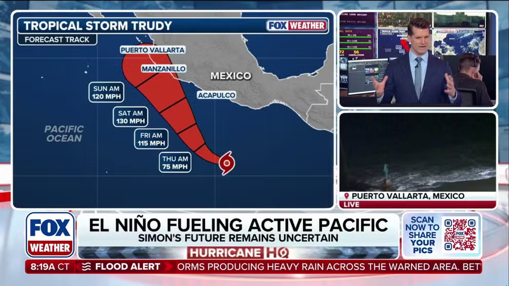
Two of the season's strongest hurricanes could be brewing in the Pacific
Two potential monster hurricanes could be brewing in the Eastern and Western Pacific basins that could make landfall. Tropical Storm Trudy is expected to rapidly intensify into a Category 4 hurricane before potentially making landfall along the western Mexican coast. Meanwhile, Invest 96W could pass over the U.S. territories of Guam and the Northern Mariana Islands as a typhoon, en route to matching Super Typhoon Sinalaku as the strongest storm on earth this year, with sustained winds of 185 mph.
Last updated at 9:30 a.m. on Oct. 14, 2026
The El Niño-driven band of upper-level winds stretches from the Gulf to the Caribbean to Africa. We still can't rule out a system developing in a random pocket of slightly supportive atmosphere outside of the band before this hurricane season ends, however, so we'll continue to watch.
LATEST FROM FOX WEATHER HURRICANE SPECIALIST BRYAN NORCROSS
For now, no tropical development is expected for the foreseeable future.
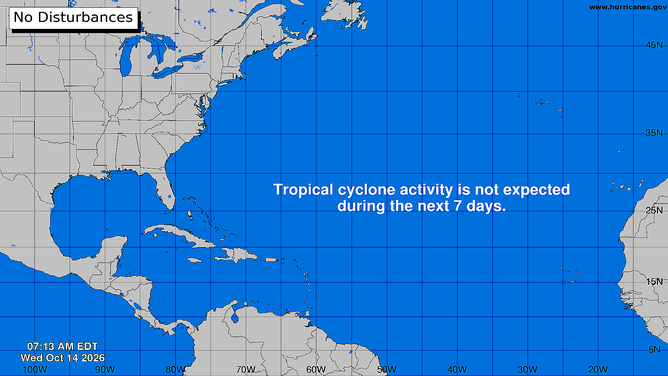
Atlantic Basin on Oct. 14, 2026
(Bryan Norcross)
A comment about Hurricane Isaias: a lot has been said about what caused the band of strong winds over the western Florida Panhandle. You've probably heard the term "sting jet" floated around. A sting jet normally occurs in systems transitioning to non-tropical storms heading in a general west-to-east direction. The band of strong winds – the sting jet – occurs on the back-right quadrant of the storm when dry air suddenly forces strong winds above the surface down to ocean or ground level.
No doubt something similar happened during Isaias's landfall, but these strong winds occurred in a different part of the storm – the back-left quadrant.
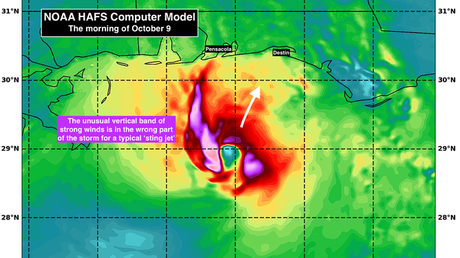
NOAA HAFS Computer Model Hurricane Isaias
(NOAA / FOX Weather)
Descending air was clearly involved in the phenomenon. Suddenly the temperatures warmed and the winds gusted like a sudden Santa Ana in California or Chinook in Colorado. Air compresses as it moves to higher pressure, like an old-fashioned bicycle pump gets warm as you compress the air to blow up tires.
Almost certainly, high-speed air was descending on the left side of the storm as dry air was wrapping in. Also, there can be an acceleration of the air near the coast due to the land slowing the air's movement while it speeds by over the water.
WHAT'S THE DIFFERENCE BETWEEN A HURRICANE MAKING A DIRECT HIT AND LANDFALL?
My bottom line is that it was a sting-jet-like phenomenon, but it doesn't quite fit into the typical sting jet bucket because it occurred in the wrong part of the circulation.
NOAA's high-resolution hurricane model showed the band of extra-strong wind on the west side of the storm. That model can be picked apart to understand where exactly in the atmosphere the strong winds came from and what triggered them. There was, for example, a strong upper-level disturbance just to the west, which was propelling Isaias north.
EYE OF THE SEASON: THE MOST NOTABLE ATLANTIC HURRICANES DURING EL NIÑO YEARS
In the end, the gusts from the band of extra-strong gusts were within what is expected in a 105-mph hurricane, but the exact meteorology that generated them is an open question.
In the Pacific near Mexico
Tiny Hurricane Simon is loitering well south of Cabo San Lucas, offshore of west-central Mexico. Steering currents have collapsed, so the future track is uncertain, but Cabo is going to have to watch it. The highly uncertain forecast eventually takes the storm that way, although it's forecast to be weakening on the trip north.
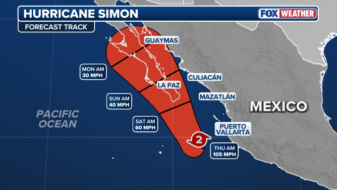
Forecast track Hurricane Simon
(FOX Weather)
As always, forecasts for storms caught in pockets of atmosphere with no clear steering winds are subject to large errors and are likely to change. So far, Simon has been a poster child for this reality.
TROPICAL STORM TRUDY FORMS IN PACIFIC, COULD RAPIDLY INTENSIFY INTO POWERFUL CATEGORY 4 HURRICANE
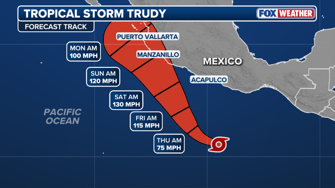
Tropical Storm Trudy forecast track
(FOX Weather)
Simon's big sister, Hurricane Trudy, is offshore of southern Mexico. It's also defying forecasters. Again, the steering currents are expected to collapse on its track offshore or near the Mexican coast. Everyone in west-central Mexico needs to pay attention to the forecast.