Bryan Norcross: Tropical Atlantic hits pause
Recall that before the busy stretch in the Atlantic that included giant Hurricane Erin, the Eastern Pacific was busy, and before that there was one storm after the other in the Central Pacific south of Hawaii.

FOX Weather is your Hurricane HQ
(FOX Weather)
Updated at 9:15 a.m. ET on Tuesday, Aug. 26, 2025
Tropical Storm Fernand is heading into the North Atlantic, where it will die in a day or so. Otherwise, the Atlantic is quiet.
Around next Saturday, a disturbance might move off Africa, but dry air, hostile upper winds and extra-strong high pressure across the tropical belt are currently forecast to prohibit much development.
Recall that before the busy stretch in the Atlantic that included giant Hurricane Erin, the Eastern Pacific was busy, and before that there was one storm after the other in the Central Pacific south of Hawaii. The conducive-for-development bubble progressed from the Pacific across Central America and into the Caribbean, Gulf and Atlantic, where suddenly tropical systems started spinning up.
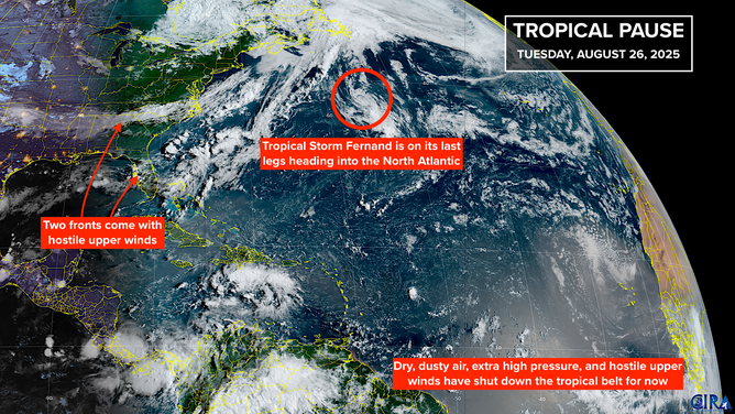
This image shows information on Tropical Storm Fernand and the rest of the tropical Atlantic basin.
(FOX Weather)
The bubble, so to speak, is mostly caused by the Madden-Julian Oscillation, or the MJO. It's a broad pulse that tracks around the equator, moving from west to east. It has a supportive phase and a suppressive phase, and sometimes it has very little effect. Also, sometimes it’s strong and has a dramatic effect, and sometimes it’s weak and only nudges development one way or the other.
The consensus of the various computer forecasts is that the MJO phase that perked up Atlantic activity is fading away, and a new one will rotate across the Pacific over the next couple of weeks. The current thinking is that the next development-supporting phase will cross the Atlantic around the second week to the middle of September.
That doesn't mean that nothing can develop in the meantime, but if something does try to spin up, it won't have the MJO's help.
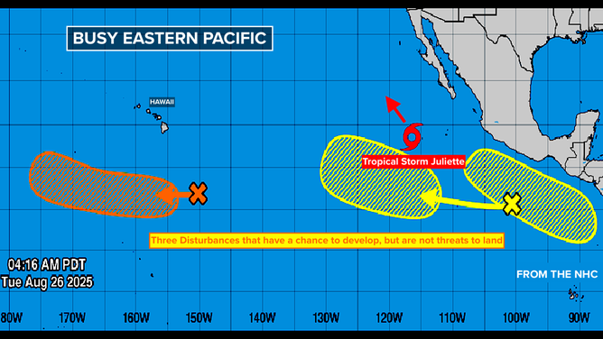
This image shows information on the tropical Pacific Basin.
(FOX Weather)
Interestingly, the Eastern Pacific is lighting up with a tropical storm and other possible disturbances. It doesn’t seem to be from the MJO pulse, but as we’ve seen, the Eastern Pacific often gets busy when the Atlantic is quiet, then the more supportive bubble eventually moves over the Gulf and Caribbean. We’ll see. Sometimes, as happened early this year, the bubble just fades out.
The sharp cold front that is pushing south across the eastern U.S. will linger over Florida, and next weekend's possible system moving off Africa will be candidates to watch for development. But for now, there are no signs of any threats on the horizon.
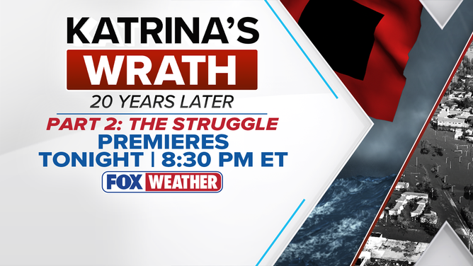
Katrina’s Wrath: 20 Years Later Tuesday night with Part 2: The Struggle. It will be on FOX Weather at 8:30 p.m. ET.
(FOX Weather)
Our series, Katrina’s Wrath: 20 Years Later continues tonight with Part 2: THE STRUGGLE. It will be on FOX Weather at 8:30 p.m. ET.
If you’re not sure how to watch, just go to FOXWeather.TV. It will tell you how to tune in on your phone, iPad, computer or TV.