

Bryan Norcross: Eventually we might have to watch the Atlantic disturbance (#96L)
The National Hurricane Center now has the development odds in the high range.
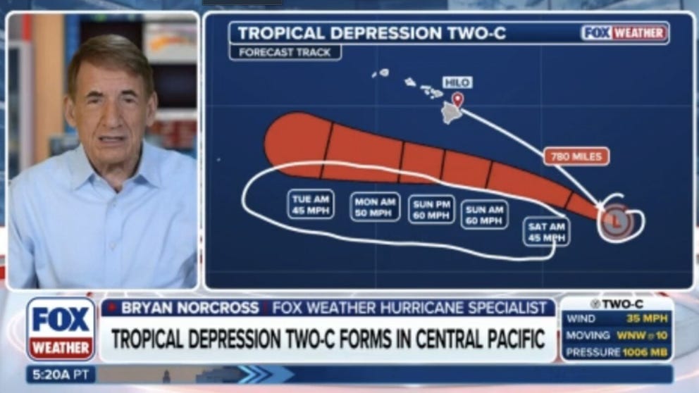
FILE: Exclusive Analysis: Back-to-back storms set to soak Hawaii
Future Tropical Storm Moke is on track to impact the Big Island of Hawaii just days after Hurricane Lala caused significant damage to the Aloha State. FOX Weather Hurricane Specialist Bryan Norcross joins FOX Weather to talk about all of the tropical activity lightning up the Pacific as well as what we can expect in the Atlantic.
Updated at 8:45 a.m. ET on Monday, August 25.
The robust tropical disturbance that the National Hurricane Center officially tagged Invest 96L has begun its trek across the tropical Atlantic in the general direction of the northeast Caribbean. It's carrying a reasonable amount of moisture, so it has a chance to fight off the Saharan dust sufficiently to develop into a tropical depression or tropical storm over the next day or two.
The National Hurricane Center now has the development odds in the high range.
BRYAN NORCROSS: REMEMBERING 34 YEARS AGO TODAY AND KEEPING AN EYE ON HAWAII AGAIN
As it gets closer to the Caribbean toward the weekend, the El Niño-powered upper-level winds could become more formidable, however, so the consensus of the various computer forecasts is that the system will weaken and possibly dissipate.
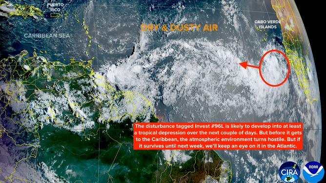
Invest 96L likely to develop in the Atlantic basin
(Bryan Norcross)
In any case, it's too early to know exactly what's going to happen when the system is near the islands since the potential depression or storm has just begun to think about developing. Having said that, there is no indication at this point that a major storm would impact the northeast Caribbean.
Things get murky after that. If the system survives its encounter with the hostile upper winds, and ends up north or northeast of the islands, the water is warm and the atmospheric environment is forecast to become more conducive to the system strengthening.
BREWING SUPER EL NIÑO EXPECTED TO BE STRONGEST ANYONE ALIVE ON THE PLANET HAS EVER EXPERIENCED
There is no consensus in the long-range computer forecasts where the potential storm will track or how strong it will be if it does develop or redevelop next week. Some potential tracks take it near the U.S., others arc it north well offshore, while a significant number die out before it can get to the more hospitable conditions north of Puerto Rico.
If and when the system develops, the models should settle down and give us a better idea of the real chances of whether there will be a storm to track in the Atlantic late next week.
Elsewhere in the Atlantic
The disturbance northeast of Bermuda is hanging on. If it can't get organized by tomorrow, its window of opportunity to become a depression or maybe be named Dolly will close. The NHC chances are in the medium range.
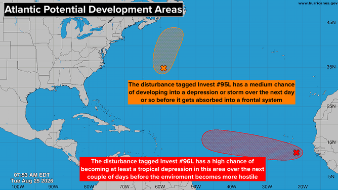
Disturbances in the Atlantic basin
(Bryan Norcross)
In the Pacific
The Eastern and Central Pacific have gone insane with tropical development. Seven tropical systems are either strengthening, weakening, or are likely to develop. The good news is that there is no threat to land for the next week, at least.
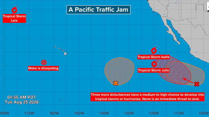
Disturbances in the Pacific
(Bryan Norcross)
LATEST FROM FOX WEATHER HURRICANE SPECIALIST BRYAN NORCROSS
100 years ago today
Landfalling Hurricane #2 of the epic 1926 season came ashore southwest of New Orleans on the evening of August 25, 1926. It formed in the Caribbean five days earlier, snuck between Cuba and Mexico, and intensified in the Gulf. The modern estimate is that the top winds were 115 mph at landfall.
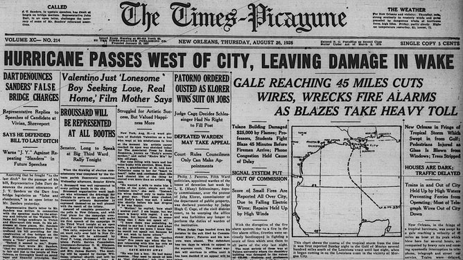
Hurricane #2 leaves heavy damage across New Orleans
(Bryan Norcross)
There was damage across a wide swath of southeastern Louisiana, but New Orleans took a glancing blow. There was still plenty of drama there, however.
Hurricane Season 1926 was just getting started.