

Bryan Norcross: Hawaii's Big Island is on alert for more flooding and signs of life in the Atlantic
Unfortunately, the focus of the rain appears to be over the same areas on Hawaii Island that were devastated by Lala.
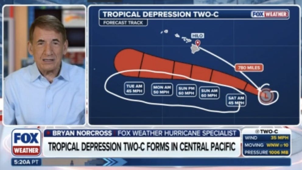
Exclusive Analysis: Back-to-back storms set to soak Hawaii
Future Tropical Storm Moke is on track to impact the Big Island of Hawaii just days after Hurricane Lala caused significant damage to the Aloha State. FOX Weather Hurricane Specialist Bryan Norcross joins FOX Weather to talk about all of the tropical activity lightning up the Pacific as well as what we can expect in the Atlantic.
Last updated at 9 a.m. on Aug. 21, 2026
The tropical depression southeast of Hawaii is forecast to become Tropical Storm Moke later today or tonight and take a similar track to Hurricane Lala's last week. The difference is that Moke won't be as strong when it passes south of the Big Island. It will still produce pockets of extreme rainfall, however, when the tropical moisture interacts with the tall mountains.
The atmospheric environment is not as conducive for strengthening as it was for Lala, so likely-Moke is forecast to remain a tropical storm as it tracks past the islands.
LATEST FROM FOX WEATHER HURRICANE SPECIALIST BRYAN NORCROSS
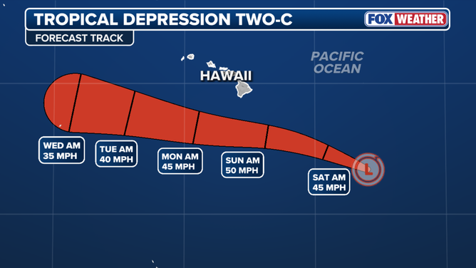
Tropical Depression Two-C forecast
(FOX Weather)
Unfortunately, the focus of the rain appears to be over the same areas on Hawaii Island that were devastated by Lala. The National Hurricane Center is forecasting 5 to 10 inches of rainfall with some areas receiving 15 inches. The windward side of Maui will also receive some heavy rainfall, but much less. Otherwise, enhanced rain is expected on the other Hawaiian Islands, but nothing severe.
Impacts from likely-Moke will begin late Saturday on the Big Island and spread across the rest of Hawaii into early next week.
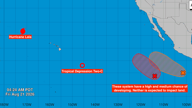
Pacific Basin
(Bryan Norcross / FOX Weather)
Elsewhere in the Pacific
Hurricane Lala is heading north into the Pacific where it will weaken.
LALA ROARS BACK TO HURRICANE STRENGTH, PUTTING MARINE WILDLIFE AND HISTORIC MONUMENT IN ITS PATH
One or two storms are expected to develop in the potential development areas off the coast of Mexico with no impact on land.
In the Atlantic
The National Hurricane Center is painting two lemons – small areas where there is a chance for tropical development. Although the chances are low in both cases.
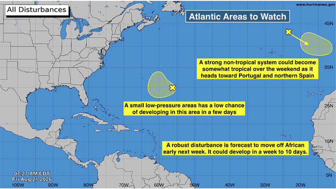
Atlantic Basin
(Bryan Norcross)
In the middle of the Atlantic, there's a small non-tropical low-pressure system that could turn into a depression in a few days. The computer forecasts are not very enthusiastic about that possibility, but there's a chance. The system could bring some rain to Bermuda around Monday.
The system near Portugal and northern Spain is a robust non-tropical storm producing winds near hurricane force. There is a pool of unusually warm water in that area that could be just warm enough to allow the system to develop tropical characteristics before it dies out early next week. The chances are in the low category that this will happen over the weekend.
Looking ahead
The long-range computer forecasts are showing a strong disturbance moving off Africa early next week and tracking across the tropical Atlantic. At the same time, the Saharan dust is forecast to thin out, so it will likely have less effect on this system than the disturbances so far this year.
BREWING SUPER EL NIÑO EXPECTED TO BE STRONGEST ANYONE ALIVE ON THE PLANET HAS EVER EXPERIENCED
The El Niño-driven band of hostile upper-level winds continues to blow west to east, so the system will eventually have to contend with that. This will likely be something for the northeastern Caribbean islands to watch toward the end of next week.
There are no signs of a threat to the continental U.S. or nearby areas.