

Bryan Norcross: Developing disturbance in the Gulf to bring rain, Tropical development odds remain low
The weather pattern over the tropics is exactly what we would expect for an El Niño July. Hostile upper-level winds are protecting Mexico and the Caribbean. Saharan dust is eliminating development over the open tropical Atlantic.
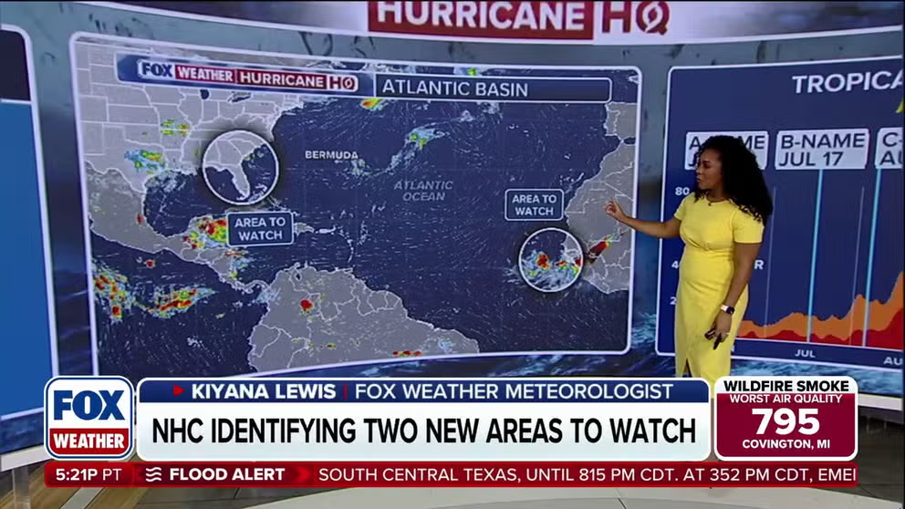
FILE: Tropical development possible as areas to watch identified near Florida and approaching Atlantic basin
The Atlantic is beginning to show signs of life as the National Weather Service flags two areas for possible tropical development: one in the open waters near West Africa and another along the Gulf Coast.
The non-tropical system that's expected to slowly form in the northeastern Gulf tomorrow will bring some heavy rain to the west coast of Florida beginning today and continuing into next week. It will also generally increase the chance of thunderstorms across the state and surrounding areas.
It looks likely that the rain will fall where it's needed most. Drought conditions persist across the western part of the peninsula.
Early next week, there's a slight chance the low-pressure system will drift over very warm Gulf or ocean water, which could allow it to turn into a tropical depression. The National Hurricane Center puts the odds in the low category.
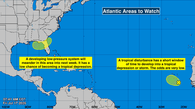
Atlantic tropics
(Bryan Norcross / FOX Weather)
The strong consensus of the computer forecast models is that the non-tropical low-pressure system will remain in the Gulf, drifting west or northwest along or over the Gulf coast pushed along by the flow around the heat-dome high to the north. While it's over the water, there remains the low chance that it becomes a tropical depression. We’ll keep an eye on it.
But by far the highest odds from the various models is that the system gets stretched out by the strong upper winds and creates unsettled weather along the coastal South and Florida.
BRIGHT IDEA: BOLD PLAN SUGGESTS WEAKENING ONE OF EARTH'S MOST POWERFUL CLIMATE FORCES
From the northern Gulf Coast across a good part of the Florida peninsula and possibly to the Georgia and Carolina coast, be ready for an extended period of enhanced storminess that peaks Sunday to Tuesday.
On the other side of the Atlantic
The National Hurricane Center is still painting a potential development area for a disturbance that moved off Africa a couple days ago. If it's going to pull itself together, it's going to have to do it in a hurry because there's a bumpy road ahead. It's plowing into Saharan dust, and the upper winds will soon become too hostile for development.
They'll have to watch it in the Cabo Verde Islands, but otherwise, there's no threat to land.
In the Pacific
Elida is almost a hurricane. It will soon run into cooler water and weaken without any effect on land except big surf in Hawaii.
The NHC is showing a big red development zone where Fausto is likely to form. It is likely to strengthen, but will follow Elida and die over the cold water.
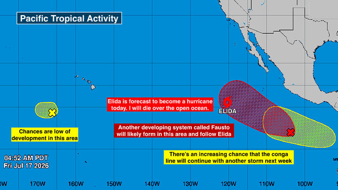
Eastern Pacific tropics
(Bryan Norcross / FOX Weather)
Next week, another system looks likely to plow the same furrow in the eastern Pacific.
El Niño update
The weather pattern over the tropics is exactly what we would expect for an El Niño July. Hostile upper-level winds are protecting Mexico and the Caribbean. Saharan dust is eliminating development over the open tropical Atlantic.
This midsummer lull is expected and usual. The question is: what's going to happen a month from now when, on average, dust season lets up? The tropics are likely to be less conducive than normal to development due to El Niño's upper winds. But there will still be plenty of warm water areas to watch.
On average, the second named storm of the season forms on this date, July 17. So by tomorrow, we'll officially be behind the curve. All good.