

Bryan Norcross: The Atlantic is on snooze while Hawaii watches Fausto
If this forecast holds, it will be noticeable that the tropical storm is passing. The wind direction will shift, affecting where rain will fall on the islands, but the main effect will be very high surf, which should begin tomorrow.
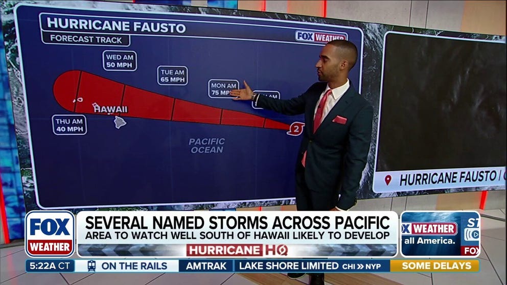
Hurricane Fausto continues to barrel towards Hawaii, with Tropical Storm Genevieve following
Hurricane Fausto, which has peaked in intensity and is currently a Category 2 system, is continuing along its path through the Pacific towards the Hawaiian islands. Trailing Fausto is Tropical Storm Genevieve which is forecast to become the first major hurricane of the 2026 East Pacific season.
Updated at 9:05 a.m. on Saturday, July 25, 2026.
Dry and dusty air plus hostile upper-level winds are dominating the tropical zone in the Atlantic and the Caribbean, so no development is expected into early August, at least.
Fronts will continue to push down the East Coast, like the one producing excessive rainfall and flooding across the South, including the coastal Carolinas. This type of system can sometimes trigger a tropical system over the Gulf Stream offshore of the Southeast, so we'll keep an eye out for that. But there's no indication of that happening in the long-range computer forecasts.
EYE OF THE SEASON: THE MOST NOTABLE ATLANTIC HURRICANES DURING EL NIÑO YEARS
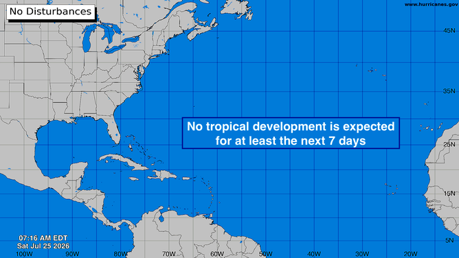
No activity expected in the Atlantic for the next week.
(Bryan Norcross / FOX Weather)
Fausto and Hawaii
Hurricane Fausto is in a slow weakening phase. The forecast storm track takes it in the direction of Hawaii. The storm is forecast to reach the state around Tuesday, passing by or near the islands on Wednesday.
Currently, the strong indication from the computer forecast models is that the center of then-Tropical Storm Fausto will pass north of the islands. The storm will be plowing into dry air, and the upper-level winds will become more hostile, so the weakening trend should continue as it tracks near the islands. The strongest winds associated with the circulation look likely to be north of the center, away from the islands, when the system makes its closest approach.
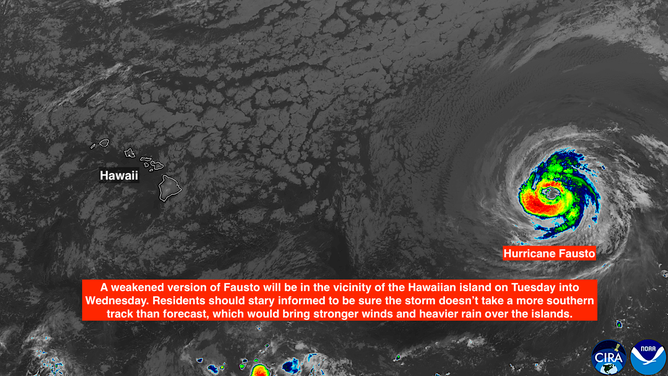
Satellite imagery of Hurricane Fausto in the East Pacific.
(CIRA/CSU / NOAA)
If this forecast holds, it will be noticeable that the tropical storm is passing. The wind direction will shift, affecting where rain will fall on the islands, but the main effect will be very high surf, which should begin tomorrow.
A slight deviation in the track, however, would bring tropical storm conditions – very gusty winds and heavy rain – especially at the higher elevations. Residents in Hawaii should stay up-to-date on the latest forecast in case preparations need to be made early next week.
Because the Hawaiian Islands are laid out at a slight angle, the center of Fausto or whatever's left of it looks likely to come closest to Oahu and Kauai. The storm should be quite weak at that time, but gusty winds and heavy rains are still possible, especially on the north side of the island.