

Bryan Norcross: Tropical Storm Dolly is showing signs of already weakening
After Dolly's remnants’ trip across the islands, the most likely scenario is that the system will be dead and done.
Tropical Storm Dolly battling hostile conditions as it treks across Atlantic
After forming on Thursday, Tropical Storm Dolly is fighting a slew of hostile conditions from a brewing Super El Niño as it treks across the Atlantic Ocean. Strong winds and Saharan dust will significantly weaken Dolly, with forecasts expecting the system to become depression or gusty moisture surge rather quickly.
Last updated at 9:00 a.m. on Thursday, Aug. 28, 2026.
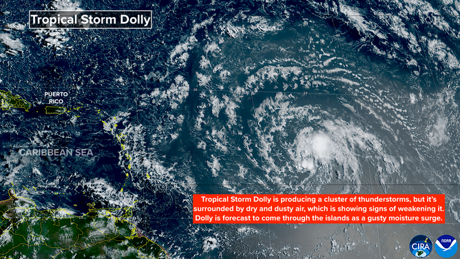
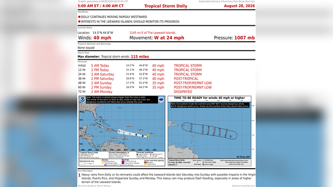
Tropical Storm Dolly finally formed yesterday out of the disturbance we've been following across the tropical Atlantic. It's speeding along at almost 25 mph, heading for an increasingly hostile atmospheric environment as it approaches the northeastern Caribbean islands tomorrow.
The system is surrounded by Saharan dust and dry air cover, which is choking off Dolly's moisture. In addition, the mid- to upper-level winds blowing across the system have not allowed the thunderstorms to build around the center.
Atlantic basin
(Bryan Norcross)
WHAT’S THE DIFFERENCE BETWEEN A TROPICAL DEPRESSION, TROPICAL STORM AND HURRICANE?
The National Hurricane Center is forecasting Dolly to remain a weak tropical storm into tomorrow. Then by late in the day, the El Niño-driven upper winds, combined with the dry air and Saharan dust, should disrupt Dolly enough that it loses its circulation.
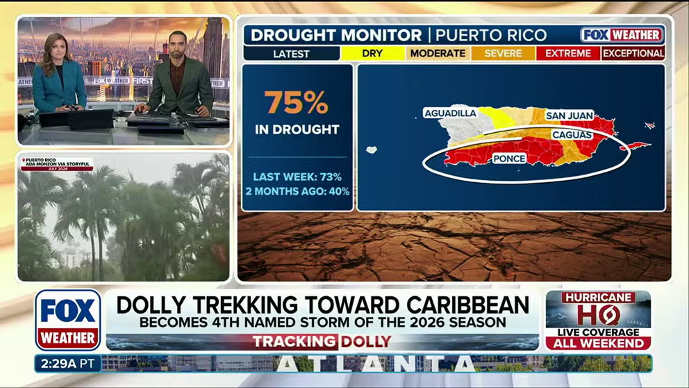
The remnants will likely include squalls with winds gusting 40 to 50 mph, however, as they move across Puerto Rico and the nearby islands. Much of Puerto Rico has been in a drought situation for some time, so the rain will be beneficial if too much doesn't come all at once. Be ready for alerts from the National Weather Service in San Juan.
After Dolly's remnants’ trip across the islands, the most likely scenario is that the system will be dead and done. There is a slight chance, however, that enough of the disturbance survives to kick off another system in the Gulf or the Atlantic.
Tropical Storm Dolly forecast
DO SANDBAGS ACTUALLY PREVENT FLOODING? WHAT TO KNOW BEFORE A BIG STORM
The odds are very low and there is no indication of any particular threat. In any case it would be more than a week away, which is obviously too far in the future to pin anything down.
For now, we'll plan for some gusty winds but beneficial rain for the northeastern Caribbean islands including Puerto Rico, and then we'll see if there's anything left of Dolly.
Elsewhere in the Atlantic, nothing else of note is showing up in the computer models, so El Niño is doing its job.
In the Pacific
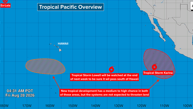
El Niño and the marine heat wave in the ocean from Hawaii to California and south to the equator are powering one storm after the other. None is an immediate threat to land, but we'll watch Tropical Storm Lowell toward the end of next week. Some very long-range computer forecasts bring it uncomfortably close to Hawaii.
Pacific basin
Lowell is just developing and is very slow-moving, so the forecasts are iffy at best. It's just something to keep in the back of our minds.
It is exceptionally humid in Los Angeles and across Southern California thanks to the remnants of ex-Hurricane Iselle. The extra moisture in the air is causing record warm temperatures overnight. During the day, the humidity is not quite at Miami levels, but combined with temperatures in the 90s to near 100, it's nasty.
It will be noticeably more comfortable by Sunday and getting back closer to normal next week.