

Bryan Norcross: In October we'll keep an eye on the southwestern Gulf
The bottom line is that nothing is pending, but there's plenty of hurricane season to go.
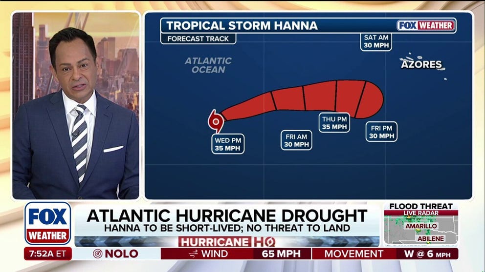
September ends hurricane-free in the Atlantic for first time in 32 years amid strengthening El Niño
September has come to a close without a hurricane forming in the Atlantic for just the second time in the satellite era (1996), despite being the climatological peak of the season as El Niño-driven winds have suppressed activity this year. Tropical Storm Hanna is on its last legs in the open waters of the Central Subtropical Atlantic after forming Monday morning, becoming just the eighth named storm of the Atlantic hurricane season.
Updated at 9:00 a.m. on Wednesday, Sept. 30, 2026
In a typical October, a large area of low-pressure spans from the Pacific to the western Caribbean to the southwestern Gulf – the so-called Central American Gyre. Occasionally, deep dips in the jet stream interact with the gyre and an independent disturbance gets pulled north. Sometimes, a tropical disturbance that originated over Africa gets absorbed into the gyre, energized, and deflected into the Gulf.
During the fall, fronts can dip south leaving behind a nascent disturbance that can become a tropical system. Stalled upper lows are occasionally a seed from which a storm develops.

Windy day at the beach.
(BlueFolio / Getty Images)
CALIFORNIA DECLARES STATE OF EMERGENCY AS POTENTIALLY HISTORIC SUPER EL NIÑO LOOMS
These typical triggers will exist this season, based on what we see in long-range computer model forecasts, but there is no signal that they will congeal into a defined tropical system. At least not yet. But the indications are that, if it happens, it's most likely to be in the southwestern Gulf.
Having said that, the Gulf is plenty warm to support a tropical system. But this year, the heat content – the warm water under the surface - is significantly below normal. That means if a storm were to develop, it would have less energy than average to strengthen.
The bottom line is that nothing is pending, but there's plenty of hurricane season to go. There's no reason to think that the typical October development mechanisms can’t at some point trigger a tropical storm or hurricane. We'll see.
In the Atlantic today
Tropical Storm Hanna is still tottering in the middle of the Atlantic. It doesn't have long to totter. The National Hurricane Center gives it a matter of hours before the atmospheric environment becomes so hostile that Hanna dissipates.
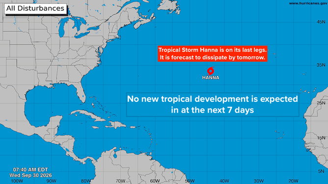
Atlantic basin
WHAT'S THE DIFFERENCE BETWEEN A HURRICANE MAKING A DIRECT HIT AND LANDFALL?
In the Pacific near Mexico
Hurricane Rachel is tracking north offshore of Mexico. Its fringes will bring gusty winds and some heavy rain to the coastal sections. The storm is forecast to turn out to sea, but it will put energy in the ocean that could push significant swells toward Southern California next week.
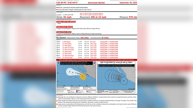
Hurricane Rachel stats
GET THE LATEST FROM FOX WEATHER HURRICANE SPECIALIST BRYAN NORCROSS
Behind Rachel, the National Hurricane Center is painting a medium odds potential development area. If a storm develops, long-range computer forecasts predict that it could track closer to the Mexican coast than Polo and Rachel. This system's name will be Simon.
Nolo is now a tropical storm. It's slowly moving away from the main Hawaiian Islands.
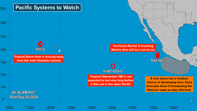
Pacific basin
In the middle of the ocean between Hawaii and Mexico, a new Tropical Depression 19E is drifting east. It's not forecast to intensify and is expected to die out without affecting land.
For the next week or more, Simon will be the one to watch.