

Bryan Norcross: Keeping half an eye on the Atlantic and Pacific while we look back to 100 years ago today
There's a lot of the 2026 hurricane season to go, and nasty storms have occurred in years that featured a strong El Niño in the past.
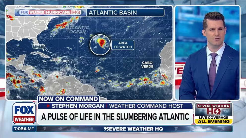
Atlantic gets new area to watch amid historically quiet season
After days of quiet, the National Hurricane Center has highlighted a new area to watch — and this time, it's outside the main belt, in the subtropical Atlantic. Full outlook:
Last updated at 11 a.m. on Monday, Sept. 14, 2026.
SEPTEMBER 14, 1926
Florida newspapers on Tuesday mentioned the hurricane southwest of Bermuda, as well as what they called a disturbance "of only slight intensity" near Cienfuegos on Cuba’s south coast.
There was no mention of the low-pressure system near the northeastern Caribbean that would go on to become one of the greatest hurricanes of all time.
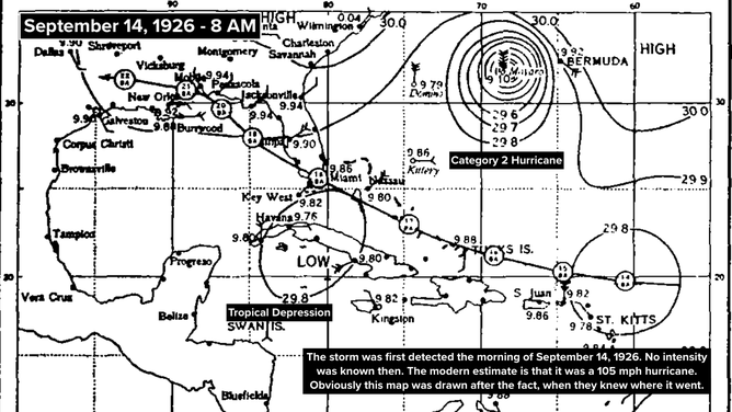
Forecast track of the hurricane 100 years ago.
(Bryan Norcross / FOX Weather)
The U.S. Weather Bureau in Washington sent word to the Miami office that a disturbance had been detected northeast of Saint Kitts in the morning. That information was too late to make it into the papers that day, but there wasn't much to say anyway, except that it existed.
GET THE LATEST FROM HURRICANE SPECIALIST BRYAN NORCROSS
The modern estimate, based on data received the following day, is that the system was in fact a Category 2 hurricane with top winds of about 105 mph at 8 a.m. The NOAA reanalysis shows it slowly strengthening during the day.
IN THE CENTRAL ATLANTIC
The National Hurricane Center is still giving the small disturbance in the central Atlantic a low chance of developing into a tropical depression somewhere in the yellow-hatched area. Nothing is going to happen right away, but it could find a pocket of atmosphere conducive enough to spin up later in the week.
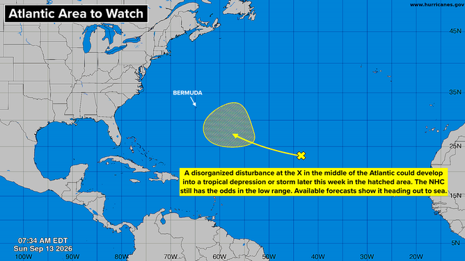
Tropical activity in the Atlantic basin.
(Bryan Norcross)
The models diverge on the likelihood of development. The Google DeepMind AI model continues to be enthusiastic, while others acknowledge the possibility, but put the odds at very low.
In any case, there's no apparent threat to land, although folks in Bermuda should keep an eye on it.
Otherwise, this unusual storm-free peak of the season is expected to continue for the foreseeable future. There have been hurricane seasons with limited activity in the past, so this isn't a complete freak. But as the planet has warmed, El Niños have become less frequent, so we haven't had one of these recently.
There's a lot of the 2026 hurricane season to go, of course. And nasty storms occurred in years that featured a strong El Niño in the past. So we don't want to count any chickens.
IN THE PACIFIC
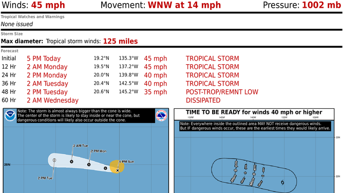
The latest on Tropical Storm Norbert.
(Bryan Norcross / FOX Weather)
Tropical Storm Norbert is tracking west in the general direction of Hawaii. But soon, it's going to run into a blast of strong upper-level winds, and that should wipe out the circulation.
Norbert's remnant tropical moisture looks likely to continue west, however. On the current schedule, it will impact the islands with gusty squalls about Thursday. The heaviest rain will be on the windward side of the islands. Stay aware of potential flood alerts from the National Weather Service in Honolulu.
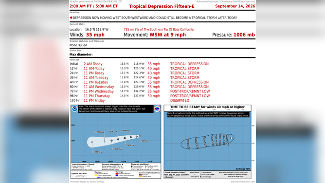
The latest on Tropical Depression 15-E.
(Bryan Norcross)
Tropical Depression 15E behind it is forecast to briefly spin up into Tropical Storm Odalys. Its forecast track is a little farther south than Norbert's. It is also forecast to die out as it moves into the hostile atmospheric environment.