

Bryan Norcross: Slight chance of late season development but no worries
FOX Weather Hurricane Specialist Bryan Norcross gives us the latest on the newly designated area to watch in the Atlantic amid as tropical activity starts to wind down for the season.
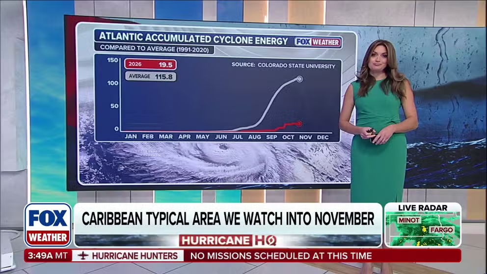
Eying the Caribbean for tropical activity early this month
NOVEMBER TROPICAL STORM WATCH: FOX Weather Meteorologist Britta Merwin shares an update for the 2026 hurricane season as the Caribbean is being monitored for possible tropical development for early November.
This story was last updated at 9:30 a.m. on Monday, Nov. 2, 2026
The National Hurricane Center has designated an Area to Watch northeast of the Bahamas. A low-pressure system is expected to form along an old front over the still-warm waters of the Atlantic.
A patch of slightly conducive upper-level winds might move over that area late this week, giving the system a brief window to get named. The odds of development are in the low range.
COULD SUPER EL NIÑO INFLUENCE THE POLAR VORTEX TO DO SOMETHING IT'S NEVER DONE BEFORE THIS WINTER?
Since it will start as a non-tropical disturbance and won't have much time in a somewhat tropically conducive weather pattern, it looks likely to develop into one of those subtropical depressions or storms, if it takes on any tropical characteristics at all.
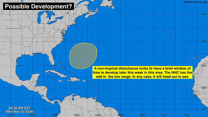
Area to watch in the Atlantic.
(Bryan Norcross)
The system, in its non-tropical form, looks to be strong enough to get named Kyle if the NHC determines it is able to separate from the front and at least partially derive energy from the warm ocean.
No matter what happens with the system, it will head out to sea.
Otherwise, the Gulf, the Caribbean, and the tropical Atlantic are in wintertime mode. Fringe systems are always possible, but no threats are likely.