Hurricane season 2024: Here’s what to look for in the tropics this year
An average season produces 14 named storms and seven hurricanes. Francine and Milton are new names that were added to the identification list that will be used in 2024. Plus, here's a look at the 2024 hurricane names.
Preview of the 2024 hurricane season
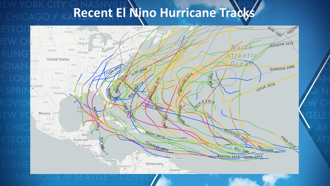
Hurricane Specialist Bryan Norcross explains what the dying El Nino being replaced by a La Nina pattern could mean to hurricane season.
There are 100 days before the arrival of the 2024 hurricane season in the Atlantic basin, but for Mother Nature, the processes that lead to tropical cyclone production begin well before the hurricane season’s annual start.
Forecasters pay close attention to trade winds in the Pacific and water temperature anomalies to determine the status of the El Niño-Southern Oscillation index, or what is commonly referred to as the ENSO.
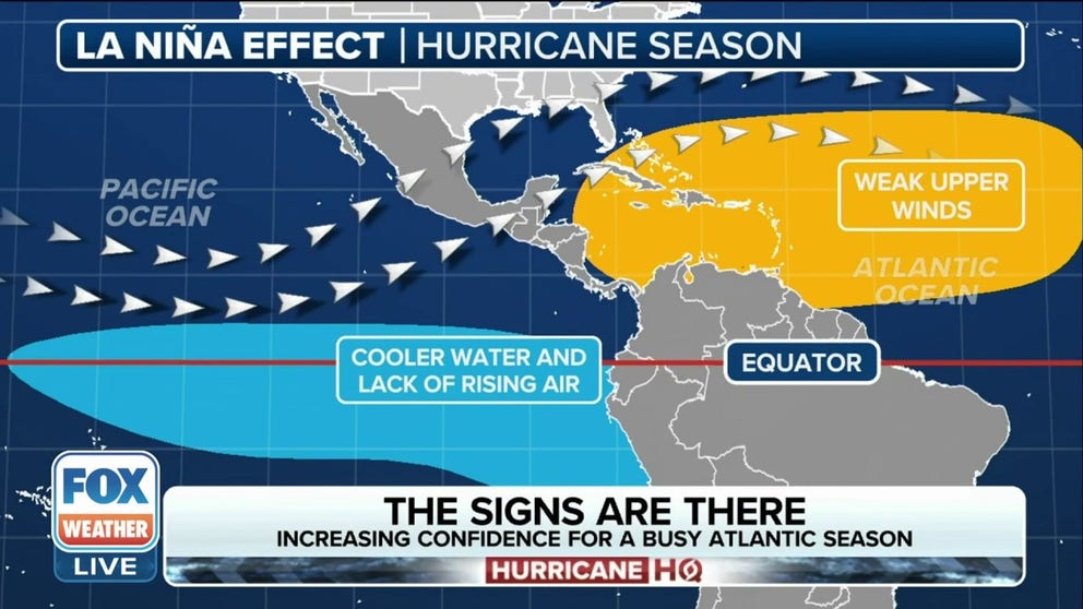
Historically, El Niños have produced hostile conditions for tropical cyclones, while the opposite is known to be true for La Niñas – when conditions are more favorable.
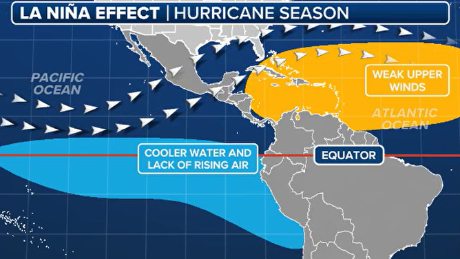
La Nina hurricane season impacts
(FOX Weather)
"There are two parts of the El Niño. One is it generally produces hostile winds over the tropical Atlantic, and that kind of keeps the hurricanes either from forming or keeps them from getting terribly strong. That did not happen last year. The other part of an El Niño, though, is the upper-level wind pattern that often makes the storms turn north before they get to the U.S. before they get too far west. And that did happen," said FOX Weather Hurricane Specialist Bryan Norcross.
Early indications from NOAA show that the world could be in a neutral or La Niña status during the upcoming hurricane season after the 2023-24 El Niño decays.
WHAT ARE EL NINO AND LA NINA CLIMATE PATTERNS?
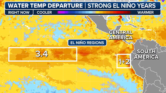
Current state of ENSO
The current El Niño pattern continues to weaken, and climate models anticipate the world will enter a neutral status around the start of meteorological summer.
An exit out of the El Niño would require water temperatures in the central and eastern Pacific to cool below the threshold of anomaly of 0.5 °C.
A neutral ENSO runs from 0.5 °C to -0.5 °C, and a La Niña is considered to be in control when water temperatures slip below the -0.5 °C threshold.
Eastern and central Pacific water temperatures
(FOX Weather)
According to NOAA, the El Niño of 2023-24 reached an anomaly of at least 2.0 °C, making the event very strong, but there remain considerable questions on how fast the event will decline.
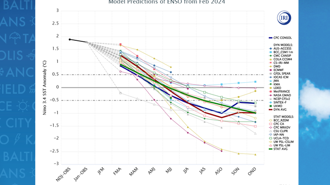
"There is something called the spring predictability barrier when it comes to El Niño. The El Niño and La Niña forecasts before you get to about May are iffy, especially on timing. There is a big consensus that we’re going to get toward a La Niña later in the year, but these things often adjust when you get closer to the hurricane season. So, we’ll put kind of a question mark on that," said Norcross.
What the neutral or La Niña status means for the 2024 season
An average Atlantic basin hurricane season produces 14 named storms, seven of which go on to become hurricanes, and three normally reach major hurricane status with winds of at least 115 mph.
The average from the last five years with an atmospheric state similar to what 2024 could be have produced 19 named storms and nine hurricanes. Of the nine hurricanes, four went on to become major cyclones of at least Category 3 strength or stronger.
If the demise of the El Niño is slower than anticipated, then hostile conditions across the basin could be at play for longer during the season, creating less-than-prime conditions for tropical cyclone development.
There is known to be significant variability when it comes to exiting an El Niño and the arrival of the next ENSO state.
Climate models are known to greatly struggle in anticipating impacts around the world when the state of the atmosphere is in flux.
But at this point, all signs point to a more active year than 2023, but then again, it wouldn’t take much for a season to outdo last year as it was the least impactful for the U.S. in nearly a decade.
ENSO model forecast
(FOX Weather)
2023 HURRICANE SEASON: LEAST IMPACTFUL FOR US IN NEARLY A DECADE
Changes for the hurricane season
The National Hurricane Center is planning for several changes during the 2024 season that are designed to help those in harm’s way better understand the potential impacts from a tropical cyclone.
Starting around August 15, about a month before peak hurricane season, which runs from June to November, the agency plans to start releasing an experimental forecast cone that will show all related watches and warnings from local National Weather Services offices and the NHC.
The product will be in addition to the cone that has been used for decades that, up until this season, has only shown coastal alerts and not inland watches and warnings.
Media organizations such as FOX Weather have sometimes shown the combined forecast track and alert products, but the NHC believes its usage will help further enhance storm messaging.
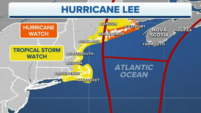
Hurricane Lee forecast cone
(FOX Weather)
In addition to the experimental cone, the NHC said watches and warnings could now be adjusted more frequently and not during the set times of 5 A.M., 11 A.M., 5 P.M., and 11 P.M. when the full advisory packages are typically issued.
Additionally, the agency said the public should be on the lookout for more Spanish-language products during the 2024 season.
According to the Instituto Cervantes, a language school and cultural center, the U.S. is home to the fourth-largest population of Spanish speakers globally, with many living in hurricane-impact zones.
NEW FORECAST CONE TO BE TESTED BY NATIONAL HURRICANE CENTER DURING 2024 SEASON
Careful with preseason hype
Several private forecast organizations have declared the upcoming season will be extremely active and worrisome, but hurricane experts caution against believing some of the preseason hype.
Some of the same groups that are ringing alarm bells also forecasted the 2023-24 winter to be one full of arctic outbreaks and heavy snowfall – the opposite of what actually happened, with the season finishing as one of the warmest.
Hurricane outlooks issued in April were 27% off for the total amount of named storms in 2022, 47% inaccurate in 2020 and 48% in 2012.
![]() Image 1 of 3
Image 1 of 3Last 10 hurricane seasons under neutral conditions ( )
![Last 10 hurricane seasons under La Nina conditions]() Image 2 of 3
Image 2 of 3Last 10 hurricane seasons under La Nina conditions ( )
![Last 10 hurricane seasons under El Nino conditions]() Image 3 of 3
Image 3 of 3Last 10 hurricane seasons under El Nino conditions ( )


Just because water temperatures are warm does not guarantee increased tropical cyclone activity.
Take August 2022, for example. Water temperatures resembled a bathtub, and a La Niña controlled weather patterns.
Typically, the month is the second-busiest time period in the entire season, but during that particular August, zero named tropical cyclones formed.
A reanalysis found dry air, high pressure and shear prevented cyclones from developing, which could theoretically happen during any season.
The science simply doesn’t exist to make significant judgment calls months ahead of time, and outlooks are designed to provide an overview of trends.
The hurricane outlook from Colorado State University is to be released in April, and NOAA’s forecast will be made public in May.
7 FACTS TO KNOW ABOUT HURRICANES
Names for the 2024 tropical cyclone season
The National Hurricane Center will begin issuing Tropical Weather Outlooks on May 15, with the official start on June 1.
There are six rotating lists the NHC uses to name tropical storms and hurricanes in the Atlantic basin.
This year’s list was last used in 2018 when storms such as Michael and Florence impacted the U.S. coastline.
Michael struck the Florida Panhandle as a Category 5 hurricane, and Florence impacted nearly every community in the Carolinas.
Due to the hurricanes’ widespread destruction and human toll, the World Meteorological Organization retired both names and replaced them with Francine and Milton, which will make their first appearance in 2024.
The full list of cyclone names in the Atlantic basin includes:
- Alberto
- Beryl
- Chris
- Debby
- Ernesto
- Francine
- Gordon
- Helene
- Isaac
- Joyce
- Kirk
- Leslie
- Milton
- Nadine
- Oscar
- Patty
- Rafael
- Sara
- Tony
- Valeria
- William