Nesbit, MS

See Radar

Current Weather Forecast for Nesbit

MS 38651  |   12:30pm

Weather Conditions

74°
Feels Like 74°
Cloudy
Cloudy
65° 76°
UV Index
3
UV Index
Air Quality
Good
Air Quality
Wind
SSE 16 mph
Wind
Rain
0 in
rain

Today

Tue 11/3
76°
Highest Temperature
Thunderstorms
88%
Thunderstorms. Storms may contain strong gusty winds. High 76F. Winds SSE at 15 to 25 mph. Chance of rain 90%.

Tonight

Tue 11/3
59°
Lowest Temperature
Scattered Thunderstorms
100%
Thunderstorms, some locally heavy early, then partly cloudy after midnight. Storms may contain strong gusty winds. Low 59F. Winds SW at 5 to 10 mph. Chance of rain 100%. 1 to 2 inches of rain expected.

Tomorrow

Wed 11/4
68°
Highest Temperature
Partly / Cloudy
8%
Some clouds in the morning will give way to mainly sunny skies for the afternoon. High 68F. Winds W at 5 to 10 mph.

Local Weather Radar - Nesbit, MS

Live Nesbit Local Radar Forecast by FOX Weather

Next 12 Hours Forecast in Nesbit

Hourly Weather Forecast & Temperature

1PM
Cloudy
2%
74°
Feels Like 74°
Cloudy
Wind
SSE 18 mph
Wind
Pressure
1012 mb
Pressure
Humidity
71%
Humidity
UV Index
2
UV Index
Visibility
10mi
Visibility
Visibility
86%
Cloud Cover
2PM
Cloudy
4%
75°
Feels Like 75°
Cloudy
Wind
SSE 17 mph
Wind
Pressure
1012 mb
Pressure
Humidity
69%
Humidity
UV Index
2
UV Index
Visibility
10mi
Visibility
Visibility
84%
Cloud Cover
3PM
Cloudy
8%
75°
Feels Like 75°
Cloudy
Wind
SSE 15 mph
Wind
Pressure
1011 mb
Pressure
Humidity
69%
Humidity
UV Index
1
UV Index
Visibility
10mi
Visibility
Visibility
87%
Cloud Cover
4PM
Cloudy
15%
75°
Feels Like 75°
Cloudy
Wind
SSE 14 mph
Wind
Pressure
1010 mb
Pressure
Humidity
69%
Humidity
UV Index
0
UV Index
Visibility
10mi
Visibility
Visibility
90%
Cloud Cover
5PM
Cloudy
17%
74°
Feels Like 74°
Cloudy
Wind
SSE 13 mph
Wind
Pressure
1010 mb
Pressure
Humidity
73%
Humidity
UV Index
0
UV Index
Visibility
10mi
Visibility
Visibility
93%
Cloud Cover
6PM
Thunderstorms
88%
71°
Feels Like 71°
Thunderstorms
Wind
S 11 mph
Wind
Pressure
1010 mb
Pressure
Humidity
81%
Humidity
UV Index
0
UV Index
Visibility
6mi
Visibility
Visibility
95%
Cloud Cover
7PM
Thunderstorms
100%
69°
Feels Like 69°
Heavy Thunderstorms
Wind
S 9 mph
Wind
Pressure
1010 mb
Pressure
Humidity
87%
Humidity
UV Index
0
UV Index
Visibility
3mi
Visibility
Visibility
100%
Cloud Cover
8PM
Thunderstorms
100%
67°
Feels Like 68°
Heavy Thunderstorms
Wind
S 8 mph
Wind
Pressure
1011 mb
Pressure
Humidity
95%
Humidity
UV Index
0
UV Index
Visibility
1.8mi
Visibility
Visibility
100%
Cloud Cover
9PM
Thunderstorms
100%
66°
Feels Like 68°
Heavy Thunderstorms
Wind
S 6 mph
Wind
Pressure
1010 mb
Pressure
Humidity
98%
Humidity
UV Index
0
UV Index
Visibility
1.5mi
Visibility
Visibility
100%
Cloud Cover
10PM
Thunderstorms
85%
66°
Feels Like 68°
Thunderstorms
Wind
SSW 7 mph
Wind
Pressure
1010 mb
Pressure
Humidity
96%
Humidity
UV Index
0
UV Index
Visibility
3mi
Visibility
Visibility
99%
Cloud Cover
11PM
Thunderstorms
84%
66°
Feels Like 68°
Thunderstorms
Wind
SSW 8 mph
Wind
Pressure
1010 mb
Pressure
Humidity
95%
Humidity
UV Index
0
UV Index
Visibility
3mi
Visibility
Visibility
99%
Cloud Cover
12AM
Scattered Thunderstorms
35%
66°
Feels Like 68°
Scattered Thunderstorms
Wind
SSW 6 mph
Wind
Pressure
1010 mb
Pressure
Humidity
95%
Humidity
UV Index
0
UV Index
Visibility
6mi
Visibility
Visibility
93%
Cloud Cover
Tue 11/3
Tue
Thunderstorms
88%
65°
76°
Thunderstorms. Highs in the mid 70s and lows in the upper 50s.
Feels Like
76°
Feels Like
Wind
SSE 18 mph
Wind
Humidity
72%
Humidity
UV Index
3
UV Index
Visibility
6:22 AM
Sunrise
Visibility
5:03 PM
Sunset
Wed 11/4
Wed
Partly / Cloudy
8%
52°
68°
Times of sun and clouds. Highs in the upper 60s and lows in the upper 40s.
Feels Like
68°
Feels Like
Wind
W 9 mph
Wind
Humidity
76%
Humidity
UV Index
4
UV Index
Visibility
6:23 AM
Sunrise
Visibility
5:02 PM
Sunset
Thu 11/5
Thu
Sunny
8%
48°
73°
Sunshine. Highs in the low 70s and lows in the low 50s.
Feels Like
73°
Feels Like
Wind
WSW 3 mph
Wind
Humidity
62%
Humidity
UV Index
4
UV Index
Visibility
6:24 AM
Sunrise
Visibility
5:02 PM
Sunset
Fri 11/6
Fri
Partly / Cloudy
5%
51°
66°
Times of sun and clouds. Highs in the mid 60s and lows in the mid 40s.
Feels Like
66°
Feels Like
Wind
N 9 mph
Wind
Humidity
64%
Humidity
UV Index
4
UV Index
Visibility
6:25 AM
Sunrise
Visibility
5:01 PM
Sunset
Sat 11/7
Sat
Mostly Cloudy
5%
43°
57°
Considerable cloudiness. Highs in the upper 50s and lows in the low 40s.
Feels Like
44°
Feels Like
Wind
N 8 mph
Wind
Humidity
61%
Humidity
UV Index
3
UV Index
Visibility
6:26 AM
Sunrise
Visibility
5:00 PM
Sunset
Sun 11/8
Sun
Partly / Cloudy
5%
40°
59°
Mix of sun and clouds. Highs in the upper 50s and lows in the upper 30s.
Feels Like
39°
Feels Like
Wind
N 6 mph
Wind
Humidity
64%
Humidity
UV Index
4
UV Index
Visibility
6:27 AM
Sunrise
Visibility
4:59 PM
Sunset
Mon 11/9
Mon
Fair / Mostly Sunny
10%
38°
65°
Mostly sunny. Highs in the mid 60s and lows in the low 40s.
Feels Like
65°
Feels Like
Wind
NNW 4 mph
Wind
Humidity
59%
Humidity
UV Index
4
UV Index
Visibility
6:28 AM
Sunrise
Visibility
4:58 PM
Sunset
Tue 11/10
Tue
Fair / Mostly Sunny
8%
40°
69°
A few clouds. Highs in the upper 60s and lows in the low 40s.
Feels Like
69°
Feels Like
Wind
WNW 5 mph
Wind
Humidity
52%
Humidity
UV Index
4
UV Index
Visibility
6:29 AM
Sunrise
Visibility
4:57 PM
Sunset
Plans up in the air? We'll help you weather-proof them. Get the FREE FOX Weather app.
Download the App

Latest Stories from Mississippi
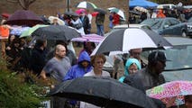
Fall blast sends temperatures tumbling across the US

A powerful cold front is sweeping across parts of the U.S., bringing the late-season heat wave to a screeching halt. Starting this weekend, the cold front is expected to impact much of the central and eastern U.S., causing temperatures to plummet by more than 40 degrees.

Loading...