

Thanksgiving weather nightmares: A look back at the most powerful holiday storms in US history
The Great Appalachian Storm of 1950 struck on Thanksgiving weekend and left 160 people dead, delivering a superfecta of snow, bone-chilling temperatures, widespread flooding and intense wind gusts.
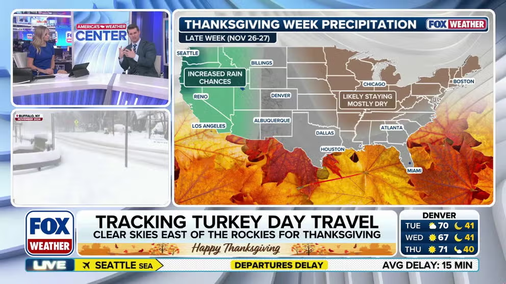
Thanksgiving week weather outlook features rain and possibly snow
We're just two weeks from Thanksgiving, and we're taking a look at what the forecast holds for the Lower 48 as millions travel for the holiday. While it's still early, forecast models show that the West will be wet and the East should dry out just in time for Thanksgiving Day.
THE TAKEAWAY
- Great Appalachian Storm of 1950: Left 160 people dead after dropping record snow and flooding across the Ohio Valley and Northeast.
- Hurricane Iwa: Late-season hurricane carved a trail of damage after making a rare landfall on Hawaii during a Super El Niño year.
- 2019 Pacific Northwest bomb cyclone: The storm brought record-low pressure to Northern California, heavy snow and major Thanksgiving travel disruptions.
As Thanksgiving approaches, FOX Weather is taking a closer look at some of the most impactful Thanksgiving storms in our country’s history.
The Great Appalachian Storm of 1950
This storm struck on Thanksgiving weekend of 1950 and left 160 people dead, delivering a superfecta of snow, bone-chilling temperatures, widespread flooding and intense wind gusts.
It dropped more than 2 feet of snow across parts of the Ohio Valley, as well as near-record flooding in eastern Pennsylvania, and widespread wind damage across the heavily populated Northeast cities of Boston, New York City and Newark, New Jersey, according to information from the National Weather Service (NWS) and National Centers for Environmental Information (NCEI).
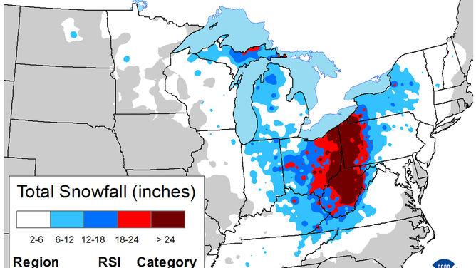
Great Appalachian Storm of 1950
(NCEI / FOX Weather)
A cold blast of arctic air plunged temperatures from the 40s into the teens just ahead of the storm and set the stage for the record-breaking storm, according to the NWS office in Jackson, Kentucky.
All told, Coburn Creek, West Virginia saw 62 inches of snow. The storm’s winds caused widespread damage and power outages, making it the costliest storm on record at the time, the NWS said.
THANKSGIVING OUTLOOK: RAIN, STORMS AND POSSIBLE SNOW COULD DISRUPT HOLIDAY TRAVEL PLANS FOR MILLIONS
Additionally, the storm was characterized by a unique temperature gradient, a change in temperature over a short distance.
"Case in point, Pittsburgh, PA received 30.5" of snow and recorded temperatures in the single digits while only 200 miles to the north, Buffalo, NY enjoyed temps in the 40s and recorded no snow at all," the NWS office said.
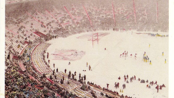
Postcard of the Snow Bowl between Ohio State and Michigan in 1950.
(GNU Card Company via Columbus Metropolitan Library / FOX Weather)
Notably, the storm also set the stage for the Snow Bowl, one of the most storied games in the Ohio State–Michigan college football rivalry. The game was played on Nov. 25 in Ohio Stadium and saw frigid temperatures as well as driving snow and wind.
The teams combined for 45 punts, and Michigan won 9-3 en route to the 1951 Rose Bowl.
Hurricane Iwa
Hurricane Iwa made a rare landfall in Hawaii on Nov. 23, 1982. The very late-season hurricane killed a Navy sailor and damaged over 11,00 buildings after buzzsawing through Kaua'i, O'ahu and Niʻihau as a Category 1 storm, according to Hawaii's Emergency Management Agency.
Iwa's damage displaced 500 people from their homes and cost more than $300 million at the time, according to the agency. The sailor died after his ship "was struck by a huge wave while leaving Pearl Harbor," Hawaii's Department of Defense said.
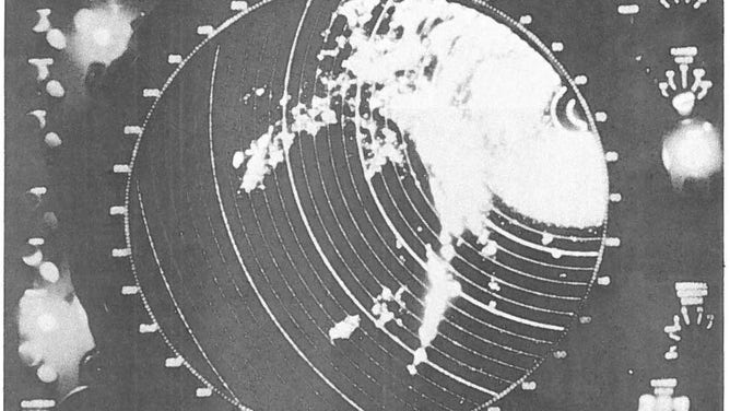
Hurricane lwa as seen on a 169th ACW Sq. radar screen. Maj. Steven Berg took the picture when the eye was 200 miles southwest of Kauai.
(Hawaii Department of Defense / Hawaii National Guard - Pūpūkahi Newsletter Winter 1983 / FOX Weather)
The department said evacuations and other preparations that afternoon helped prevent additional deaths.
Hawaii rarely sees tropical activity due to its small size and generally cooler waters around the state. However, El Niño typically supercharges the Central Pacific, producing more storms, and 1982 is considered a Super El Niño year.
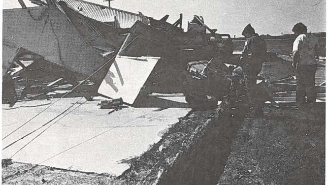
Officials evaluate losses at the 202nd ATCF at Barking Sands, Kauai. Guard facilities suffered more than $1.2 million in damages during Hurricane lwa.
(Hawaii Department of Defense / Hawaii National Guard - Pūpūkahi Newsletter Winter 1983 / FOX Weather)
It's been an active hurricane season for Hawaii this year, with NOAA expecting Super El Niño conditions to take hold later this fall or winter.
Hawaii saw a direct hit from major Hurricane Lowell in early September, in addition to close passes from Lala, Moke and Nolo.
Pacific Northwest Bomb Cyclone of 2019
More recently, the Thanksgiving Bomb Cyclone of 2019 is still fresh in the minds of some along the coast in southwest Oregon and northern California. The storm slammed the region on Nov. 26 with flash flooding, heavy snow, and hurricane-force winds.
The term "bomb cyclone" comes from the term "bombogenesis." It refers to a storm in the mid-latitudes, between the tropics and polar regions, that intensifies rapidly and can create large impacts such as heavy snow, rain, high winds and coastal flooding.
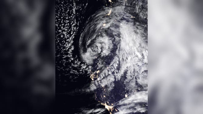
Satellite imagery of the Pacific Northwest Bomb Cyclone 2019 on Nov. 26.
(NASA Earth Observatory image by Joshua Stevens , using MODIS data from NASA EOSDIS/LANCE and GIBS/Worldview and Black Marble data courtesy of NASA Goddard Space Flight Center. / FOX Weather)
NOAA's Weather Prediction Center (WPC) reported at the time that the storm brought whiteout conditions from LaPine to Lakeview, Oregon.
The WPC said it was the strongest storm to hit Northern California with a record-low sea-level pressure reading of 973.6 millibars at Crescent City. The storm also produced a 106 mph gust at Cape Blanco.