How the lay of the land affects wildfire behavior
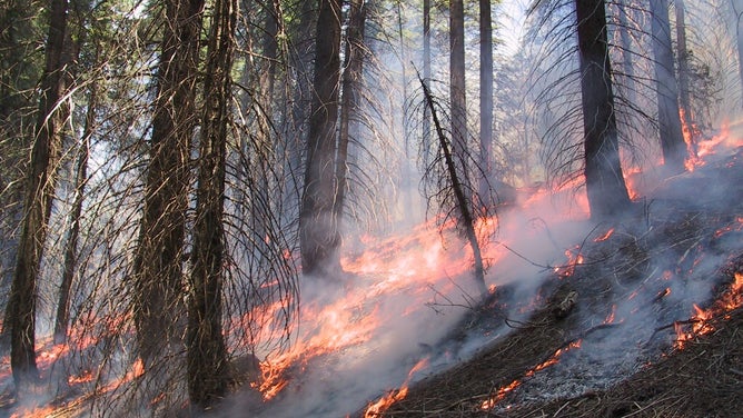
When wildfires are raging along the countryside, it's not just the weather and the flames that challenge firefighters in their battle, but the topography can play a big role in the fire's behavior if the blaze gets into hilly terrain.
(Teresa Brennan / USGS)
When wildfires are raging along the countryside, it's not just the weather and the flames that challenge firefighters in their battle, but the topography can play a significant role in the fire's behavior if the blaze gets into hilly terrain.
For one, fire will spread faster up a hillside than heading down a slope, according to Prof. Stephen Fitzgerald who is the Director of College of Forestry at Oregon State University. As heat rises ahead of the flames, it will dry out trees and other fuels farther up the slope, priming them to catch fire as the flames approach more quickly.
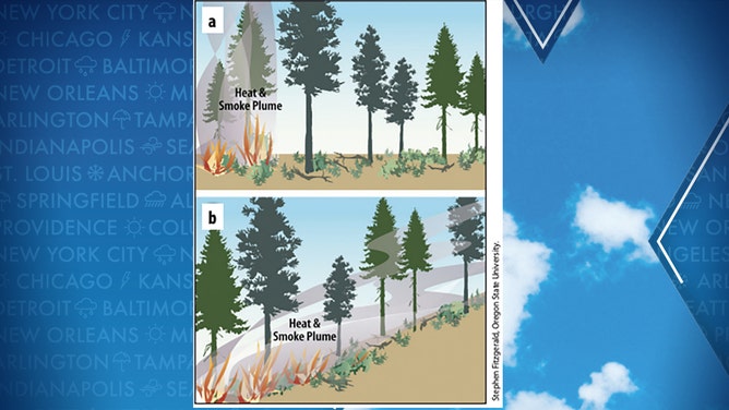
(Stephen Fitzgerald / Oregon State University)
The direction of the slope also affects their wildfire potential. South- and west-facing slopes receive more direct sunshine, with less vegetation, especially in lower-elevation forests. On the other hand, those slopes tend to get less rainfall, leaving the fuels there drier, Fitzgerald says.
The north-facing slopes stay on the cooler, shadier side of the hills, making them a little more resilient to dry conditions. But with typically larger amounts of vegetation, those conditions can lead to more severe wildfires once a wildfire is triggered in that area.
In the Pacific Northwest, fuel loads can be plenty on both the north and south sides of hills due to their rainier climate, Fitzgerald said.
(FOX Weather)
A similar catch-22 is found in how elevation can affect wildfire behavior. On the one hand, lower elevations tend to dry out sooner due to warmer temperatures and lower precipitation amounts. But higher elevations attract more lightning strikes that are a common source of wildfire ignitions.
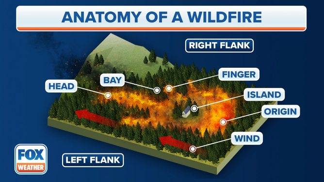
And then other landscaping features like canyons, ridges and saddles can affect localized wildfire behavior by funneling wind and increasing their speed, helping rapidly spread fires, according to Fitzgerald. Any fires burning on lateral ridges can move in any direction depending on winds coming up through canyons and saddles.
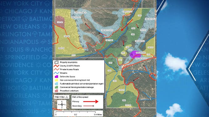
Treatment map showing types and dates of treatment of a property in southern Oregon.
(Max Bennett, Oregon State Univ. and Marty Main, Small Woodland Services.)
But topography can also help firefighters use natural breaks to establish fire lines and prevent their spread. Rock outcroppings, roads, rivers and other bodies of water can be used as anchor points for developing fire breaks.
"By analyzing a topographic map of your property, you may identify topographic features that can be used to your advantage," Fitzgerald said.