What are these creepy clouds? Shallow fog explained
Shallow fog doesn't extend very high above the ground
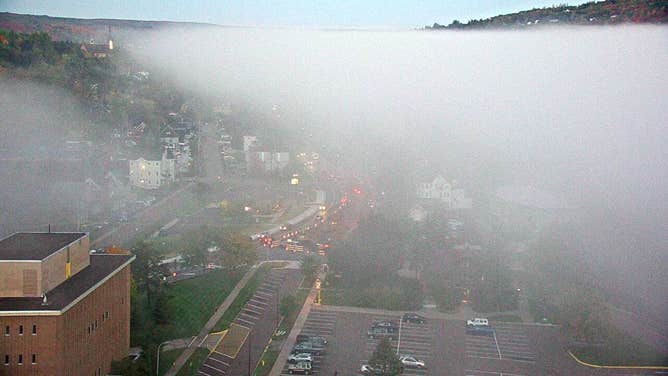
This webcam image from Michigan Technological University shows shallow fog over Houghton, Michigan, on Oct. 6, 2021.
(Michigan Technological University webcam)
Creepy clouds filled the sky over the Upper Peninsula of Michigan on the morning of Oct. 6, 2021, with blue sky clearly visible above while city streets could barely be seen below.
A shallow fog layer was responsible for this eery start to the day.
The fog was so close to the ground that the top of the treeline was higher than the top of the fog bank.
The National Weather Service office in Marquette, Michigan, said the thin layer of fog was clinging to the Portage Canal and covering the city of Houghton, Michigan, but it quickly dissipated by the time it reached the tops of the trees surrounding the canal.
Shallow fog layers like these are a type of radiation fog, which can form on a clear night with light winds and moist air.
Without clouds, the heat absorbed during the day quickly escapes into the atmosphere, so the land surface rapidly cools down. If the air is moist, that moisture comes into contact with the cooling land surface and also cools down. Once the temperature drops to the dew point, the moisture condenses into radiation fog because the air has become saturated.
Radiation fog typically burns off shortly after sunrise as the temperature warms back above the dew point, so the air is no longer saturated enough to support fog.