Watch: Raging California wildfire seen from space
The Garnet Fire was sparked on Aug. 24 by lightning and has consumed nearly 30,000 acres. Firefighters have been working to protect Giant Sequoia groves and have the fire 12% contained as of Wednesday.
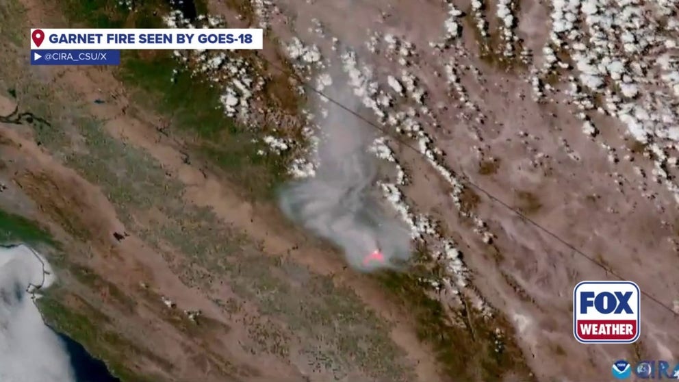
California'a Garnet Fire seen by NOAA satellite
Satellite imagery from NOAA's GOES-18 shows the quick-moving Garnet Fire.
FRESNO COUNTY, Calif. – NOAA's satellites are tracking California wildfires consuming thousands of acres, including the Garnet Fire in the Sierra National Forest.
The Garnet Fire was sparked on Aug. 24 by lightning and has consumed nearly 30,000 acres. Firefighters have been working to protect Giant Sequoia groves and have the fire 12% contained as of Wednesday.
Due to the wildfire, parts of the Sierra National Forest are closed, according to the U.S. Forest Service.
The video above from NOAA's GOES East satellite Advanced Base Imager instrument shows the heavy smoke and flames from space. The video was taken from space on Monday, according to the Cooperative Institute for Research in the Atmosphere at Colorado State University.
Winds have been causing rapid fire spread in the West.
According to the U.S. Forest Service, continued isolated thunderstorms are anticipated through Wednesday, with erratic, downdraft winds and the possibility of rapid and dangerous fire spread.
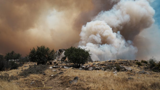
The Garnet Fire in Fresno County, California.
(FOX Weather)
Another NOAA satellite is also tracking the Emigrant Fire in Oregon, which has consumed more than 23,000 acres.