Major Northeast cities eye 90 degrees as record heat brings summer feel to the Ohio Valley and Mid-Atlantic
Let’s see what the prediction markets, brought to you by Kalshi, are saying about the potential for record warmth in Northeast cities like Washington, D.C., Philadelphia, and New York City.

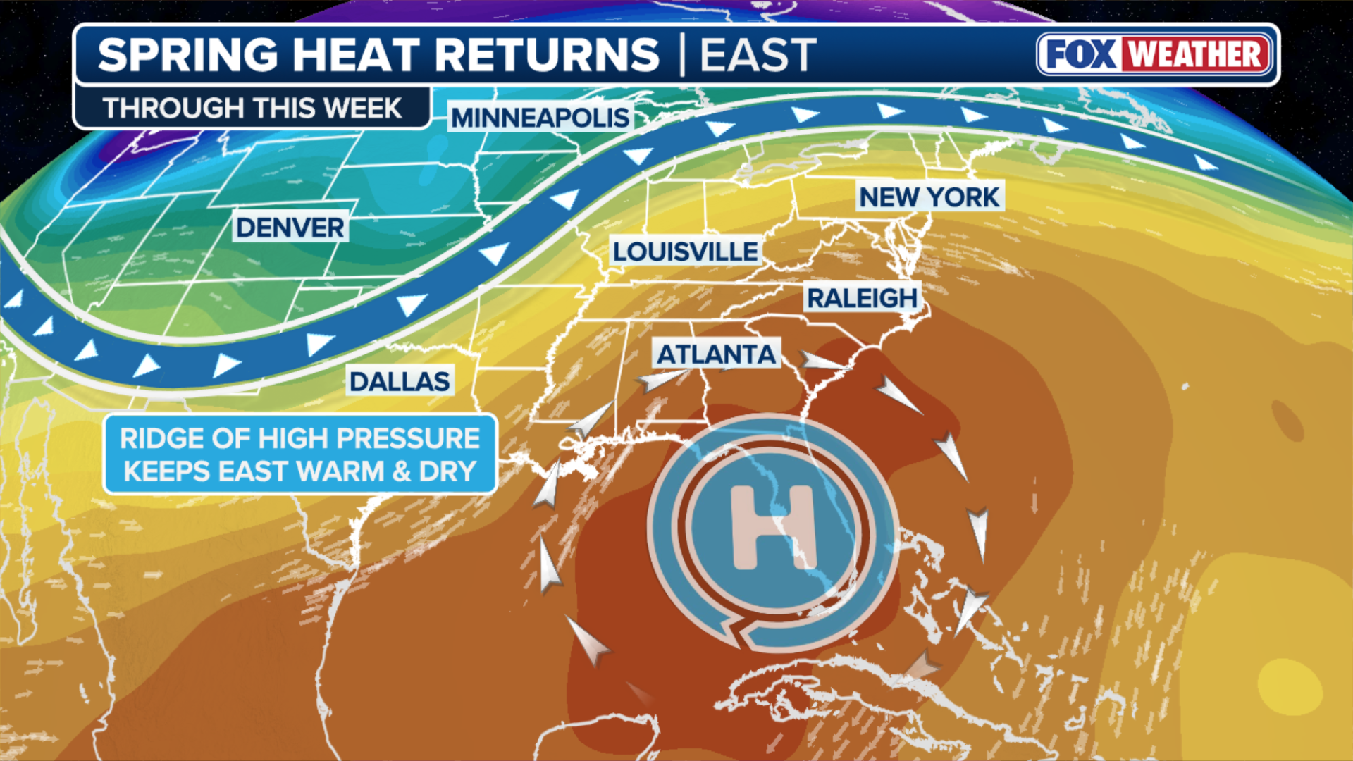
Spring heat wave bakes eastern US through the week
A ridge of high pressure over the eastern half of the country is ushering in record-warm temperatures with temperatures 20-30 degrees above average across parts of the Southeast, the Ohio Valley, and the Mid-Atlantic. Parts of the northeastern Interstate 95 corridor could approach 90 degrees on Wednesday and Thursday.
A ridge of high pressure over the eastern half of the country is ushering in record-warm temperatures with conditions 20-30 degrees above average across parts of the Southeast, the Ohio Valley, and the Mid-Atlantic.
Parts of the northeastern Interstate 95 corridor, including Washington, Philadelphia and New York City, could approach 90 degrees for the first time this year on Wednesday and Thursday.
(FOX Weather)
The FOX Forecast Center noted that this early-season heat follows a record-setting heat dome in March across the West.
According to the Forecast Center, the intensity of this week's heat will peak on Wednesday and Thursday, with temperatures in places like Washington, DC, expected to soar into the low to mid-90s. Heat like this is typically not seen until May or June.
Let's take a look at what prediction markets are saying about Wednesday's high temperature in Washington, D.C.:
Here's what prediction markets are saying about Wednesday's low temperature in Philadelphia:
Here's what prediction markets are saying about Wednesday's low temperature in New York City:
The heat wave will remain in place for the rest of the week.
The cold front that is producing severe storms in the Midwest will swing into the Northeast this weekend, producing a notable cooldown. Temperatures will fall over 30 degrees in some locations by Monday with temperatures returning closer to average.

(FOX Weather)