Tropical Disturbance likely to develop into a depression or storm next week
The long-range computer forecast models show a tropical Atlantic dominated by dust and dry air. If that works out, the tropics should stay calm well into August.

FOX Weather is your Hurricane HQ, streaming free 24/7.
(FOX Weather / FOX Weather)
The Atlantic Tropical Disturbance is still plowing through a dense plume of Saharan dust in the central tropical Atlantic. The dry, dusty air is helping to keep the disturbance in a very disorganized state. It’s currently nothing more than a cluster of random thunderstorms with some signs of turning winds under them.
Once the disturbance clears the bulk of the dust next week, however, the atmospheric pattern is forecast to become conducive for development, and a more organized circulation should be able to form. The National Hurricane Center rates its chances of becoming at least a tropical depression as high.
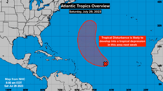
Atlantic Tropics Overview. July 29, 2023.
(National Hurricane Center / NOAA)
If top winds ever reach 40 mph or higher in the circulation, it will be named Emily.
The disturbance is turning north through a break in the blocking high-pressure system that sprawls across the Atlantic in the summer – the so-called Bermuda High. Next week, a big dip in the jet stream off the East Coast of the U.S. will scoop up the system and send it into the cold North Atlantic. There is no threat to land.
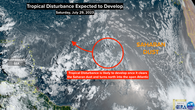
Tropical Disturbance Expected to Develop. July 29, 2023.
(CIRA / RAMMB / FOX Weather)
The long-range computer forecast models show a tropical Atlantic dominated by dust and dry air. If that works out, the tropics should stay calm well into August.
Recall that last year, dust and dry air helped keep the tropics calm through August – a surprising development. But then, Mother Nature threw the big tropical switch, and one after the other systems developed. Every year is different, but it looks like August will at least begin in a similar way.