

Invest 90E may bring impacts to Hawaii's Big Island just a week after Hurricane Lala's severe flooding, damage
A new area to watch for tropical development in the Eastern Pacific has an outside chance of delivering rain to Mexico and even the Southwest U.S.
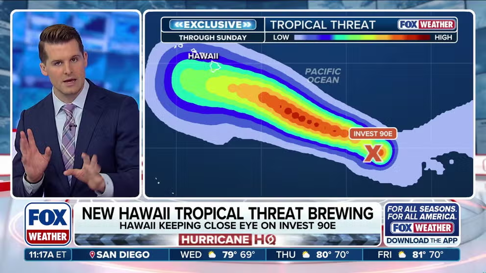
Hawaii back on alert as Invest 90E lines up behind Lala
As Category 3 Hurricane Lala continues tracking toward the Northwestern Hawaiian Islands, the FOX Forecast Center is also closely watching newly designated Invest 90E as it lines up on the horizon with possible impacts by this weekend, while another disturbance churns off the coast of Mexico. Full outlook:
THE TAKEAWAY
- Lala regained hurricane status over the Pacific as it pulled away from Hawaii.
- Invest 90E could bring impacts to Hawaii's Big Island, just days after Lala brings destructive flooding.
- An Eastern Pacific disturbance off Mexico’s coast has an outside chance of bringing moisture to the Southwest U.S.
As Lala pulled away from the Hawaiian Islands, it regained hurricane status over the open ocean, while a string of new tropical threats emerged across the wider Pacific basin, fueled by warm waters associated with the El Niño climate pattern.
While Lala brought heavy rain, strong winds, flash flooding and widespread power outages to Hawaii, its regained hurricane status will remain well out to sea, posing no threat to the main islands.
![]() Image 1 of 6
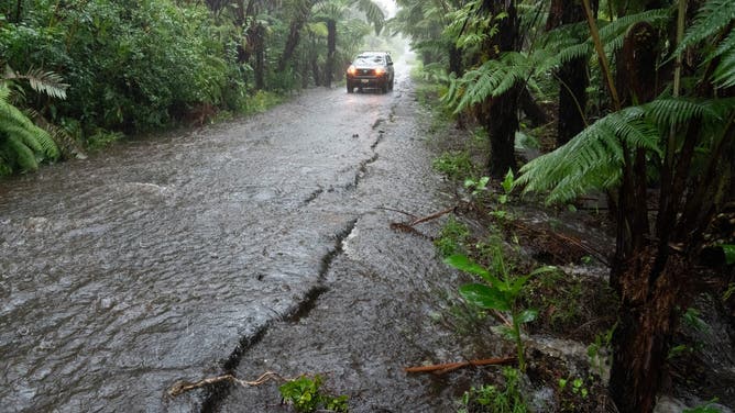
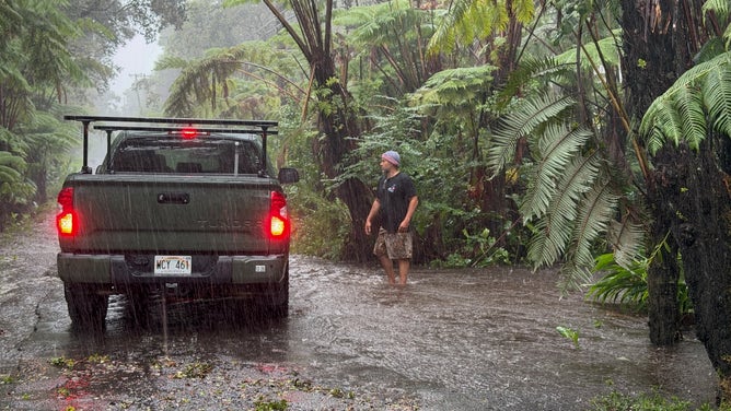
Image 1 of 6A rural road floods in Volcano Village on Hawaii Island, on August 15, 2026. Hurricane Lala on Saturday lashed Hawaii's Big Island with heavy rain and strong winds, as forecasters warned of potentially dangerous flooding across the US Pacific island state. Lala strengthened into a Category 1 hurricane at around 9:00 am local time (1900 GMT), generating winds of up to 75 miles per hour (120 kilometers per hour). (Photo by Jill K. Briggs / AFP via Getty Images) ( )
![]() Image 2 of 6
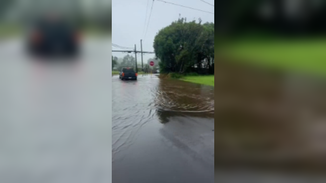
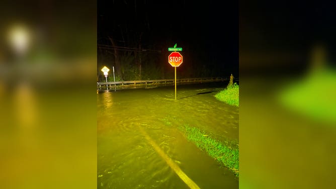
Image 2 of 6Flooding in Waimea Big Island, Hawaii from Hurricane Lala on Saturday, Aug. 15. (Christina Butler)
![]() Image 3 of 6
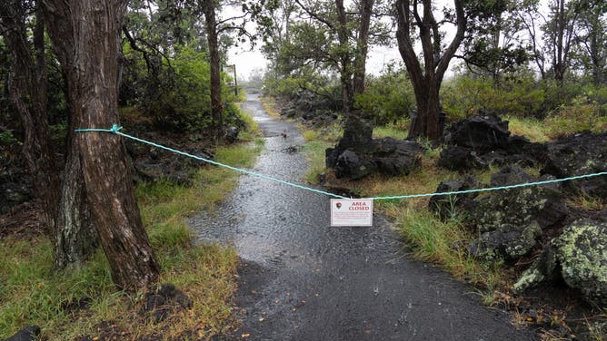
Image 3 of 6The Ka'u Desert section of Hawaii Volcanoes National Park is seen closed due to high winds and heavy rainfall in Volcano Village, Hawaii, on August 15, 2026. Hurricane Lala on Saturday lashed Hawaii's Big Island with heavy rain and strong winds, as forecasters warned of potentially dangerous flooding across the US Pacific island state. Lala strengthened into a Category 1 hurricane at around 9:00 am local time (1900 GMT), generating winds of up to 75 miles per hour (120 kilometers per hour). (Photo by Jill K. Briggs / AFP via Getty Images) ( )
![]() Image 4 of 6
Image 4 of 6A resident stops on a rural road as it floods in Volcano Village on Hawaii Island, on August 15, 2026. Hurricane Lala on Saturday lashed Hawaii's Big Island with heavy rain and strong winds, as forecasters warned of potentially dangerous flooding across the US Pacific island state. Lala strengthened into a Category 1 hurricane at around 9:00 am local time (1900 GMT), generating winds of up to 75 miles per hour (120 kilometers per hour). (Photo by Jill K. Briggs / AFP via Getty Images) ( )
![]() Image 5 of 6
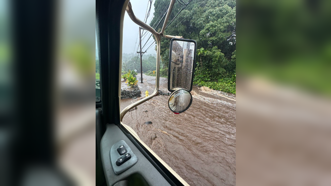
Image 5 of 6Major flooding in Waiohinu, Hawaii, from Hurricane Lala on Saturday, Aug. 15. (Hawaii Department of Transportation )
![]() Image 6 of 6
Image 6 of 6Major flooding in Waiohinu, Hawaii, from Hurricane Lala on Saturday, Aug. 15. (Hawaii Department of Transportation )
However, the system will pass over the northwestern leeward islands in the Hawaiian Island archipelago on Thursday.
While these islands are uninhabited and are mostly nature preserves and house research facilities and part of the Papahānaumokuākea Marine National Monument, portions are under a Hurricane Warning and Tropical Storm Warning.
Lala will continue on its trek across these islands and is forecast to continue to weaken as it takes a more northerly track into cooler water.
 Areas to Watch in the Pacific.
(FOX Weather)
Invest 90E
Newly designated Invest 90E was designated overnight in the far eastern Pacific southeast of Hawaii, which is expected to track into the central Pacific this weekend.
As the clean-up across the Hawaiian Islands from Lala begins, this new system is worth keeping a close eye on, as it could bring a new threat to the Big Island of Hawaii.
HOW THE BIGGEST WAVES IN THE WORLD BREAK OFF THE COAST OF PORTUGAL
While the system is disorganized, there is a high chance of development.
There is a 90% chance of development over the next 48 hours, with an 90% chance of development over the next 7 days.
According to the FOX Forecast Center, traditional forecast models agree that as 90E advances very close to the Big Island, it is likely to organize into a tropical depression or tropical storm.
Meanwhile, AI forecast models are not as far north, but still bring rain to the Big Island in the same timeframe, potentially enough rain to create flooding issues.
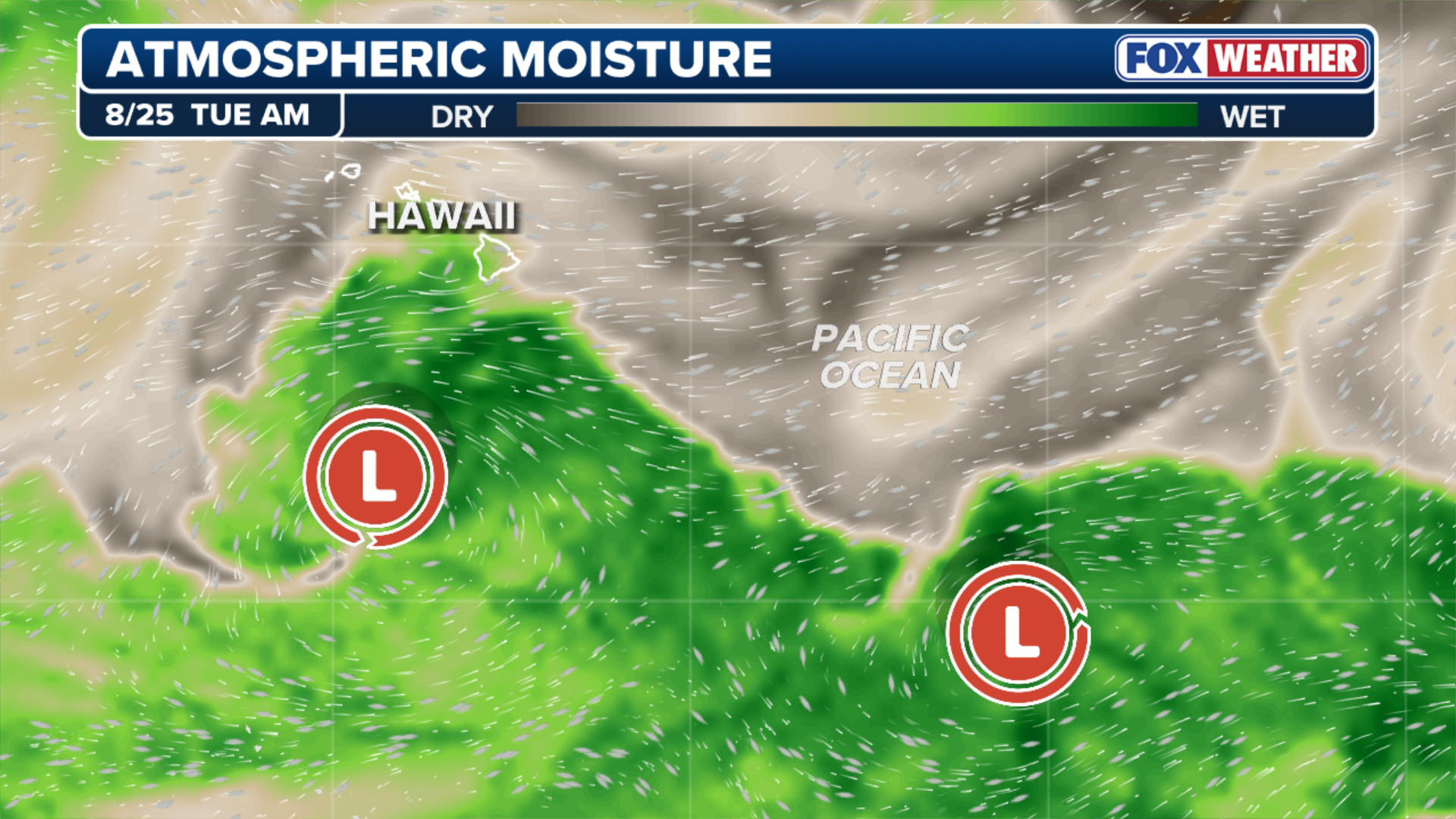 Atmospheric Moisture levels in the Pacific. While Lala begins to spin away from Hawaii, a second area of low pressure follows in it’s path.
(FOX Weather)
If this system develops, the biggest threat to the Big Island of Hawaii will come on Sunday. Tropical moisture could wrap around the eastern and northern sides of the system and will push directly into the windward terrain.
Long-lasting downpours could create a flash flood threat, along with mudslides over steep mountain passes, while high, dangerous surf will impact the coasts.
The FOX Forecast Center will continue to monitor any tropical disturbance that could approach Hawaii.
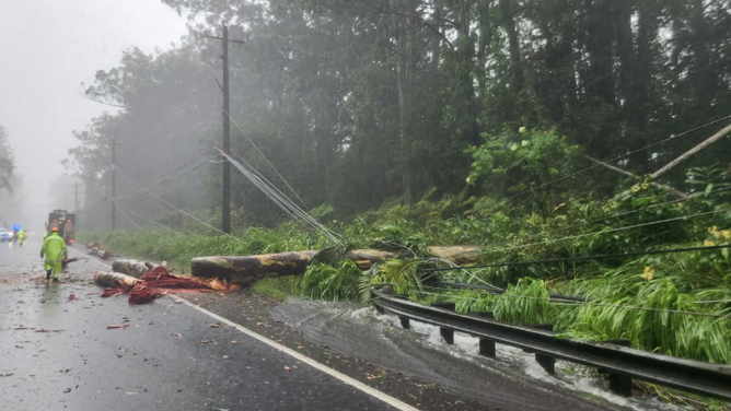
Downed trees and power lines in Waiohinu, HI, from Hurricane Lala on Saturday, Aug. 15.
(Hawaii Department of Transportation )
Conditions are primed far out in the East Pacific
In the East Pacific Basin, conditions are primed for robust tropical development due to warm waters associated with a strengthening El Niño. A new area to watch for has an outside chance of delivering rain to Baja California and even the Southwest U.S.
According to the FOX Forecast Center, computer forecast models show a strong area of low pressure consolidating within a very rich moisture environment off southern Mexico, that the National Hurricane Center (NHC) is now giving a high chance of development over the next seven days.
WHAT’S THE DIFFERENCE BETWEEN A TROPICAL DEPRESSION, TROPICAL STORM AND HURRICANE?
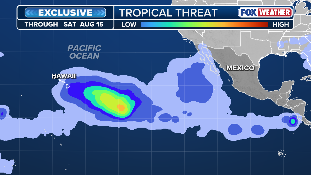 FOX Weather Tropical Threat.
(FOX Weather)
According to the FOX Forecast Center, it is expected to become a hurricane as it tracks west-northwestward over the next several days.
At this point, there are two primary scenarios for how this storm unfolds as it grows.
The first keeps a strong subtropical ridge anchored to the north, steering the system on a more traditional westward track across the open Pacific and away from any land.
MASSIVE METEOR TURNS PACIFIC NORTHWEST NIGHT SKY ELECTRIC BLUE

Surfers wipe out in choppy waves in Honolulu, Hawaii, brought on by Hurricane Lala on Aug. 15.
(COURTEY COLLINS )
The second involves a weakness developing in the ridge, which could allow the storm to gain latitude and curve further north.
While the system remains far out in the Pacific and there is still considerable uncertainty surrounding its eventual track, FOX Weather will continue to monitor its development, forecast trends and any potential impacts in the days ahead.
Check back for updates on this developing story.